Ixtenco elevation
Ixtenco (Tlaxcala), Mexico elevation is 2507 meters and Ixtenco elevation in feet is 8225 ft above sea level [src 1]. Ixtenco is a seat of a second-order administrative division (feature code) with elevation that is 1193 meters (3914 ft) bigger than average city elevation in Mexico.
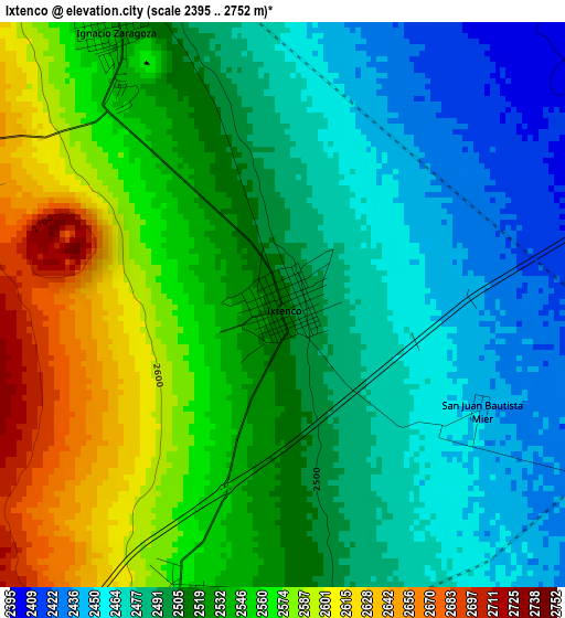
Below is the Elevation map of Ixtenco, which displays elevation range with different colors. Scale of the first map is from 2395 to 2752 m (7858 to 9029 ft) with average elevation of 2519.6 meters (=8266 ft) [note 1]
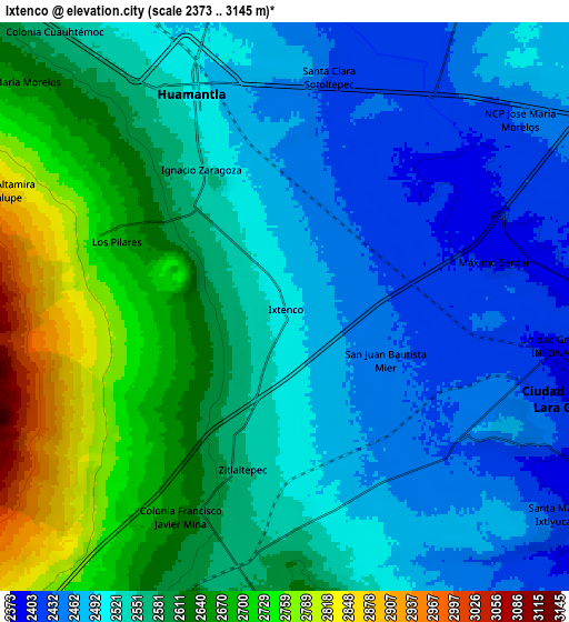
These maps also provides idea of topography and contour of this city, they are displayed at different zoom levels. More info about maps, scale and edge coordinates you can find below images.
| \ | Map #1 | Map #2 | Topo.Map |
| Scale [m] | 2395..2752 m | 2373..3145 m | × |
| Scale [ft] | 7858..9029 ft | 7785..10318 ft | × |
| Average | 2519.6 m = 8266 ft | 2559.7 m = 8398 ft | × |
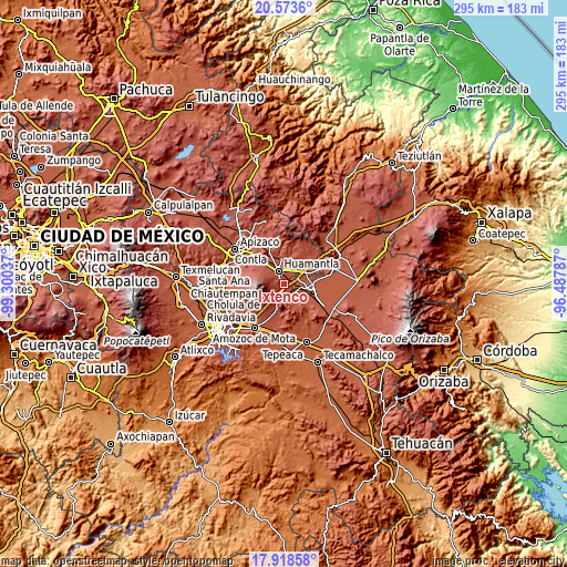
| Width | 9.23 km = 5.7 mi | 18.45 km = 11.5 mi | 295.2 km = 183.4 mi |
| Height | 9.23 km = 5.7 mi | 18.45 km = 11.5 mi | 295.2 km = 183.4 mi |
| ↑Max Latitude | 19.292943° | 19.334415° | 20.5736° |
| Latitude at center | 19.25146° | 19.25146° | 19.25146° |
| ↓Min Latitude | 19.209967° | 19.168463° | 17.91858° |
| ← Min Longitude | -97.938065° | -97.982011° | -99.30037° |
| Longitude center | -97.89412° | -97.89412° | -97.89412° |
| →Max Longitude | -97.850175° | -97.806229° | -96.48787° |
Nearby cities:
Cities around Ixtenco sort by population:
• Huamantla elevation 2519 m
7.7 km,  335°
335°
• Grajales 2385 m
9.9 km,  105°
105°
• Santa María Ixtiyucán 2429 m
11.3 km,  129°
129°
• Ignacio Zaragoza 2531 m
5.4 km,  327°
327°
• Nopalucán 2460 m
8.3 km,  116°
116°
• Zitlaltépec 2564 m
5.5 km,  194°
194°
• El Rincón Citlaltépetl 2600 m
10.7 km,  180°
180°
• Máximo Serdán 2402 m
7 km,  79°
79°
• Juan de la Granja 2409 m
9.6 km, 110°
• Los Pilares 2691 m
6 km,  291°
291°
• Colonia Obrera 2380 m
10.4 km,  103°
103°
• Unidad Grajales INFONAVIT 2396 m
8.8 km, 97°
Multilingual:
 En español:
Ixtenco elevación 2507 m.
 En France:
Ixtenco élévation 2507 m.
 Auf Deutsch:
Ixtenco höhe über dem Meeresspiegel ist 2507 m.

Sources and notes:
- [note 1] Map square and city borders are not equal. Map elevation data is calculated only from area inside that square.
- [src 1] Elevation data from geonames database provided with same terms of usage.
- [src 2] The elevation map of Ixtenco is generated using elevation data from NASA's 3 arcsec (90m) resolution SRTM data.
- [src 3] Base (background) map © OpenStreetMap contributors tiles are generated by Geofabrik and OpenTopoMap.
Copyright & License:
This Ixtenco Elevation Map is licensed under CC BY-SA. You may reuse any part from this page, if you give a proper credit by linking to this URL:
 More info on terms of use page.