Almecatla elevation
Almecatla (Puebla, Cuautlancingo), Mexico elevation is 2224 meters and Almecatla elevation in feet is 7297 ft above sea level [src 1]. Almecatla is a populated place (feature code) with elevation that is 910 meters (2986 ft) bigger than average city elevation in Mexico.
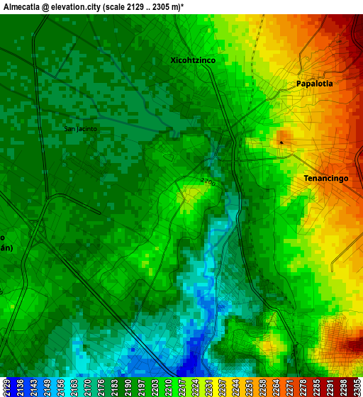
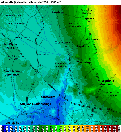
Below is the Elevation map of Almecatla, which displays elevation range with different colors. Scale of the first map is from 2129 to 2305 m (6985 to 7562 ft) with average elevation of 2201.6 meters (=7223 ft) [note 1]
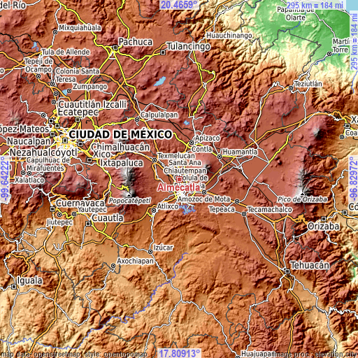
These maps also provides idea of topography and contour of this city, they are displayed at different zoom levels. More info about maps, scale and edge coordinates you can find below images.
| \ | Map #1 | Map #2 | Topo.Map |
| Scale [m] | 2129..2305 m | 2092..2529 m | × |
| Scale [ft] | 6985..7562 ft | 6864..8297 ft | × |
| Average | 2201.6 m = 7223 ft | 2225.8 m = 7302 ft | × |
| Width | 9.23 km = 5.7 mi | 18.46 km = 11.5 mi | 295.4 km = 183.6 mi |
| Height | 9.23 km = 5.7 mi | 18.46 km = 11.5 mi | 295.4 km = 183.6 mi |
| ↑Max Latitude | 19.18437° | 19.22587° | 20.4659° |
| Latitude at center | 19.14286° | 19.14286° | 19.14286° |
| ↓Min Latitude | 19.101339° | 19.059809° | 17.80913° |
| ← Min Longitude | -98.279915° | -98.323861° | -99.64222° |
| Longitude center | -98.23597° | -98.23597° | -98.23597° |
| →Max Longitude | -98.192025° | -98.148079° | -96.82972° |
Nearby cities:
Cities around Almecatla sort by population:
• Sanctorum elevation 2146 m
5.2 km,  201°
201°
• Cuautlancingo 2160 m
7.1 km,  213°
213°
• Papalotla 2251 m
4.4 km,  49°
49°
• Coronango 2189 m
7.7 km,  251°
251°
• Xicohtzinco 2202 m
3.4 km,  3°
3°
• San Francisco Ocotlán 2189 m
5.1 km,  258°
258°
• Tenancingo 2267 m
3.7 km,  82°
82°
• Mazatecochco 2323 m
6.5 km, 52°
• Santa Catarina Ayometla 2266 m
6.6 km,  20°
20°
• San Antonio Mihuacán 2203 m
7.3 km,  279°
279°
• La Trinidad Chautenco 2149 m
6.6 km, 206°
• San Marcos Contla 2307 m
7.3 km,  31°
31°
Multilingual:
 En español:
San Lorenzo elevación 2224 m.
 En France:
Almecatla élévation 2224 m.
 Auf Deutsch:
Almecatla höhe über dem Meeresspiegel ist 2224 m.

Sources and notes:
- [note 1] Map square and city borders are not equal. Map elevation data is calculated only from area inside that square.
- [src 1] Elevation data from geonames database provided with same terms of usage.
- [src 2] The elevation map of Almecatla is generated using elevation data from NASA's 3 arcsec (90m) resolution SRTM data.
- [src 3] Base (background) map © OpenStreetMap contributors tiles are generated by Geofabrik and OpenTopoMap.
Copyright & License:
This Almecatla Elevation Map is licensed under CC BY-SA. You may reuse any part from this page, if you give a proper credit by linking to this URL:
 More info on terms of use page.