Xicohtzinco elevation
Xicohtzinco (Tlaxcala), Mexico elevation is 2202 meters and Xicohtzinco elevation in feet is 7224 ft above sea level [src 1]. Xicohtzinco is a seat of a second-order administrative division (feature code) with elevation that is 888 meters (2913 ft) bigger than average city elevation in Mexico.
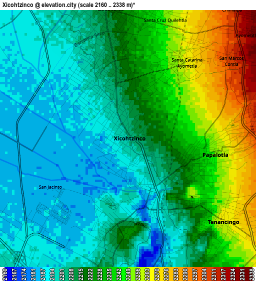
Below is the Elevation map of Xicohtzinco, which displays elevation range with different colors. Scale of the first map is from 2160 to 2338 m (7087 to 7671 ft) with average elevation of 2218.5 meters (=7279 ft) [note 1]
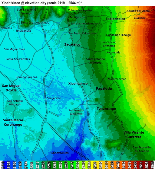
These maps also provides idea of topography and contour of this city, they are displayed at different zoom levels. More info about maps, scale and edge coordinates you can find below images.
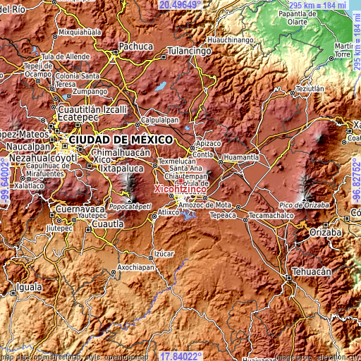
| \ | Map #1 | Map #2 | Topo.Map |
| Scale [m] | 2160..2338 m | 2119..2544 m | × |
| Scale [ft] | 7087..7671 ft | 6952..8346 ft | × |
| Average | 2218.5 m = 7279 ft | 2251.2 m = 7386 ft | × |
| Width | 9.23 km = 5.7 mi | 18.46 km = 11.5 mi | 295.3 km = 183.5 mi |
| Height | 9.23 km = 5.7 mi | 18.46 km = 11.5 mi | 295.4 km = 183.6 mi |
| ↑Max Latitude | 19.215212° | 19.256704° | 20.49649° |
| Latitude at center | 19.17371° | 19.17371° | 19.17371° |
| ↓Min Latitude | 19.132197° | 19.090674° | 17.84022° |
| ← Min Longitude | -98.277715° | -98.321661° | -99.64002° |
| Longitude center | -98.23377° | -98.23377° | -98.23377° |
| →Max Longitude | -98.189825° | -98.145879° | -96.82752° |
Nearby cities:
Cities around Xicohtzinco sort by population:
• Zacatelco elevation 2223 m
4.7 km,  352°
352°
• Papalotla 2251 m
3.2 km,  100°
100°
• Almecatla 2224 m
3.4 km,  183°
183°
• Tenancingo 2267 m
4.5 km,  130°
130°
• Mazatecochco 2323 m
5 km,  83°
83°
• Santa Catarina Ayometla 2266 m
3.5 km,  37°
37°
• San Lorenzo Axocomanitla 2212 m
5.8 km,  344°
344°
• Santa Cruz Quilehtla 2264 m
4.8 km,  15°
15°
• San Marcos Contla 2307 m
4.6 km,  51°
51°
• San Pedro Xalcaltzinco 2239 m
6 km,  5°
5°
• Ayometitla 2327 m
5.7 km, 48°
• Concepción Chimalpa 2309 m
6 km, 38°
Multilingual:
 En español:
Xicohtzinco elevación 2202 m.
 En France:
Xicohtzinco élévation 2202 m.
 Auf Deutsch:
Xicohtzinco höhe über dem Meeresspiegel ist 2202 m.

Sources and notes:
- [note 1] Map square and city borders are not equal. Map elevation data is calculated only from area inside that square.
- [src 1] Elevation data from geonames database provided with same terms of usage.
- [src 2] The elevation map of Xicohtzinco is generated using elevation data from NASA's 3 arcsec (90m) resolution SRTM data.
- [src 3] Base (background) map © OpenStreetMap contributors tiles are generated by Geofabrik and OpenTopoMap.
Copyright & License:
This Xicohtzinco Elevation Map is licensed under CC BY-SA. You may reuse any part from this page, if you give a proper credit by linking to this URL:
 More info on terms of use page.