Zinacantepec elevation
Zinacantepec (State of Mexico), Mexico elevation is 2754 meters and Zinacantepec elevation in feet is 9035 ft above sea level [src 1]. Zinacantepec is a seat of a second-order administrative division (feature code) with elevation that is 1440 meters (4724 ft) bigger than average city elevation in Mexico.
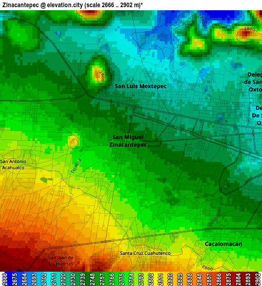
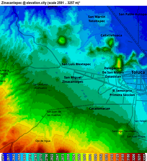
Below is the Elevation map of Zinacantepec, which displays elevation range with different colors. Scale of the first map is from 2666 to 2902 m (8747 to 9521 ft) with average elevation of 2763.7 meters (=9067 ft) [note 1]
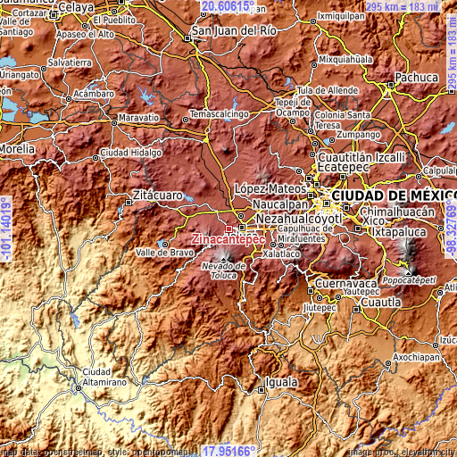
These maps also provides idea of topography and contour of this city, they are displayed at different zoom levels. More info about maps, scale and edge coordinates you can find below images.
| \ | Map #1 | Map #2 | Topo.Map |
| Scale [m] | 2666..2902 m | 2591..3257 m | × |
| Scale [ft] | 8747..9521 ft | 8501..10686 ft | × |
| Average | 2763.7 m = 9067 ft | 2788.3 m = 9148 ft | × |
| Width | 9.22 km = 5.7 mi | 18.45 km = 11.5 mi | 295.2 km = 183.4 mi |
| Height | 9.22 km = 5.7 mi | 18.45 km = 11.5 mi | 295.2 km = 183.4 mi |
| ↑Max Latitude | 19.325754° | 19.367218° | 20.60615° |
| Latitude at center | 19.28428° | 19.28428° | 19.28428° |
| ↓Min Latitude | 19.242795° | 19.2013° | 17.95166° |
| ← Min Longitude | -99.777885° | -99.821831° | -101.14019° |
| Longitude center | -99.73394° | -99.73394° | -99.73394° |
| →Max Longitude | -99.689995° | -99.646049° | -98.32769° |
Nearby cities:
Cities around Zinacantepec sort by population:
• San Francisco Tlalcilalcalpan elevation 2769 m
3.7 km,  288°
288°
• San Antonio Acahualco 2806 m
4.1 km,  253°
253°
• Cacalomacan 2772 m
4.5 km,  139°
139°
• Ejido San Lorenzo Cuauhtenco 2745 m
2.6 km,  317°
317°
• Santa Cruz Cuauhtenco 2803 m
3.9 km,  173°
173°
• San Antonio Buenavista 2771 m
3.5 km, 138°
• La Joya 2795 m
2.8 km, 251°
• Colonia Morelos 2853 m
4.4 km,  196°
196°
• Colonia Ricardo Flores Magón 2811 m
3.1 km,  235°
235°
• El Porvenir I 2696 m
3.7 km,  8°
8°
• Cerro del Murciélago 2789 m
2.2 km,  263°
263°
• San José Barbabosa 2749 m
1.7 km,  122°
122°
Multilingual:
 En español:
Zinacantepec elevación 2754 m.
 En France:
Zinacantepec élévation 2754 m.
 Auf Deutsch:
Zinacantepec höhe über dem Meeresspiegel ist 2754 m.

Sources and notes:
- [note 1] Map square and city borders are not equal. Map elevation data is calculated only from area inside that square.
- [src 1] Elevation data from geonames database provided with same terms of usage.
- [src 2] The elevation map of Zinacantepec is generated using elevation data from NASA's 3 arcsec (90m) resolution SRTM data.
- [src 3] Base (background) map © OpenStreetMap contributors tiles are generated by Geofabrik and OpenTopoMap.
Copyright & License:
This Zinacantepec Elevation Map is licensed under CC BY-SA. You may reuse any part from this page, if you give a proper credit by linking to this URL:
 More info on terms of use page.