Chalchihuitán elevation
Chalchihuitán (Chiapas), Mexico elevation is 1475 meters and Chalchihuitán elevation in feet is 4839 ft above sea level [src 1]. Chalchihuitán is a seat of a second-order administrative division (feature code) with elevation that is 161 meters (528 ft) bigger than average city elevation in Mexico.
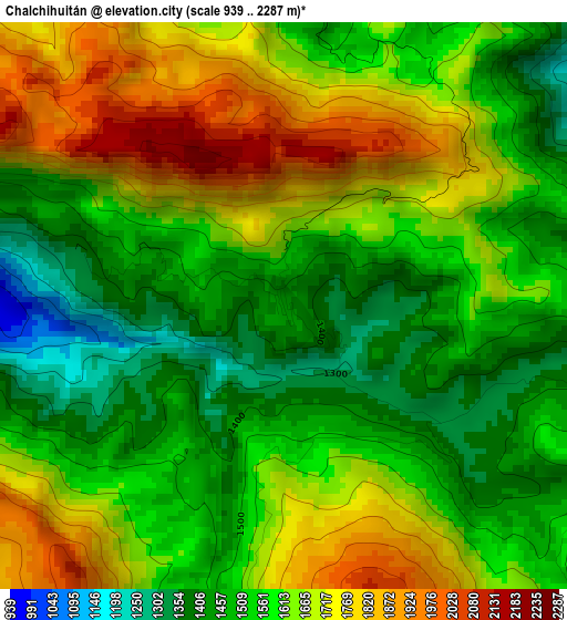
Below is the Elevation map of Chalchihuitán, which displays elevation range with different colors. Scale of the first map is from 939 to 2287 m (3081 to 7503 ft) with average elevation of 1599 meters (=5246 ft) [note 1]
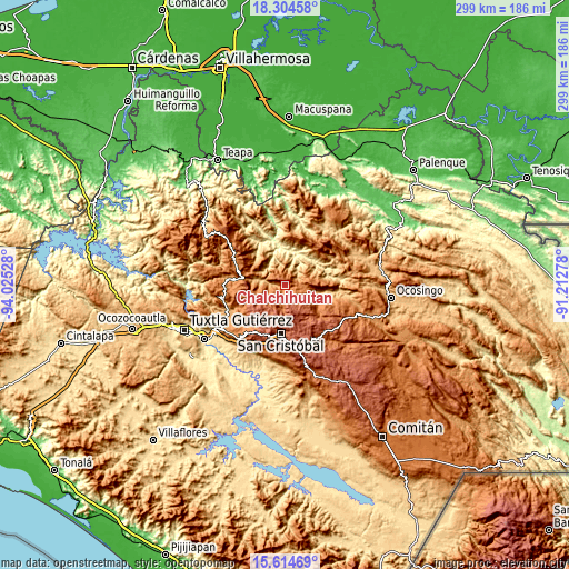
These maps also provides idea of topography and contour of this city, they are displayed at different zoom levels. More info about maps, scale and edge coordinates you can find below images.
| \ | Map #1 | Topo.Map |
| Scale [m] | 939..2287 m | × |
| Scale [ft] | 3081..7503 ft | × |
| Average | 1599 m = 5246 ft | × |
| Width | 9.35 km = 5.8 mi | 299.1 km = 185.9 mi |
| Height | 9.35 km = 5.8 mi | 299.1 km = 185.9 mi |
| ↑Max Latitude | 17.006478° | 18.30458° |
| Latitude at center | 16.96445° | 16.96445° |
| ↓Min Latitude | 16.922412° | 15.61469° |
| ← Min Longitude | -92.662975° | -94.02528° |
| Longitude center | -92.61903° | -92.61903° |
| →Max Longitude | -92.575085° | -91.21278° |
Nearby cities:
Cities around Chalchihuitán sort by population:
• Chenalhó elevation 1526 m
7.9 km,  185°
185°
• Chiquinshulum 1017 m
12.2 km,  10°
10°
• Chicumtantic 2271 m
11.1 km,  172°
172°
• Belisario Domínguez 1870 m
9.2 km,  208°
208°
• Chalam 1790 m
11.3 km,  139°
139°
• Tzoeptic 1964 m
10.6 km,  149°
149°
• Yibeljoj 1477 m
12.3 km,  93°
93°
• Aldama 1820 m
9.1 km,  234°
234°
• Chimhucum 1776 m
12.5 km,  131°
131°
• Tentic 2034 m
13.1 km, 210°
• Santiago el Pinar 1682 m
10.5 km,  255°
255°
• Joltealal 1072 m
12.5 km,  358°
358°
Multilingual:
 En español:
Chalchihuitán elevación 1475 m.
 En France:
Chalchihuitán élévation 1475 m.
 Auf Deutsch:
Chalchihuitán höhe über dem Meeresspiegel ist 1475 m.

Sources and notes:
- [note 1] Map square and city borders are not equal. Map elevation data is calculated only from area inside that square.
- [src 1] Elevation data from geonames database provided with same terms of usage.
- [src 2] The elevation map of Chalchihuitán is generated using elevation data from NASA's 3 arcsec (90m) resolution SRTM data.
- [src 3] Base (background) map © OpenStreetMap contributors tiles are generated by Geofabrik and OpenTopoMap.
Copyright & License:
This Chalchihuitán Elevation Map is licensed under CC BY-SA. You may reuse any part from this page, if you give a proper credit by linking to this URL:
 More info on terms of use page.