Tzoeptic elevation
Tzoeptic (Chiapas, Mitontic), Mexico elevation is 1964 meters and Tzoeptic elevation in feet is 6444 ft above sea level [src 1]. Tzoeptic is a populated place (feature code) with elevation that is 650 meters (2133 ft) bigger than average city elevation in Mexico.
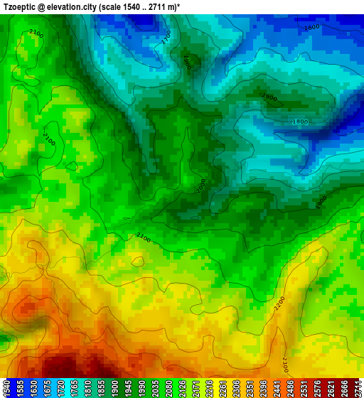
Below is the Elevation map of Tzoeptic, which displays elevation range with different colors. Scale of the first map is from 1540 to 2711 m (5052 to 8894 ft) with average elevation of 2040.2 meters (=6694 ft) [note 1]
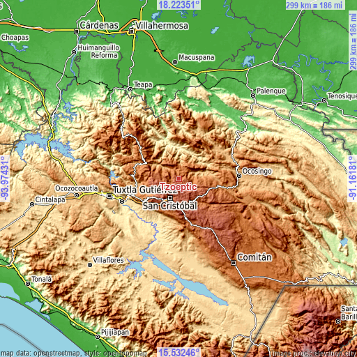
These maps also provides idea of topography and contour of this city, they are displayed at different zoom levels. More info about maps, scale and edge coordinates you can find below images.
| \ | Map #1 | Topo.Map |
| Scale [m] | 1540..2711 m | × |
| Scale [ft] | 5052..8894 ft | × |
| Average | 2040.2 m = 6694 ft | × |
| Width | 9.35 km = 5.8 mi | 299.2 km = 185.9 mi |
| Height | 9.35 km = 5.8 mi | 299.2 km = 185.9 mi |
| ↑Max Latitude | 16.924827° | 18.22351° |
| Latitude at center | 16.88278° | 16.88278° |
| ↓Min Latitude | 16.840724° | 15.53246° |
| ← Min Longitude | -92.612005° | -93.97431° |
| Longitude center | -92.56806° | -92.56806° |
| →Max Longitude | -92.524115° | -91.16181° |
Nearby cities:
Cities around Tzoeptic sort by population:
• Cancuc elevation 1302 m
9.8 km,  67°
67°
• Chenalhó 1526 m
6.3 km,  281°
281°
• Tenejapa 2013 m
9.7 km,  137°
137°
• Chicumtantic 2271 m
4.4 km,  244°
244°
• Belisario Domínguez 1870 m
9.9 km, 275°
• Muquén 2310 m
9.6 km,  207°
207°
• Chacoma 1895 m
8.2 km,  95°
95°
• Chalam 1790 m
2 km, 74°
• Puebla 1391 m
7.8 km,  61°
61°
• Chimhucum 1776 m
4 km,  78°
78°
• Oxinam 2031 m
3 km, 137°
• Tzontehuitz 2578 m
5.7 km,  192°
192°
Multilingual:
 En español:
Tzoeptic elevación 1964 m.
 En France:
Tzoeptic élévation 1964 m.
 Auf Deutsch:
Tzoeptic höhe über dem Meeresspiegel ist 1964 m.

Sources and notes:
- [note 1] Map square and city borders are not equal. Map elevation data is calculated only from area inside that square.
- [src 1] Elevation data from geonames database provided with same terms of usage.
- [src 2] The elevation map of Tzoeptic is generated using elevation data from NASA's 3 arcsec (90m) resolution SRTM data.
- [src 3] Base (background) map © OpenStreetMap contributors tiles are generated by Geofabrik and OpenTopoMap.
Copyright & License:
This Tzoeptic Elevation Map is licensed under CC BY-SA. You may reuse any part from this page, if you give a proper credit by linking to this URL:
 More info on terms of use page.