San Pedro el Alto elevation
San Pedro el Alto (State of Mexico, Ixtlahuaca), Mexico elevation is 2598 meters and San Pedro el Alto elevation in feet is 8524 ft above sea level [src 1]. San Pedro el Alto is a populated place (feature code) with elevation that is 1284 meters (4213 ft) bigger than average city elevation in Mexico.
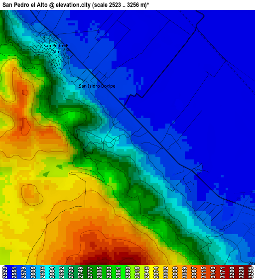
Below is the Elevation map of San Pedro el Alto, which displays elevation range with different colors. Scale of the first map is from 2523 to 3256 m (8278 to 10682 ft) with average elevation of 2724.8 meters (=8940 ft) [note 1]
These maps also provides idea of topography and contour of this city, they are displayed at different zoom levels. More info about maps, scale and edge coordinates you can find below images.
| \ | Map #1 | Map #2 | Topo.Map |
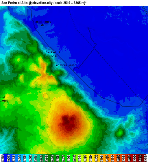
| Scale [m] | 2523..3256 m | 2519..3365 m | × |
| Scale [ft] | 8278..10682 ft | 8264..11040 ft | × |
| Average | 2724.8 m = 8940 ft | 2714.6 m = 8906 ft | × |
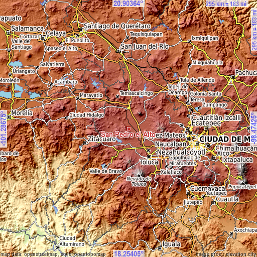
| Width | 9.21 km = 5.7 mi | 18.41 km = 11.4 mi | 294.6 km = 183.1 mi |
| Height | 9.21 km = 5.7 mi | 18.41 km = 11.4 mi | 294.6 km = 183.1 mi |
| ↑Max Latitude | 19.625688° | 19.667075° | 20.90364° |
| Latitude at center | 19.58429° | 19.58429° | 19.58429° |
| ↓Min Latitude | 19.542882° | 19.501463° | 18.25405° |
| ← Min Longitude | -99.924445° | -99.968391° | -101.28675° |
| Longitude center | -99.8805° | -99.8805° | -99.8805° |
| →Max Longitude | -99.836555° | -99.792609° | -98.47425° |
Nearby cities:
Cities around San Pedro el Alto sort by population:
• San Agustín Mextepec elevation 2587 m
7.2 km,  318°
318°
• Santa Ana Ixtlahuaca (Santa Ana Ixtlahuacingo) 2641 m
0.7 km,  273°
273°
• San Juan de las Manzanas 2569 m
5.8 km,  129°
129°
• Guadalupe Cachi 2540 m
6.1 km,  72°
72°
• Santa Ana la Ladera 2542 m
1.7 km,  40°
40°
• San Isidro Boxipe 2579 m
2.2 km,  329°
329°
• San Miguel Enyege 2562 m
2.7 km, 126°
• La Concepción Enyege 2552 m
4.6 km,  117°
117°
• San Andrés del Pedregal 2567 m
1.3 km,  106°
106°
• Palos Amarillos (Palos Amarillos Yebuciví) 2977 m
6.3 km,  217°
217°
• El Rincón de los Perales 2604 m
7.2 km, 130°
• La Guadalupana 3005 m
4.5 km, 221°
Multilingual:
 En español:
San Pedro el Alto elevación 2598 m.
 En France:
San Pedro el Alto élévation 2598 m.
 Auf Deutsch:
San Pedro el Alto höhe über dem Meeresspiegel ist 2598 m.
 На русском:
San Pedro el Alto высота над уровнем моря 2598 м
Sources and notes:
- [note 1] Map square and city borders are not equal. Map elevation data is calculated only from area inside that square.
- [src 1] Elevation data from geonames database provided with same terms of usage.
- [src 2] The elevation map of San Pedro el Alto is generated using elevation data from NASA's 3 arcsec (90m) resolution SRTM data.
- [src 3] Base (background) map © OpenStreetMap contributors tiles are generated by Geofabrik and OpenTopoMap.
Copyright & License:
This San Pedro el Alto Elevation Map is licensed under CC BY-SA. You may reuse any part from this page, if you give a proper credit by linking to this URL:
 More info on terms of use page.