San Pedro Mártir Quiechapa elevation
San Pedro Mártir Quiechapa (Oaxaca), Mexico elevation is 1827 meters and San Pedro Mártir Quiechapa elevation in feet is 5994 ft above sea level [src 1]. San Pedro Mártir Quiechapa is a seat of a second-order administrative division (feature code) with elevation that is 513 meters (1683 ft) bigger than average city elevation in Mexico.
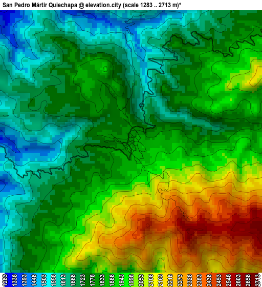
Below is the Elevation map of San Pedro Mártir Quiechapa, which displays elevation range with different colors. Scale of the first map is from 1283 to 2713 m (4209 to 8901 ft) with average elevation of 1853.4 meters (=6081 ft) [note 1]
These maps also provides idea of topography and contour of this city, they are displayed at different zoom levels. More info about maps, scale and edge coordinates you can find below images.
| \ | Map #1 | Topo.Map |
| Scale [m] | 1283..2713 m | × |
| Scale [ft] | 4209..8901 ft | × |
| Average | 1853.4 m = 6081 ft | × |
| Width | 9.37 km = 5.8 mi | 299.9 km = 186.3 mi |
| Height | 9.37 km = 5.8 mi | 300 km = 186.4 mi |
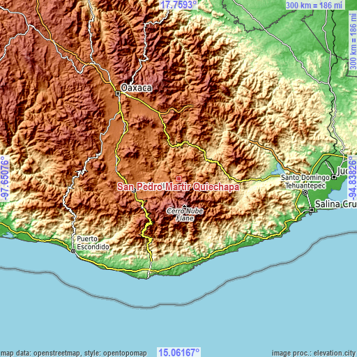
| ↑Max Latitude | 16.457309° | 17.7593° |
| Latitude at center | 16.41516° | 16.41516° |
| ↓Min Latitude | 16.373001° | 15.06167° |
| ← Min Longitude | -96.288455° | -97.65076° |
| Longitude center | -96.24451° | -96.24451° |
| →Max Longitude | -96.200565° | -94.83826° |
Nearby cities:
Cities around San Pedro Mártir Quiechapa sort by population:
• San Cristóbal Amatlán elevation 1733 m
20.6 km,  237°
237°
• San Pedro Mixtepec 2132 m
16.6 km,  194°
194°
• El Camarón 688 m
27.9 km,  55°
55°
• Santa María Zoquitlán 1037 m
19.7 km,  324°
324°
• San José Lachiguirí 1694 m
10.6 km,  246°
246°
• San Francisco Logueche 1845 m
15.7 km, 244°
• San Ildefonso Amatlán 1546 m
27.8 km, 251°
• San Carlos Yautepec 887 m
17.3 km, 58°
• Santa María Quiegolani 2153 m
25.6 km,  126°
126°
• San Luis Amatlán 1503 m
27.3 km,  263°
263°
• San Juan Mixtepec 2051 m
16.5 km,  201°
201°
• Santa Catalina Quieri 1965 m
10.7 km, 192°
Multilingual:
 En español:
San Pedro Mártir Quiechapa elevación 1827 m.
 En France:
San Pedro Mártir Quiechapa élévation 1827 m.
 Auf Deutsch:
San Pedro Mártir Quiechapa höhe über dem Meeresspiegel ist 1827 m.
 На русском:
San Pedro Mártir Quiechapa высота над уровнем моря 1827 м
Sources and notes:
- [note 1] Map square and city borders are not equal. Map elevation data is calculated only from area inside that square.
- [src 1] Elevation data from geonames database provided with same terms of usage.
- [src 2] The elevation map of San Pedro Mártir Quiechapa is generated using elevation data from NASA's 3 arcsec (90m) resolution SRTM data.
- [src 3] Base (background) map © OpenStreetMap contributors tiles are generated by Geofabrik and OpenTopoMap.
Copyright & License:
This San Pedro Mártir Quiechapa Elevation Map is licensed under CC BY-SA. You may reuse any part from this page, if you give a proper credit by linking to this URL:
 More info on terms of use page.