Santa Cruz Xitla elevation
Santa Cruz Xitla (Oaxaca), Mexico elevation is 1791 meters and Santa Cruz Xitla elevation in feet is 5876 ft above sea level [src 1]. Santa Cruz Xitla is a seat of a second-order administrative division (feature code) with elevation that is 477 meters (1565 ft) bigger than average city elevation in Mexico.
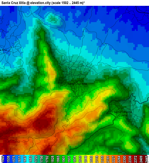
Below is the Elevation map of Santa Cruz Xitla, which displays elevation range with different colors. Scale of the first map is from 1502 to 2445 m (4928 to 8022 ft) with average elevation of 1830.3 meters (=6005 ft) [note 1]
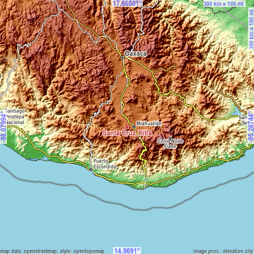
These maps also provides idea of topography and contour of this city, they are displayed at different zoom levels. More info about maps, scale and edge coordinates you can find below images.
| \ | Map #1 | Map #2 | Topo.Map |
| Scale [m] | 1502..2445 m | 1435..2651 m | × |
| Scale [ft] | 4928..8022 ft | 4708..8698 ft | × |
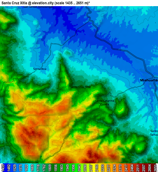
| Average | 1830.3 m = 6005 ft | 1814.1 m = 5952 ft | × |
| Width | 9.38 km = 5.8 mi | 18.76 km = 11.7 mi | 300.1 km = 186.5 mi |
| Height | 9.38 km = 5.8 mi | 18.76 km = 11.7 mi | 300.1 km = 186.5 mi |
| ↑Max Latitude | 16.365379° | 16.40754° | 17.66801° |
| Latitude at center | 16.32321° | 16.32321° | 16.32321° |
| ↓Min Latitude | 16.281032° | 16.238844° | 14.9691° |
| ← Min Longitude | -96.717635° | -96.761581° | -98.07994° |
| Longitude center | -96.67369° | -96.67369° | -96.67369° |
| →Max Longitude | -96.629745° | -96.585799° | -95.26744° |
Nearby cities:
Cities around Santa Cruz Xitla sort by population:
• Miahuatlán de Porfirio Díaz elevation 1554 m
8.4 km,  82°
82°
• San Miguel Coatlán 1875 m
14.2 km,  189°
189°
• Santa Ana 1597 m
5 km,  293°
293°
• Santa Catarina Roatina 1774 m
17.3 km,  106°
106°
• Santa Lucía 2009 m
16.3 km,  156°
156°
• Santo Tomás Tamazulapam 1713 m
11.4 km,  120°
120°
• Santa Catarina Cuixtla 1768 m
3.8 km, 119°
• San Simón Almolongas 1521 m
10.5 km,  332°
332°
• Guixé 1577 m
16.6 km,  349°
349°
• San Nicolás 1455 m
13 km, 326°
• San Pablo Coatlán 1484 m
16.1 km,  226°
226°
• Sitio de Xitlapehua 1554 m
15.4 km, 78°
Multilingual:
 En español:
Santa Cruz Xitla elevación 1791 m.
 En France:
Santa Cruz Xitla élévation 1791 m.
 Auf Deutsch:
Santa Cruz Xitla höhe über dem Meeresspiegel ist 1791 m.

Sources and notes:
- [note 1] Map square and city borders are not equal. Map elevation data is calculated only from area inside that square.
- [src 1] Elevation data from geonames database provided with same terms of usage.
- [src 2] The elevation map of Santa Cruz Xitla is generated using elevation data from NASA's 3 arcsec (90m) resolution SRTM data.
- [src 3] Base (background) map © OpenStreetMap contributors tiles are generated by Geofabrik and OpenTopoMap.
Copyright & License:
This Santa Cruz Xitla Elevation Map is licensed under CC BY-SA. You may reuse any part from this page, if you give a proper credit by linking to this URL:
 More info on terms of use page.