Santa María Mazatla elevation
Santa María Mazatla (State of Mexico, Jilotzingo), Mexico elevation is 2826 meters and Santa María Mazatla elevation in feet is 9272 ft above sea level [src 1]. Santa María Mazatla is a populated place (feature code) with elevation that is 1512 meters (4961 ft) bigger than average city elevation in Mexico.
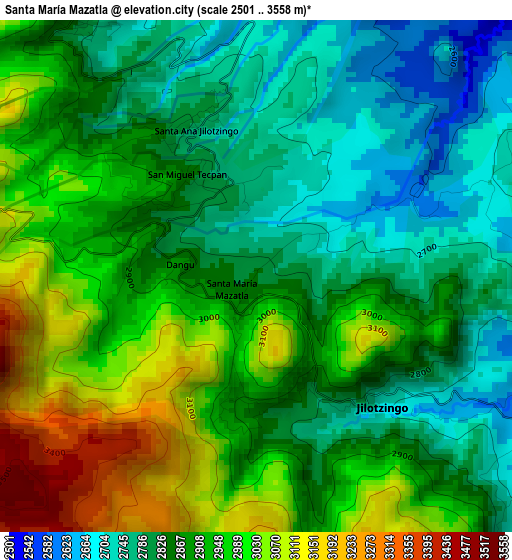
Below is the Elevation map of Santa María Mazatla, which displays elevation range with different colors. Scale of the first map is from 2501 to 3558 m (8205 to 11673 ft) with average elevation of 2894.7 meters (=9497 ft) [note 1]
These maps also provides idea of topography and contour of this city, they are displayed at different zoom levels. More info about maps, scale and edge coordinates you can find below images.
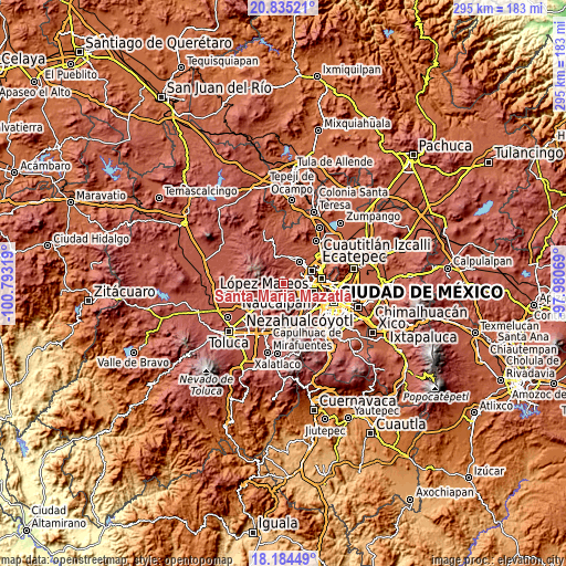
| \ | Map #1 | Topo.Map |
| Scale [m] | 2501..3558 m | × |
| Scale [ft] | 8205..11673 ft | × |
| Average | 2894.7 m = 9497 ft | × |
| Width | 9.21 km = 5.7 mi | 294.7 km = 183.1 mi |
| Height | 9.21 km = 5.7 mi | 294.8 km = 183.2 mi |
| ↑Max Latitude | 19.556695° | 20.83521° |
| Latitude at center | 19.51528° | 19.51528° |
| ↓Min Latitude | 19.473854° | 18.18449° |
| ← Min Longitude | -99.430885° | -100.79319° |
| Longitude center | -99.38694° | -99.38694° |
| →Max Longitude | -99.342995° | -97.98069° |
Nearby cities:
Cities around Santa María Mazatla sort by population:
• Transfiguración elevation 2856 m
7.7 km,  333°
333°
• Santiago Tepatlaxco 2724 m
6.4 km,  135°
135°
• San Luis Ayucán 2717 m
3.3 km,  130°
130°
• Tlazala de Fabela 2819 m
5.6 km, 328°
• La Rosa 2554 m
6.9 km,  119°
119°
• San Miguel Tecpan 2830 m
2.2 km, 328°
• Colonia Palma 2977 m
6.7 km,  324°
324°
• Ejido Palma (Ejido San Francisco) 2775 m
6.4 km,  338°
338°
• Barrio de Ensido 2778 m
2.7 km,  151°
151°
• Chimalpa Viejo 2893 m
8.6 km, 148°
• Ejido Miraflores 2679 m
6.2 km,  349°
349°
• Santa Ana Jilotzingo 2767 m
3 km, 344°
Multilingual:
 En español:
Santa María Mazatla elevación 2826 m.
 En France:
Santa María Mazatla élévation 2826 m.
 Auf Deutsch:
Santa María Mazatla höhe über dem Meeresspiegel ist 2826 m.
 На русском:
Santa María Mazatla высота над уровнем моря 2826 м
Sources and notes:
- [note 1] Map square and city borders are not equal. Map elevation data is calculated only from area inside that square.
- [src 1] Elevation data from geonames database provided with same terms of usage.
- [src 2] The elevation map of Santa María Mazatla is generated using elevation data from NASA's 3 arcsec (90m) resolution SRTM data.
- [src 3] Base (background) map © OpenStreetMap contributors tiles are generated by Geofabrik and OpenTopoMap.
Copyright & License:
This Santa María Mazatla Elevation Map is licensed under CC BY-SA. You may reuse any part from this page, if you give a proper credit by linking to this URL:
 More info on terms of use page.