Temamatla elevation
Temamatla (State of Mexico), Mexico elevation is 2278 meters and Temamatla elevation in feet is 7474 ft above sea level [src 1]. Temamatla is a seat of a second-order administrative division (feature code) with elevation that is 964 meters (3163 ft) bigger than average city elevation in Mexico.
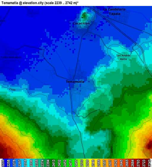
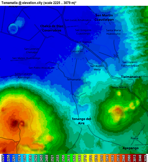
Below is the Elevation map of Temamatla, which displays elevation range with different colors. Scale of the first map is from 2239 to 2742 m (7346 to 8996 ft) with average elevation of 2342.9 meters (=7687 ft) [note 1]
These maps also provides idea of topography and contour of this city, they are displayed at different zoom levels. More info about maps, scale and edge coordinates you can find below images.
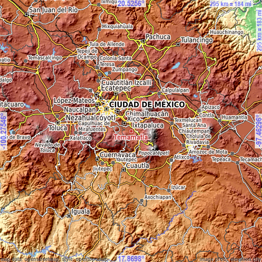
| \ | Map #1 | Map #2 | Topo.Map |
| Scale [m] | 2239..2742 m | 2225..3079 m | × |
| Scale [ft] | 7346..8996 ft | 7300..10102 ft | × |
| Average | 2342.9 m = 7687 ft | 2417.5 m = 7931 ft | × |
| Width | 9.23 km = 5.7 mi | 18.46 km = 11.5 mi | 295.3 km = 183.5 mi |
| Height | 9.23 km = 5.7 mi | 18.46 km = 11.5 mi | 295.3 km = 183.5 mi |
| ↑Max Latitude | 19.244555° | 19.286039° | 20.5256° |
| Latitude at center | 19.20306° | 19.20306° | 19.20306° |
| ↓Min Latitude | 19.161555° | 19.120039° | 17.8698° |
| ← Min Longitude | -98.913155° | -98.957101° | -100.27546° |
| Longitude center | -98.86921° | -98.86921° | -98.86921° |
| →Max Longitude | -98.825265° | -98.781319° | -97.46296° |
Nearby cities:
Cities around Temamatla sort by population:
• San Gregorio Cuautzingo elevation 2252 m
6.4 km,  11°
11°
• San Pablo Atlazalpan 2252 m
4.3 km,  291°
291°
• Santa Catarina Ayotzingo 2246 m
6.4 km,  276°
276°
• Cocotitlán 2313 m
3.4 km, 5°
• Tenango del Aire 2384 m
5.2 km,  165°
165°
• La Candelaria Tlapala 2260 m
4.7 km,  28°
28°
• Zula 2259 m
2.9 km,  311°
311°
• San Andrés Metla 2345 m
3.3 km,  61°
61°
• Lomas de San Pablo 2304 m
5.1 km,  269°
269°
• Los Reyes Acatlixhuayán 2267 m
1.5 km,  295°
295°
• El Cabi 2362 m
2.2 km,  132°
132°
• El Recodo de San José Axalco 2285 m
3.5 km, 269°
Multilingual:
 En español:
Temamatla elevación 2278 m.
 En France:
Temamatla élévation 2278 m.
 Auf Deutsch:
Temamatla höhe über dem Meeresspiegel ist 2278 m.

Sources and notes:
- [note 1] Map square and city borders are not equal. Map elevation data is calculated only from area inside that square.
- [src 1] Elevation data from geonames database provided with same terms of usage.
- [src 2] The elevation map of Temamatla is generated using elevation data from NASA's 3 arcsec (90m) resolution SRTM data.
- [src 3] Base (background) map © OpenStreetMap contributors tiles are generated by Geofabrik and OpenTopoMap.
Copyright & License:
This Temamatla Elevation Map is licensed under CC BY-SA. You may reuse any part from this page, if you give a proper credit by linking to this URL:
 More info on terms of use page.