Tepecoacuilco de Trujano elevation
Tepecoacuilco de Trujano (Guerrero), Mexico elevation is 845 meters and Tepecoacuilco de Trujano elevation in feet is 2772 ft above sea level [src 1]. Tepecoacuilco de Trujano is a seat of a second-order administrative division (feature code) with elevation that is 469 meters (1539 ft) smaller than average city elevation in Mexico.
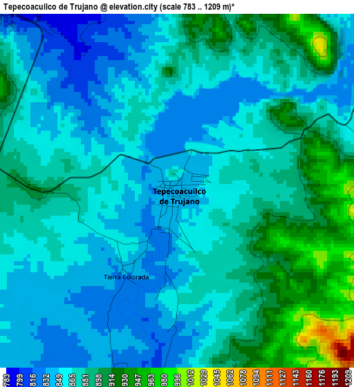
Below is the Elevation map of Tepecoacuilco de Trujano, which displays elevation range with different colors. Scale of the first map is from 783 to 1209 m (2569 to 3967 ft) with average elevation of 872.6 meters (=2863 ft) [note 1]
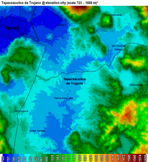
These maps also provides idea of topography and contour of this city, they are displayed at different zoom levels. More info about maps, scale and edge coordinates you can find below images.
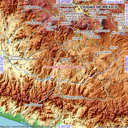
| \ | Map #1 | Map #2 | Topo.Map |
| Scale [m] | 783..1209 m | 723..1608 m | × |
| Scale [ft] | 2569..3967 ft | 2372..5276 ft | × |
| Average | 872.6 m = 2863 ft | 926 m = 3038 ft | × |
| Width | 9.28 km = 5.8 mi | 18.56 km = 11.5 mi | 296.9 km = 184.5 mi |
| Height | 9.28 km = 5.8 mi | 18.56 km = 11.5 mi | 296.9 km = 184.5 mi |
| ↑Max Latitude | 18.329221° | 18.370932° | 19.61748° |
| Latitude at center | 18.2875° | 18.2875° | 18.2875° |
| ↓Min Latitude | 18.245769° | 18.204028° | 16.94724° |
| ← Min Longitude | -99.508175° | -99.552121° | -100.87048° |
| Longitude center | -99.46423° | -99.46423° | -99.46423° |
| →Max Longitude | -99.420285° | -99.376339° | -98.05798° |
Nearby cities:
Cities around Tepecoacuilco de Trujano sort by population:
• Iguala de la Independencia elevation 743 m
10.4 km,  308°
308°
• Ciudad de Huitzuco 942 m
13.9 km,  82°
82°
• Mayanalán 859 m
13.2 km,  165°
165°
• Santa Teresa 841 m
7.9 km,  215°
215°
• Tlaxmalac 893 m
9.8 km,  33°
33°
• Tuxpan 762 m
7.1 km,  346°
346°
• Pololcingo 906 m
7.6 km,  95°
95°
• Metlapa 700 m
15.5 km,  279°
279°
• Zacacoyuca 907 m
7.9 km,  238°
238°
• Fermín Rabadán Cervantes 794 m
11.3 km,  285°
285°
• San Vicente Palapa 856 m
6.9 km,  53°
53°
• Tierra Colorada 843 m
2.5 km, 215°
Multilingual:
 En español:
Tepecoa elevación 845 m.
 En France:
Tepecoacuilco de Trujano élévation 845 m.
 Auf Deutsch:
Tepecoacuilco de Trujano höhe über dem Meeresspiegel ist 845 m.
 На русском:
Tepecoacuilco de Trujano высота над уровнем моря 845 м
Sources and notes:
- [note 1] Map square and city borders are not equal. Map elevation data is calculated only from area inside that square.
- [src 1] Elevation data from geonames database provided with same terms of usage.
- [src 2] The elevation map of Tepecoacuilco de Trujano is generated using elevation data from NASA's 3 arcsec (90m) resolution SRTM data.
- [src 3] Base (background) map © OpenStreetMap contributors tiles are generated by Geofabrik and OpenTopoMap.
Copyright & License:
This Tepecoacuilco de Trujano Elevation Map is licensed under CC BY-SA. You may reuse any part from this page, if you give a proper credit by linking to this URL:
 More info on terms of use page.