Tlacotepec elevation
Tlacotepec (Puebla, Tlacotepec de Benito Juárez), Mexico elevation is 1944 meters and Tlacotepec elevation in feet is 6378 ft above sea level [src 1]. Tlacotepec is a seat of a second-order administrative division (feature code) with elevation that is 630 meters (2067 ft) bigger than average city elevation in Mexico.
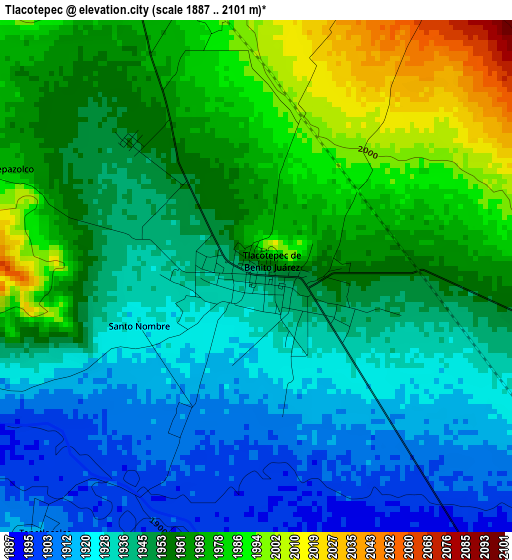
Below is the Elevation map of Tlacotepec, which displays elevation range with different colors. Scale of the first map is from 1887 to 2101 m (6191 to 6893 ft) with average elevation of 1950.9 meters (=6401 ft) [note 1]
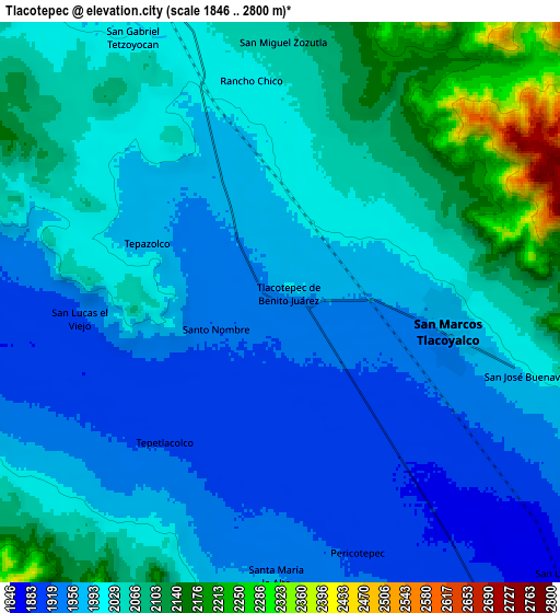
These maps also provides idea of topography and contour of this city, they are displayed at different zoom levels. More info about maps, scale and edge coordinates you can find below images.
| \ | Map #1 | Map #2 | Topo.Map |
| Scale [m] | 1887..2101 m | 1846..2800 m | × |
| Scale [ft] | 6191..6893 ft | 6056..9186 ft | × |
| Average | 1950.9 m = 6401 ft | 2012.2 m = 6602 ft | × |
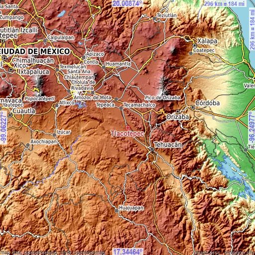
| Width | 9.26 km = 5.8 mi | 18.52 km = 11.5 mi | 296.2 km = 184 mi |
| Height | 9.26 km = 5.8 mi | 18.52 km = 11.5 mi | 296.2 km = 184 mi |
| ↑Max Latitude | 18.723555° | 18.765169° | 20.00874° |
| Latitude at center | 18.68193° | 18.68193° | 18.68193° |
| ↓Min Latitude | 18.640295° | 18.59865° | 17.34464° |
| ← Min Longitude | -97.699965° | -97.743911° | -99.06227° |
| Longitude center | -97.65602° | -97.65602° | -97.65602° |
| →Max Longitude | -97.612075° | -97.568129° | -96.24977° |
Nearby cities:
Cities around Tlacotepec sort by population:
• San Marcos Tlacoyalco elevation 1966 m
5.6 km,  99°
99°
• Santa María la Alta 1961 m
9.1 km,  181°
181°
• San Gabriel Tetzoyocán 2012 m
9.7 km,  329°
329°
• San Miguel Zozutla 2047 m
8 km,  0°
0°
• Santo Nombre 1926 m
2.3 km,  247°
247°
• San José Buenavista 1988 m
8.5 km,  107°
107°
• Rancho Chico 2016 m
7.3 km,  352°
352°
• Tepazolco 1971 m
4.7 km,  294°
294°
• San Lucas el Viejo 1922 m
6.6 km,  265°
265°
• Pericotepec 1909 m
8.8 km,  162°
162°
• Tepetlacolco 1911 m
6 km,  220°
220°
• San José Tlacuitlapan 2015 m
4.3 km,  48°
48°
Multilingual:
 En español:
Tlacotepec, Tlacotepec de Benito Juárez elevación 1944 m.
 En France:
Tlacotepec élévation 1944 m.
 Auf Deutsch:
Tlacotepec höhe über dem Meeresspiegel ist 1944 m.

Sources and notes:
- [note 1] Map square and city borders are not equal. Map elevation data is calculated only from area inside that square.
- [src 1] Elevation data from geonames database provided with same terms of usage.
- [src 2] The elevation map of Tlacotepec is generated using elevation data from NASA's 3 arcsec (90m) resolution SRTM data.
- [src 3] Base (background) map © OpenStreetMap contributors tiles are generated by Geofabrik and OpenTopoMap.
Copyright & License:
This Tlacotepec Elevation Map is licensed under CC BY-SA. You may reuse any part from this page, if you give a proper credit by linking to this URL:
 More info on terms of use page.