Tlanepantla elevation
Tlanepantla (Puebla), Mexico elevation is 2004 meters and Tlanepantla elevation in feet is 6575 ft above sea level [src 1]. Tlanepantla is a seat of a second-order administrative division (feature code) with elevation that is 690 meters (2264 ft) bigger than average city elevation in Mexico.
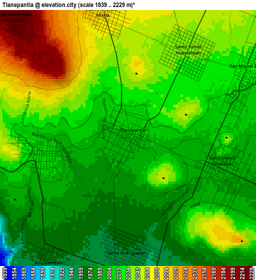
Below is the Elevation map of Tlanepantla, which displays elevation range with different colors. Scale of the first map is from 1839 to 2229 m (6033 to 7313 ft) with average elevation of 2023.6 meters (=6639 ft) [note 1]
These maps also provides idea of topography and contour of this city, they are displayed at different zoom levels. More info about maps, scale and edge coordinates you can find below images.

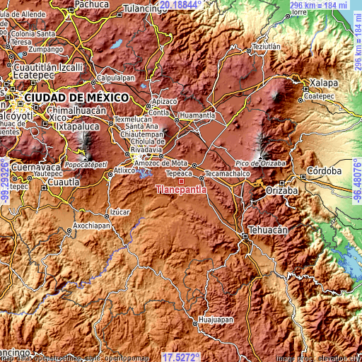
| \ | Map #1 | Map #2 | Topo.Map |
| Scale [m] | 1839..2229 m | 1736..2275 m | × |
| Scale [ft] | 6033..7313 ft | 5696..7464 ft | × |
| Average | 2023.6 m = 6639 ft | 2034 m = 6673 ft | × |
| Width | 9.25 km = 5.7 mi | 18.5 km = 11.5 mi | 295.9 km = 183.9 mi |
| Height | 9.25 km = 5.7 mi | 18.5 km = 11.5 mi | 295.9 km = 183.9 mi |
| ↑Max Latitude | 18.90468° | 18.94625° | 20.18844° |
| Latitude at center | 18.8631° | 18.8631° | 18.8631° |
| ↓Min Latitude | 18.82151° | 18.779909° | 17.5272° |
| ← Min Longitude | -97.930955° | -97.974901° | -99.29326° |
| Longitude center | -97.88701° | -97.88701° | -97.88701° |
| →Max Longitude | -97.843065° | -97.799119° | -96.48076° |
Nearby cities:
Cities around Tlanepantla sort by population:
• Tochtepec elevation 1980 m
7.3 km,  111°
111°
• Atoyatempan 1952 m
5.6 km,  210°
210°
• Hueyotlipan 2040 m
3.9 km,  35°
35°
• San Martín Caltenco 2015 m
7.6 km,  71°
71°
• Ahuatepec 2013 m
3.3 km,  260°
260°
• Ometepec 1994 m
3.7 km, 105°
• San Nicolás Zoyapetlayoca 2091 m
7.2 km,  18°
18°
• Zacaola 2020 m
4.6 km,  64°
64°
• Santa Ana Coapan 1961 m
3.6 km,  187°
187°
• Mixtla 2086 m
4.7 km,  349°
349°
• San Buenaventura 2224 m
6 km,  316°
316°
• Tepeyahualco 1942 m
5.5 km,  169°
169°
Multilingual:
 En español:
Tlanepantla elevación 2004 m.
 En France:
Tlanepantla élévation 2004 m.
 Auf Deutsch:
Tlanepantla höhe über dem Meeresspiegel ist 2004 m.

Sources and notes:
- [note 1] Map square and city borders are not equal. Map elevation data is calculated only from area inside that square.
- [src 1] Elevation data from geonames database provided with same terms of usage.
- [src 2] The elevation map of Tlanepantla is generated using elevation data from NASA's 3 arcsec (90m) resolution SRTM data.
- [src 3] Base (background) map © OpenStreetMap contributors tiles are generated by Geofabrik and OpenTopoMap.
Copyright & License:
This Tlanepantla Elevation Map is licensed under CC BY-SA. You may reuse any part from this page, if you give a proper credit by linking to this URL:
 More info on terms of use page.