Xico elevation
Xico (Veracruz), Mexico elevation is 1318 meters and Xico elevation in feet is 4324 ft above sea level [src 1]. Xico is a seat of a second-order administrative division (feature code) with elevation that is 4 meters (13 ft) bigger than average city elevation in Mexico.
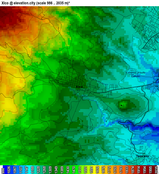
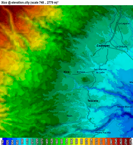
Below is the Elevation map of Xico, which displays elevation range with different colors. Scale of the first map is from 986 to 2035 m (3235 to 6677 ft) with average elevation of 1370.5 meters (=4496 ft) [note 1]
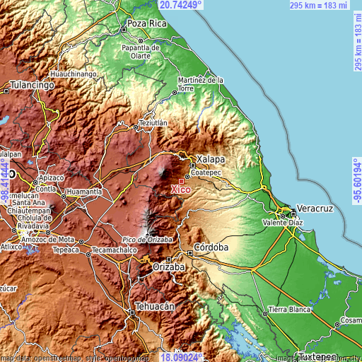
These maps also provides idea of topography and contour of this city, they are displayed at different zoom levels. More info about maps, scale and edge coordinates you can find below images.
| \ | Map #1 | Map #2 | Topo.Map |
| Scale [m] | 986..2035 m | 748..2779 m | × |
| Scale [ft] | 3235..6677 ft | 2454..9117 ft | × |
| Average | 1370.5 m = 4496 ft | 1460.3 m = 4791 ft | × |
| Width | 9.22 km = 5.7 mi | 18.43 km = 11.5 mi | 294.9 km = 183.2 mi |
| Height | 9.22 km = 5.7 mi | 18.43 km = 11.5 mi | 294.9 km = 183.2 mi |
| ↑Max Latitude | 19.463219° | 19.504648° | 20.74249° |
| Latitude at center | 19.42178° | 19.42178° | 19.42178° |
| ↓Min Latitude | 19.38033° | 19.33887° | 18.09024° |
| ← Min Longitude | -97.052135° | -97.096081° | -98.41444° |
| Longitude center | -97.00819° | -97.00819° | -97.00819° |
| →Max Longitude | -96.964245° | -96.920299° | -95.60194° |
Nearby cities:
Cities around Xico sort by population:
• Coatepec elevation 1202 m
6 km,  55°
55°
• Teocelo 1189 m
5.4 km,  138°
138°
• San Marcos de León 1097 m
4.6 km,  87°
87°
• Cosautlán 1257 m
10.2 km,  169°
169°
• Mahuixtlan 979 m
9.6 km,  98°
98°
• Colonia Úrsulo Galván 1157 m
3.2 km,  76°
76°
• Monte Blanco 997 m
9.5 km,  121°
121°
• La Orduña 1149 m
8.3 km,  66°
66°
• Piedra Parada 1083 m
9.8 km,  148°
148°
• Las Lomas 1134 m
11.1 km, 75°
• La Laguna 1247 m
10.3 km,  49°
49°
• Texin 1289 m
6.2 km,  176°
176°
Multilingual:
 En español:
Xico elevación 1318 m.
 En France:
Xico élévation 1318 m.


Sources and notes:
- [note 1] Map square and city borders are not equal. Map elevation data is calculated only from area inside that square.
- [src 1] Elevation data from geonames database provided with same terms of usage.
- [src 2] The elevation map of Xico is generated using elevation data from NASA's 3 arcsec (90m) resolution SRTM data.
- [src 3] Base (background) map © OpenStreetMap contributors tiles are generated by Geofabrik and OpenTopoMap.
Copyright & License:
This Xico Elevation Map is licensed under CC BY-SA. You may reuse any part from this page, if you give a proper credit by linking to this URL:
 More info on terms of use page.