Figuig (Centre) elevation
Figuig (Centre), Morocco elevation is 898 meters and Figuig (Centre) elevation in feet is 2946 ft above sea level [src 1]. Figuig (Centre) is a populated place (feature code) with elevation that is 282 meters (925 ft) bigger than average city elevation in Morocco.
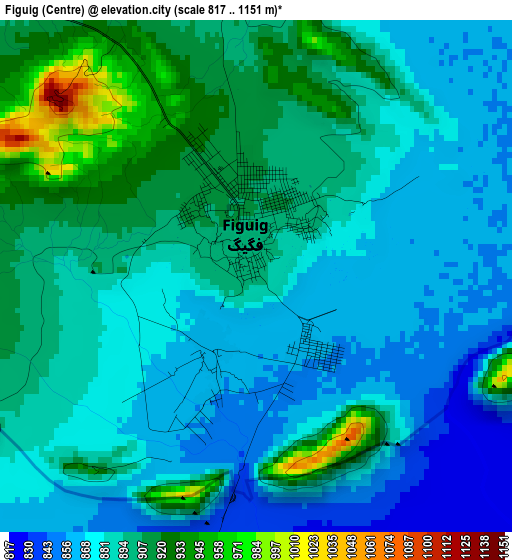
Below is the Elevation map of Figuig (Centre), which displays elevation range with different colors. Scale of the first map is from 817 to 1151 m (2680 to 3776 ft) with average elevation of 888.7 meters (=2916 ft) [note 1]
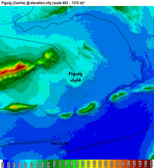
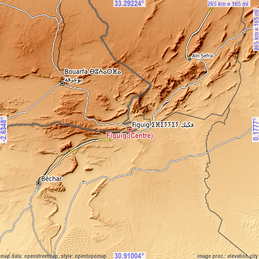
These maps also provides idea of topography and contour of this city, they are displayed at different zoom levels. More info about maps, scale and edge coordinates you can find below images.
| \ | Map #1 | Map #2 | Topo.Map |
| Scale [m] | 817..1151 m | 803..1372 m | × |
| Scale [ft] | 2680..3776 ft | 2635..4501 ft | × |
| Average | 888.7 m = 2916 ft | 877.3 m = 2878 ft | × |
| Width | 8.28 km = 5.1 mi | 16.56 km = 10.3 mi | 264.9 km = 164.6 mi |
| Height | 8.28 km = 5.1 mi | 16.56 km = 10.3 mi | 264.9 km = 164.6 mi |
| ↑Max Latitude | 32.146126° | 32.183326° | 33.29224° |
| Latitude at center | 32.10891° | 32.10891° | 32.10891° |
| ↓Min Latitude | 32.071679° | 32.034433° | 30.91004° |
| ← Min Longitude | -1.272495° | -1.316441° | -2.6348° |
| Longitude center | -1.22855° | -1.22855° | -1.22855° |
| →Max Longitude | -1.184605° | -1.140659° | 0.1777° |
Nearby cities:
Cities around Figuig (Centre) sort by population:
• Oujda-Angad elevation 549 m
292.9 km,  347°
347°
• Taourirt 394 m
299 km,  328°
328°
• Jerada 1045 m
259.6 km,  340°
340°
• El Aïoun 604 m
299.6 km, 336°
• Bouarfa 1169 m
83.6 km,  304°
304°
• Arfoud 809 m
293.7 km,  255°
255°
• Aïn Beni Mathar 917 m
224.2 km, 340°
• Aoufous 1031 m
281.7 km, 260°
• Missour 883 m
279 km,  292°
292°
• Guenfouda 818 m
274.7 km, 343°
• Debdou 994 m
268.3 km,  320°
320°
• Tiouli 1101 m
257.3 km, 347°
Multilingual:
 En español:
Figuig (Centre) elevación 898 m.
 En France:
Figuig (Centre) élévation 898 m.
 Auf Deutsch:
Figuig (Centre) höhe über dem Meeresspiegel ist 898 m.

Sources and notes:
- [note 1] Map square and city borders are not equal. Map elevation data is calculated only from area inside that square.
- [src 1] Elevation data from geonames database provided with same terms of usage.
- [src 2] The elevation map of Figuig (Centre) is generated using elevation data from NASA's 3 arcsec (90m) resolution SRTM data.
- [src 3] Base (background) map © OpenStreetMap contributors tiles are generated by Geofabrik and OpenTopoMap.
Copyright & License:
This Figuig (Centre) Elevation Map is licensed under CC BY-SA. You may reuse any part from this page, if you give a proper credit by linking to this URL:
 More info on terms of use page.