Rokiškis elevation
Rokiškis (Panevėžys), Lithuania elevation is 137 meters and Rokiškis elevation in feet is 449 ft above sea level [src 1]. Rokiškis is a seat of a second-order administrative division (feature code) with elevation that is 44 meters (144 ft) bigger than average city elevation in Lithuania.
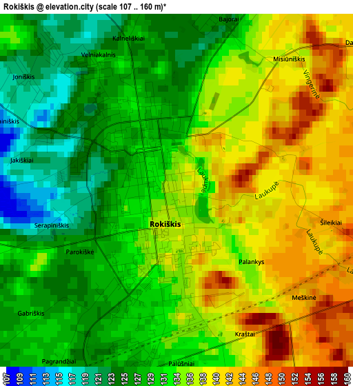
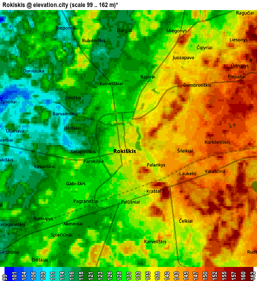
Below is the Elevation map of Rokiškis, which displays elevation range with different colors. Scale of the first map is from 107 to 160 m (351 to 525 ft) with average elevation of 133 meters (=436 ft) [note 1]
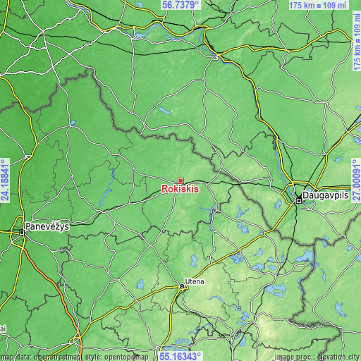
These maps also provides idea of topography and contour of this city, they are displayed at different zoom levels. More info about maps, scale and edge coordinates you can find below images.
| \ | Map #1 | Map #2 | Topo.Map |
| Scale [m] | 107..160 m | 99..162 m | × |
| Scale [ft] | 351..525 ft | 325..531 ft | × |
| Average | 133 m = 436 ft | 131.8 m = 432 ft | × |
| Width | 5.47 km = 3.4 mi | 10.94 km = 6.8 mi | 175.1 km = 108.8 mi |
| Height | 5.47 km = 3.4 mi | 10.94 km = 6.8 mi | 175 km = 108.7 mi |
| ↑Max Latitude | 55.983262° | 56.007839° | 56.7379° |
| Latitude at center | 55.95867° | 55.95867° | 55.95867° |
| ↓Min Latitude | 55.934062° | 55.909438° | 55.16343° |
| ← Min Longitude | 25.550715° | 25.506769° | 24.18841° |
| Longitude center | 25.59466° | 25.59466° | 25.59466° |
| →Max Longitude | 25.638605° | 25.682551° | 27.00091° |
Nearby cities:
Cities around Rokiškis sort by population:
• Utena elevation 104 m
51.3 km,  179°
179°
• Visaginas 158 m
66.4 km,  127°
127°
• Birzai 53 m
58.9 km,  297°
297°
• Anyksciai 74 m
57.2 km,  212°
212°
• Pasvalys 35 m
74.9 km,  278°
278°
• Kupiskis 97 m
40.5 km,  251°
251°
• Zarasai 154 m
48.1 km,  121°
121°
• Ignalina 166 m
77.3 km,  152°
152°
• Juodupė 107 m
14.3 km,  3°
3°
• Obeliai 91 m
27.3 km,  272°
272°
• Vabalninkas 64 m
52.7 km, 272°
• Dūkštas 165 m
66.5 km,  136°
136°
Multilingual:
 En español:
Rokiškis elevación 137 m.
 En France:
Rokiškis élévation 137 m.
 Auf Deutsch:
Rakischki, Rokiškis höhe über dem Meeresspiegel ist 137 m.

Sources and notes:
- [note 1] Map square and city borders are not equal. Map elevation data is calculated only from area inside that square.
- [src 1] Elevation data from geonames database provided with same terms of usage.
- [src 2] The elevation map of Rokiškis is generated using elevation data from NASA's 3 arcsec (90m) resolution SRTM data.
- [src 3] Base (background) map © OpenStreetMap contributors tiles are generated by Geofabrik and OpenTopoMap.
Copyright & License:
This Rokiškis Elevation Map is licensed under CC BY-SA. You may reuse any part from this page, if you give a proper credit by linking to this URL:
 More info on terms of use page.