Pasvalys elevation
Pasvalys (Panevėžys), Lithuania elevation is 35 meters and Pasvalys elevation in feet is 115 ft above sea level [src 1]. Pasvalys is a populated place (feature code) with elevation that is 58 meters (190 ft) smaller than average city elevation in Lithuania.
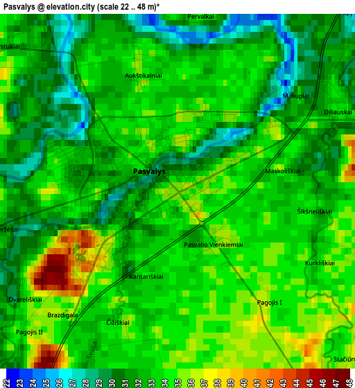
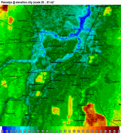
Below is the Elevation map of Pasvalys, which displays elevation range with different colors. Scale of the first map is from 22 to 48 m (72 to 157 ft) with average elevation of 32.7 meters (=107 ft) [note 1]
These maps also provides idea of topography and contour of this city, they are displayed at different zoom levels. More info about maps, scale and edge coordinates you can find below images.
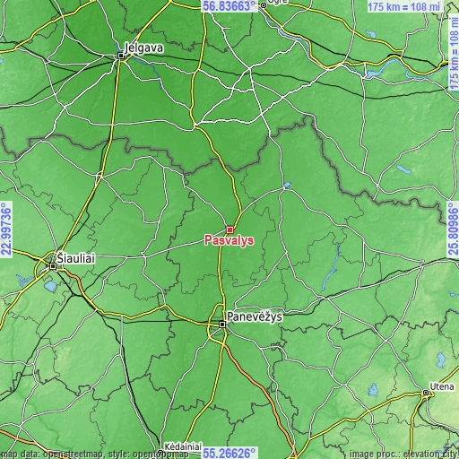
| \ | Map #1 | Map #2 | Topo.Map |
| Scale [m] | 22..48 m | 20..61 m | × |
| Scale [ft] | 72..157 ft | 66..200 ft | × |
| Average | 32.7 m = 107 ft | 35.2 m = 115 ft | × |
| Width | 5.46 km = 3.4 mi | 10.91 km = 6.8 mi | 174.6 km = 108.5 mi |
| Height | 5.46 km = 3.4 mi | 10.91 km = 6.8 mi | 174.6 km = 108.5 mi |
| ↑Max Latitude | 56.083968° | 56.108481° | 56.83663° |
| Latitude at center | 56.05944° | 56.05944° | 56.05944° |
| ↓Min Latitude | 56.034896° | 56.010337° | 55.26626° |
| ← Min Longitude | 24.359665° | 24.315719° | 22.99736° |
| Longitude center | 24.40361° | 24.40361° | 24.40361° |
| →Max Longitude | 24.447555° | 24.491501° | 25.80986° |
Nearby cities:
Cities around Pasvalys sort by population:
• Šiauliai elevation 129 m
69 km,  258°
258°
• Panevėžys 52 m
36.4 km,  185°
185°
• Radviliskis 124 m
60.5 km,  243°
243°
• Birzai 53 m
26.6 km,  53°
53°
• Joniškis 50 m
52.8 km,  292°
292°
• Kupiskis 97 m
43.4 km,  124°
124°
• Pakruojis 61 m
35.2 km, 255°
• Šeduva 96 m
53.1 km,  229°
229°
• Linkuva 76 m
27 km,  276°
276°
• Ramygala 57 m
61 km, 186°
• Obeliai 91 m
47.9 km,  102°
102°
• Vabalninkas 64 m
23.1 km,  112°
112°
Multilingual:
 En español:
Pasvalys elevación 35 m.
 En France:
Pasvalys élévation 35 m.


Sources and notes:
- [note 1] Map square and city borders are not equal. Map elevation data is calculated only from area inside that square.
- [src 1] Elevation data from geonames database provided with same terms of usage.
- [src 2] The elevation map of Pasvalys is generated using elevation data from NASA's 3 arcsec (90m) resolution SRTM data.
- [src 3] Base (background) map © OpenStreetMap contributors tiles are generated by Geofabrik and OpenTopoMap.
Copyright & License:
This Pasvalys Elevation Map is licensed under CC BY-SA. You may reuse any part from this page, if you give a proper credit by linking to this URL:
 More info on terms of use page.