Zarasai elevation
Zarasai (Utena), Lithuania elevation is 154 meters and Zarasai elevation in feet is 505 ft above sea level [src 1]. Zarasai is a seat of a second-order administrative division (feature code) with elevation that is 61 meters (200 ft) bigger than average city elevation in Lithuania.
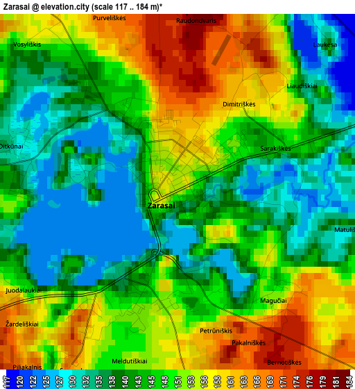
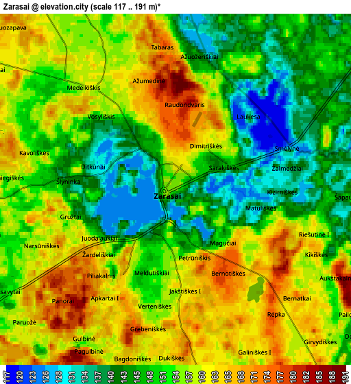
Below is the Elevation map of Zarasai, which displays elevation range with different colors. Scale of the first map is from 117 to 184 m (384 to 604 ft) with average elevation of 146.8 meters (=482 ft) [note 1]
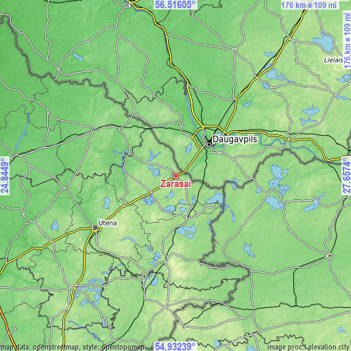
These maps also provides idea of topography and contour of this city, they are displayed at different zoom levels. More info about maps, scale and edge coordinates you can find below images.
| \ | Map #1 | Map #2 | Topo.Map |
| Scale [m] | 117..184 m | 117..191 m | × |
| Scale [ft] | 384..604 ft | 384..627 ft | × |
| Average | 146.8 m = 482 ft | 153.7 m = 504 ft | × |
| Width | 5.5 km = 3.4 mi | 11.01 km = 6.8 mi | 176.1 km = 109.4 mi |
| Height | 5.5 km = 3.4 mi | 11 km = 6.8 mi | 176.1 km = 109.4 mi |
| ↑Max Latitude | 55.756986° | 55.781706° | 56.51605° |
| Latitude at center | 55.73225° | 55.73225° | 55.73225° |
| ↓Min Latitude | 55.707498° | 55.682731° | 54.93239° |
| ← Min Longitude | 26.207205° | 26.163259° | 24.8449° |
| Longitude center | 26.25115° | 26.25115° | 26.25115° |
| →Max Longitude | 26.295095° | 26.339041° | 27.6574° |
Nearby cities:
Cities around Zarasai sort by population:
• Utena elevation 104 m
48.5 km,  237°
237°
• Visaginas 158 m
19.2 km,  141°
141°
• Rokiškis 137 m
48.1 km,  301°
301°
• Anyksciai 74 m
75.7 km,  252°
252°
• Kupiskis 97 m
80.4 km,  278°
278°
• Molėtai 164 m
77.1 km,  222°
222°
• Švenčionėliai 160 m
65.4 km,  193°
193°
• Ignalina 166 m
43.9 km, 187°
• Švenčionys 200 m
66.7 km, 185°
• Juodupė 107 m
56.3 km,  314°
314°
• Obeliai 91 m
73.2 km,  291°
291°
• Dūkštas 165 m
23.8 km,  169°
169°
Multilingual:
 En español:
Zarasai elevación 154 m.
 En France:
Zarasai élévation 154 m.


Sources and notes:
- [note 1] Map square and city borders are not equal. Map elevation data is calculated only from area inside that square.
- [src 1] Elevation data from geonames database provided with same terms of usage.
- [src 2] The elevation map of Zarasai is generated using elevation data from NASA's 3 arcsec (90m) resolution SRTM data.
- [src 3] Base (background) map © OpenStreetMap contributors tiles are generated by Geofabrik and OpenTopoMap.
Copyright & License:
This Zarasai Elevation Map is licensed under CC BY-SA. You may reuse any part from this page, if you give a proper credit by linking to this URL:
 More info on terms of use page.