Širvintos elevation
Širvintos (Vilnius, Sirvintos), Lithuania elevation is 115 meters and Širvintos elevation in feet is 377 ft above sea level [src 1]. Širvintos is a seat of a second-order administrative division (feature code) with elevation that is 22 meters (72 ft) bigger than average city elevation in Lithuania.
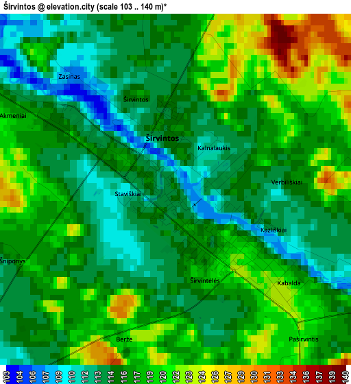
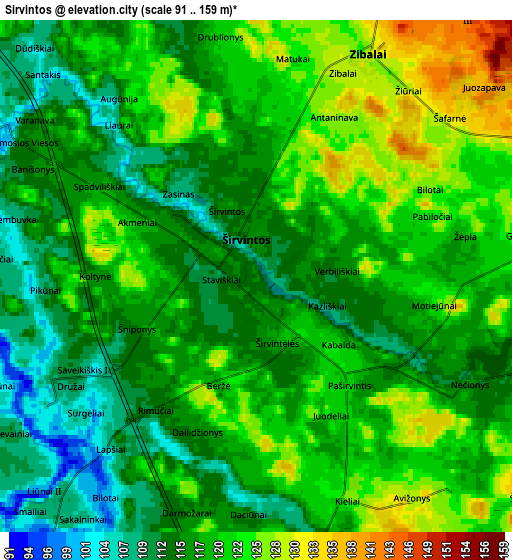
Below is the Elevation map of Širvintos, which displays elevation range with different colors. Scale of the first map is from 103 to 140 m (338 to 459 ft) with average elevation of 116.6 meters (=383 ft) [note 1]
These maps also provides idea of topography and contour of this city, they are displayed at different zoom levels. More info about maps, scale and edge coordinates you can find below images.
| \ | Map #1 | Map #2 | Topo.Map |
| Scale [m] | 103..140 m | 91..159 m | × |
| Scale [ft] | 338..459 ft | 299..522 ft | × |
| Average | 116.6 m = 383 ft | 118.2 m = 388 ft | × |
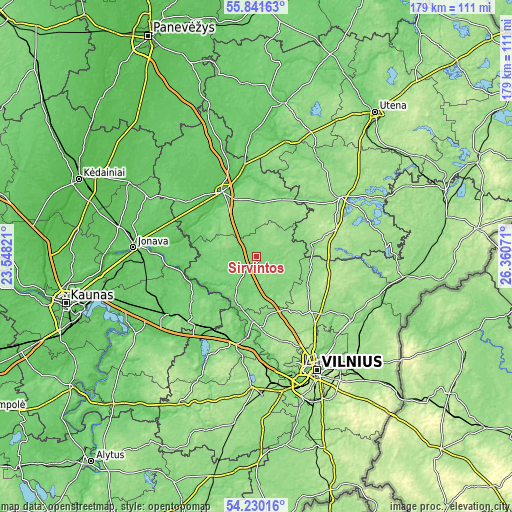
| Width | 5.6 km = 3.5 mi | 11.2 km = 7 mi | 179.2 km = 111.3 mi |
| Height | 5.6 km = 3.5 mi | 11.2 km = 7 mi | 179.2 km = 111.3 mi |
| ↑Max Latitude | 55.06917° | 55.094325° | 55.84163° |
| Latitude at center | 55.044° | 55.044° | 55.044° |
| ↓Min Latitude | 55.018814° | 54.993612° | 54.23016° |
| ← Min Longitude | 24.910515° | 24.866569° | 23.54821° |
| Longitude center | 24.95446° | 24.95446° | 24.95446° |
| →Max Longitude | 24.998405° | 25.042351° | 26.36071° |
Nearby cities:
Cities around Širvintos sort by population:
• Fabijoniškės elevation 184 m
39.1 km,  151°
151°
• Pašilaičiai 173 m
38.4 km, 153°
• Šeškinė 165 m
41.7 km, 152°
• Justiniškės 181 m
40.1 km,  155°
155°
• Ukmerge 72 m
26.3 km,  330°
330°
• Pilaitė 158 m
41 km, 159°
• Elektrėnai 114 m
34.3 km,  212°
212°
• Grigiškės 85 m
40.9 km,  168°
168°
• Kaišiadorys 82 m
36.9 km,  237°
237°
• Molėtai 164 m
35.6 km,  55°
55°
• Nemenčinė 116 m
39.5 km,  123°
123°
• Vievis 134 m
32.4 km,  197°
197°
Multilingual:
 En español:
Širvintos elevación 115 m.
 En France:
Širvintos élévation 115 m.
 Auf Deutsch:
Širvintos höhe über dem Meeresspiegel ist 115 m.

Sources and notes:
- [note 1] Map square and city borders are not equal. Map elevation data is calculated only from area inside that square.
- [src 1] Elevation data from geonames database provided with same terms of usage.
- [src 2] The elevation map of Širvintos is generated using elevation data from NASA's 3 arcsec (90m) resolution SRTM data.
- [src 3] Base (background) map © OpenStreetMap contributors tiles are generated by Geofabrik and OpenTopoMap.
Copyright & License:
This Širvintos Elevation Map is licensed under CC BY-SA. You may reuse any part from this page, if you give a proper credit by linking to this URL:
 More info on terms of use page.