Kaišiadorys elevation
Kaišiadorys (Kaunas), Lithuania elevation is 82 meters and Kaišiadorys elevation in feet is 269 ft above sea level [src 1]. Kaišiadorys is a seat of a second-order administrative division (feature code) with elevation that is 11 meters (36 ft) smaller than average city elevation in Lithuania.
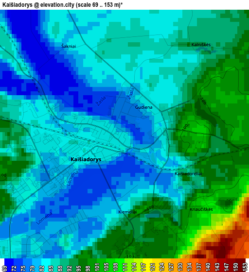
Below is the Elevation map of Kaišiadorys, which displays elevation range with different colors. Scale of the first map is from 69 to 153 m (226 to 502 ft) with average elevation of 88 meters (=289 ft) [note 1]
These maps also provides idea of topography and contour of this city, they are displayed at different zoom levels. More info about maps, scale and edge coordinates you can find below images.
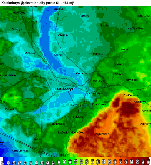
| \ | Map #1 | Map #2 | Topo.Map |
| Scale [m] | 69..153 m | 61..164 m | × |
| Scale [ft] | 226..502 ft | 200..538 ft | × |
| Average | 88 m = 289 ft | 99 m = 325 ft | × |
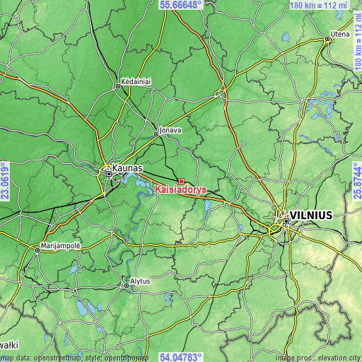
| Width | 5.62 km = 3.5 mi | 11.25 km = 7 mi | 180 km = 111.8 mi |
| Height | 5.62 km = 3.5 mi | 11.25 km = 7 mi | 180 km = 111.8 mi |
| ↑Max Latitude | 54.890563° | 54.915829° | 55.66648° |
| Latitude at center | 54.86528° | 54.86528° | 54.86528° |
| ↓Min Latitude | 54.839981° | 54.814667° | 54.04783° |
| ← Min Longitude | 24.424205° | 24.380259° | 23.0619° |
| Longitude center | 24.46815° | 24.46815° | 24.46815° |
| →Max Longitude | 24.512095° | 24.556041° | 25.8744° |
Nearby cities:
Cities around Kaišiadorys sort by population:
• Kaunas elevation 74 m
36 km,  276°
276°
• Dainava (Kaunas) 70 m
32.4 km, 279°
• Eiguliai 69 m
35 km, 282°
• Jonava 70 m
27 km,  334°
334°
• Aleksotas 73 m
35.8 km,  272°
272°
• Elektrėnai 114 m
15.3 km,  125°
125°
• Vievis 134 m
23.9 km,  117°
117°
• Žiežmariai 81 m
6.7 km,  195°
195°
• Ramučiai 74 m
29.5 km,  288°
288°
• Karmėlava 63 m
28.5 km, 294°
• Jieznas 110 m
35 km,  212°
212°
• Aukstadvaris 148 m
32 km,  173°
173°
Multilingual:
 En español:
Kaišiadorys elevación 82 m.
 En France:
Kaišiadorys élévation 82 m.
 Auf Deutsch:
Kaišiadorys höhe über dem Meeresspiegel ist 82 m.

Sources and notes:
- [note 1] Map square and city borders are not equal. Map elevation data is calculated only from area inside that square.
- [src 1] Elevation data from geonames database provided with same terms of usage.
- [src 2] The elevation map of Kaišiadorys is generated using elevation data from NASA's 3 arcsec (90m) resolution SRTM data.
- [src 3] Base (background) map © OpenStreetMap contributors tiles are generated by Geofabrik and OpenTopoMap.
Copyright & License:
This Kaišiadorys Elevation Map is licensed under CC BY-SA. You may reuse any part from this page, if you give a proper credit by linking to this URL:
 More info on terms of use page.