Aleksotas elevation
Aleksotas (Kaunas), Lithuania elevation is 73 meters and Aleksotas elevation in feet is 240 ft above sea level [src 1]. Aleksotas is a section of populated place (feature code) with elevation that is 20 meters (66 ft) smaller than average city elevation in Lithuania.
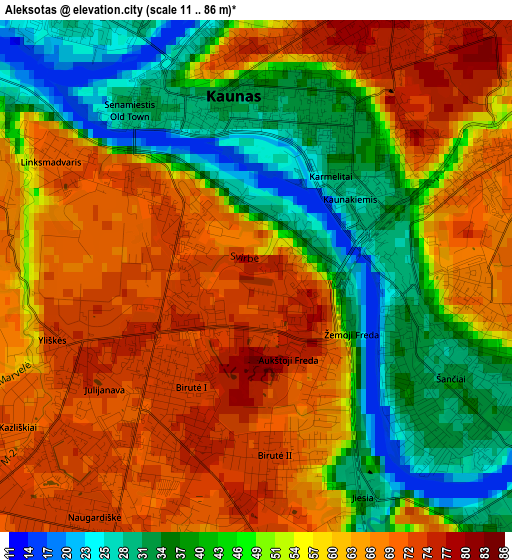
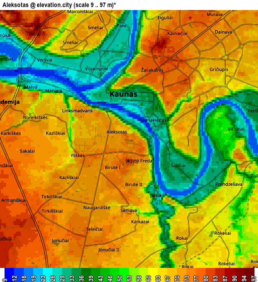
Below is the Elevation map of Aleksotas, which displays elevation range with different colors. Scale of the first map is from 11 to 86 m (36 to 282 ft) with average elevation of 54.5 meters (=179 ft) [note 1]
These maps also provides idea of topography and contour of this city, they are displayed at different zoom levels. More info about maps, scale and edge coordinates you can find below images.
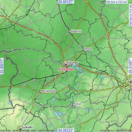
| \ | Map #1 | Map #2 | Topo.Map |
| Scale [m] | 11..86 m | 9..97 m | × |
| Scale [ft] | 36..282 ft | 30..318 ft | × |
| Average | 54.5 m = 179 ft | 59.5 m = 195 ft | × |
| Width | 5.62 km = 3.5 mi | 11.24 km = 7 mi | 179.9 km = 111.8 mi |
| Height | 5.62 km = 3.5 mi | 11.24 km = 7 mi | 179.9 km = 111.8 mi |
| ↑Max Latitude | 54.905643° | 54.9309° | 55.68127° |
| Latitude at center | 54.88037° | 54.88037° | 54.88037° |
| ↓Min Latitude | 54.855081° | 54.829776° | 54.06323° |
| ← Min Longitude | 23.864475° | 23.820529° | 22.50217° |
| Longitude center | 23.90842° | 23.90842° | 23.90842° |
| →Max Longitude | 23.952365° | 23.996311° | 25.31467° |
Nearby cities:
Cities around Aleksotas sort by population:
• Kaunas elevation 74 m
2.5 km,  1°
1°
• Dainava (Kaunas) 70 m
5.5 km,  44°
44°
• Eiguliai 69 m
5.9 km,  15°
15°
• Šilainiai 68 m
5.6 km,  345°
345°
• Garliava 72 m
7 km,  199°
199°
• Akademija (Kaunas) 75 m
5.7 km,  288°
288°
• Sargėnai 90 m
7.8 km, 348°
• Ežerėlis 72 m
19.5 km,  270°
270°
• Ramučiai 74 m
10.9 km,  45°
45°
• Kulautuva 34 m
18.4 km, 291°
• Karmėlava 63 m
14 km, 44°
• Mastaiciai 77 m
7.9 km,  211°
211°
Multilingual:
 En español:
Aleksotas elevación 73 m.
 En France:
Aleksotas élévation 73 m.
 Auf Deutsch:
Aleksotas höhe über dem Meeresspiegel ist 73 m.

Sources and notes:
- [note 1] Map square and city borders are not equal. Map elevation data is calculated only from area inside that square.
- [src 1] Elevation data from geonames database provided with same terms of usage.
- [src 2] The elevation map of Aleksotas is generated using elevation data from NASA's 3 arcsec (90m) resolution SRTM data.
- [src 3] Base (background) map © OpenStreetMap contributors tiles are generated by Geofabrik and OpenTopoMap.
Copyright & License:
This Aleksotas Elevation Map is licensed under CC BY-SA. You may reuse any part from this page, if you give a proper credit by linking to this URL:
 More info on terms of use page.