Elektrėnai elevation
Elektrėnai (Vilnius), Lithuania elevation is 114 meters and Elektrėnai elevation in feet is 374 ft above sea level [src 1]. Elektrėnai is a populated place (feature code) with elevation that is 21 meters (69 ft) bigger than average city elevation in Lithuania.
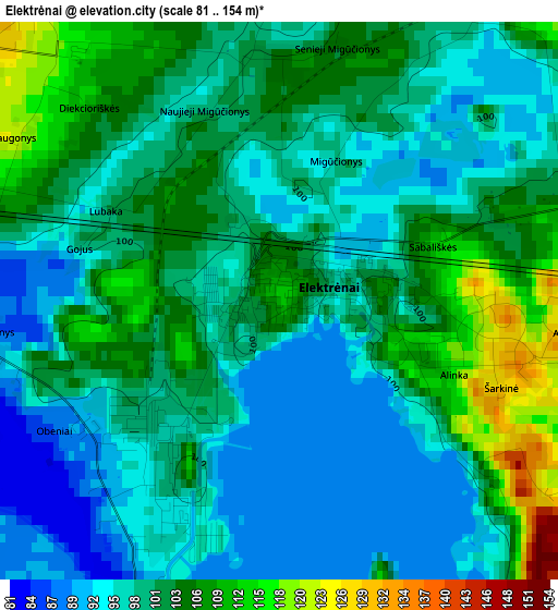
Below is the Elevation map of Elektrėnai, which displays elevation range with different colors. Scale of the first map is from 81 to 154 m (266 to 505 ft) with average elevation of 100.4 meters (=329 ft) [note 1]
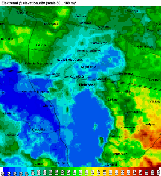
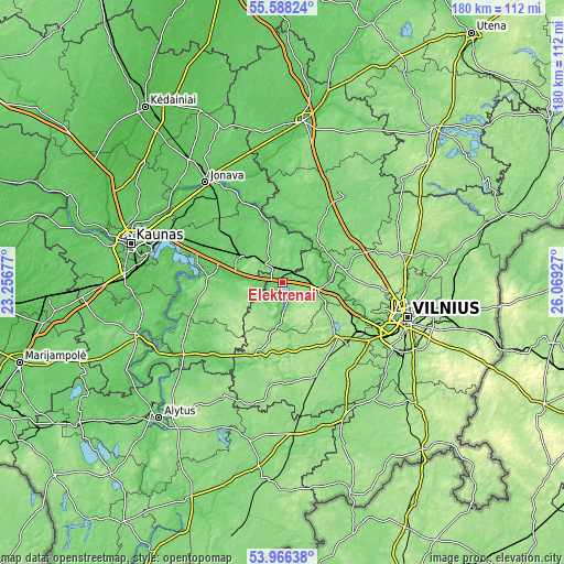
These maps also provides idea of topography and contour of this city, they are displayed at different zoom levels. More info about maps, scale and edge coordinates you can find below images.
| \ | Map #1 | Map #2 | Topo.Map |
| Scale [m] | 81..154 m | 80..189 m | × |
| Scale [ft] | 266..505 ft | 262..620 ft | × |
| Average | 100.4 m = 329 ft | 110.4 m = 362 ft | × |
| Width | 5.64 km = 3.5 mi | 11.27 km = 7 mi | 180.3 km = 112 mi |
| Height | 5.64 km = 3.5 mi | 11.27 km = 7 mi | 180.3 km = 112 mi |
| ↑Max Latitude | 54.810773° | 54.836089° | 55.58824° |
| Latitude at center | 54.78544° | 54.78544° | 54.78544° |
| ↓Min Latitude | 54.760091° | 54.734727° | 53.96638° |
| ← Min Longitude | 24.619075° | 24.575129° | 23.25677° |
| Longitude center | 24.66302° | 24.66302° | 24.66302° |
| →Max Longitude | 24.706965° | 24.750911° | 26.06927° |
Nearby cities:
Cities around Elektrėnai sort by population:
• Pašilaičiai elevation 173 m
36.1 km,  99°
99°
• Pilaitė 158 m
34.8 km,  105°
105°
• Lentvaris 166 m
29.5 km,  122°
122°
• Grigiškės 85 m
29.3 km, 112°
• Kaišiadorys 82 m
15.3 km,  305°
305°
• Širvintos 115 m
34.3 km,  32°
32°
• Trakai 152 m
23.9 km,  133°
133°
• Vievis 134 m
9 km, 103°
• Žiežmariai 81 m
14.5 km,  279°
279°
• Rūdiškės 156 m
31.8 km,  160°
160°
• Senieji Trakai 159 m
28.3 km, 133°
• Aukstadvaris 148 m
24.5 km,  200°
200°
Multilingual:
 En español:
Elektrėnai elevación 114 m.
 En France:
Elektrėnai élévation 114 m.
 Auf Deutsch:
Elektrėnai höhe über dem Meeresspiegel ist 114 m.

Sources and notes:
- [note 1] Map square and city borders are not equal. Map elevation data is calculated only from area inside that square.
- [src 1] Elevation data from geonames database provided with same terms of usage.
- [src 2] The elevation map of Elektrėnai is generated using elevation data from NASA's 3 arcsec (90m) resolution SRTM data.
- [src 3] Base (background) map © OpenStreetMap contributors tiles are generated by Geofabrik and OpenTopoMap.
Copyright & License:
This Elektrėnai Elevation Map is licensed under CC BY-SA. You may reuse any part from this page, if you give a proper credit by linking to this URL:
 More info on terms of use page.