Yuzawa elevation
Yuzawa (Akita, Yuzawa-shi), Japan elevation is 100 meters and Yuzawa elevation in feet is 328 ft above sea level [src 1]. Yuzawa is a seat of a second-order administrative division (feature code) with elevation that is 15 meters (49 ft) bigger than average city elevation in Japan.
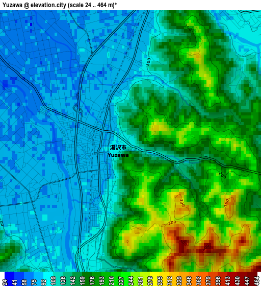
Below is the Elevation map of Yuzawa, which displays elevation range with different colors. Scale of the first map is from 24 to 464 m (79 to 1522 ft) with average elevation of 143.7 meters (=471 ft) [note 1]
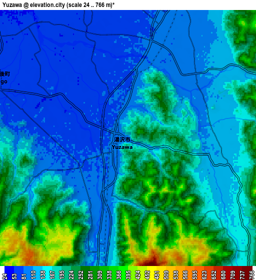
These maps also provides idea of topography and contour of this city, they are displayed at different zoom levels. More info about maps, scale and edge coordinates you can find below images.
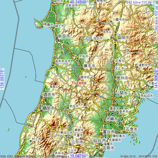
| \ | Map #1 | Map #2 | Topo.Map |
| Scale [m] | 24..464 m | 24..766 m | × |
| Scale [ft] | 79..1522 ft | 79..2513 ft | × |
| Average | 143.7 m = 471 ft | 168 m = 551 ft | × |
| Width | 7.58 km = 4.7 mi | 15.15 km = 9.4 mi | 242.5 km = 150.7 mi |
| Height | 7.58 km = 4.7 mi | 15.15 km = 9.4 mi | 242.4 km = 150.6 mi |
| ↑Max Latitude | 39.200733° | 39.23478° | 40.24848° |
| Latitude at center | 39.16667° | 39.16667° | 39.16667° |
| ↓Min Latitude | 39.13259° | 39.098494° | 38.06796° |
| ← Min Longitude | 140.456055° | 140.412109° | 139.09375° |
| Longitude center | 140.5° | 140.5° | 140.5° |
| →Max Longitude | 140.543945° | 140.587891° | 141.90625° |
Nearby cities:
Cities around Yuzawa sort by population:
• Kitakami elevation 63 m
54.7 km,  76°
76°
• Hanamaki 77 m
58.3 km,  65°
65°
• Mizusawa 64 m
54.7 km,  93°
93°
• Shinjō 99 m
48.5 km,  200°
200°
• Yokote 61 m
17.3 km,  14°
14°
• Ōmagari 28 m
31.5 km,  357°
357°
• Yuza 25 m
52 km,  251°
251°
• Kakunodatemachi 70 m
47.3 km, 7°
• Ōshū 36 m
57.7 km, 93°
• Nikaho 47 m
49.7 km,  283°
283°
• Yurihonjō 4 m
45.4 km,  303°
303°
• Daisen 22 m
30.5 km, 358°
Multilingual:
 En español:
Yuzawa elevación 100 m.
 En France:
Yuzawa élévation 100 m.


Sources and notes:
- [note 1] Map square and city borders are not equal. Map elevation data is calculated only from area inside that square.
- [src 1] Elevation data from geonames database provided with same terms of usage.
- [src 2] The elevation map of Yuzawa is generated using elevation data from NASA's 3 arcsec (90m) resolution SRTM data.
- [src 3] Base (background) map © OpenStreetMap contributors tiles are generated by Geofabrik and OpenTopoMap.
Copyright & License:
This Yuzawa Elevation Map is licensed under CC BY-SA. You may reuse any part from this page, if you give a proper credit by linking to this URL:
 More info on terms of use page.