Rukban elevation
Rukban (Mafraq), Jordan elevation is 772 meters and Rukban elevation in feet is 2533 ft above sea level [src 1]. Rukban is a populated place (feature code) with elevation that is 80 meters (262 ft) bigger than average city elevation in Jordan.
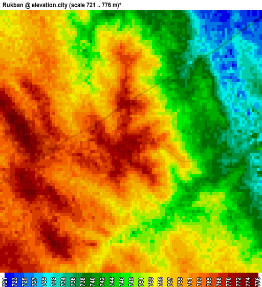
Below is the Elevation map of Rukban, which displays elevation range with different colors. Scale of the first map is from 721 to 776 m (2365 to 2546 ft) with average elevation of 753.6 meters (=2472 ft) [note 1]
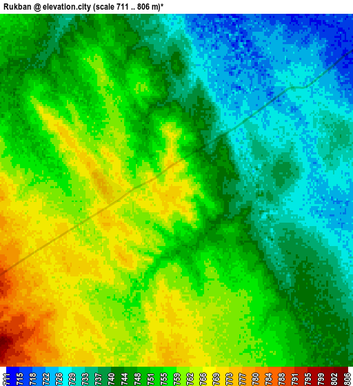
These maps also provides idea of topography and contour of this city, they are displayed at different zoom levels. More info about maps, scale and edge coordinates you can find below images.
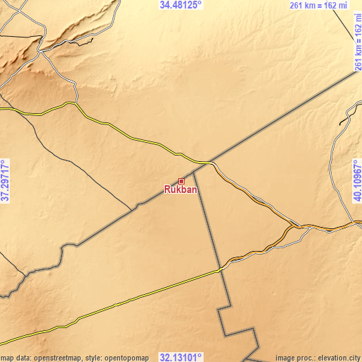
| \ | Map #1 | Map #2 | Topo.Map |
| Scale [m] | 721..776 m | 711..806 m | × |
| Scale [ft] | 2365..2546 ft | 2333..2644 ft | × |
| Average | 753.6 m = 2472 ft | 749.4 m = 2459 ft | × |
| Width | 8.17 km = 5.1 mi | 16.33 km = 10.1 mi | 261.3 km = 162.4 mi |
| Height | 8.17 km = 5.1 mi | 16.33 km = 10.1 mi | 261.3 km = 162.4 mi |
| ↑Max Latitude | 33.350766° | 33.387467° | 34.48125° |
| Latitude at center | 33.31405° | 33.31405° | 33.31405° |
| ↓Min Latitude | 33.277318° | 33.240571° | 32.13101° |
| ← Min Longitude | 38.659475° | 38.615529° | 37.29717° |
| Longitude center | 38.70342° | 38.70342° | 38.70342° |
| →Max Longitude | 38.747365° | 38.791311° | 40.10967° |
Nearby cities:
Cities around Rukban sort by population:
• Mafraq elevation 705 m
256.9 km,  245°
245°
• Al Azraq ash Shamālī 521 m
236.9 km,  227°
227°
• Al Ḩamrā’ 697 m
257.2 km, 247°
• Şabḩā 834 m
233.2 km,  241°
241°
• Umm al Qiţţayn 962 m
223.5 km, 240°
• Muthallath Jāmi‘at Āl al Bayt 679 m
254.6 km, 244°
• Samā as Sirḩān 613 m
248.1 km, 247°
• Umm al Jimāl 674 m
244.2 km, 243°
• Muthallath al Azraq 516 m
241.7 km, 227°
• Muthallath Şabḩā 750 m
239.6 km, 240°
• Dayr al Kahf 1016 m
209 km, 236°
• Ar Ruwayshid 694 m
101.7 km,  207°
207°
Multilingual:
 En español:
Rukban elevación 772 m.
 En France:
Rukban élévation 772 m.


Sources and notes:
- [note 1] Map square and city borders are not equal. Map elevation data is calculated only from area inside that square.
- [src 1] Elevation data from geonames database provided with same terms of usage.
- [src 2] The elevation map of Rukban is generated using elevation data from NASA's 3 arcsec (90m) resolution SRTM data.
- [src 3] Base (background) map © OpenStreetMap contributors tiles are generated by Geofabrik and OpenTopoMap.
Copyright & License:
This Rukban Elevation Map is licensed under CC BY-SA. You may reuse any part from this page, if you give a proper credit by linking to this URL:
 More info on terms of use page.