Al Ḩamrā’ elevation
Al Ḩamrā’ (Mafraq), Jordan elevation is 697 meters and Al Ḩamrā’ elevation in feet is 2287 ft above sea level [src 1]. Al Ḩamrā’ is a populated place (feature code) with elevation that is 5 meters (16 ft) bigger than average city elevation in Jordan.
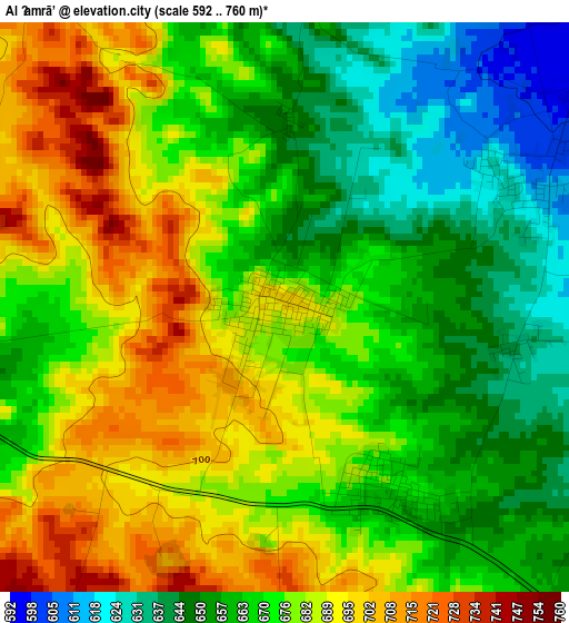
Below is the Elevation map of Al Ḩamrā’, which displays elevation range with different colors. Scale of the first map is from 592 to 760 m (1942 to 2493 ft) with average elevation of 672.7 meters (=2207 ft) [note 1]
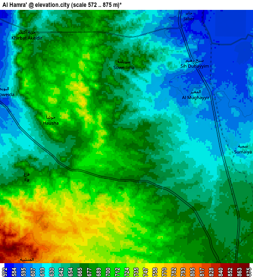
These maps also provides idea of topography and contour of this city, they are displayed at different zoom levels. More info about maps, scale and edge coordinates you can find below images.
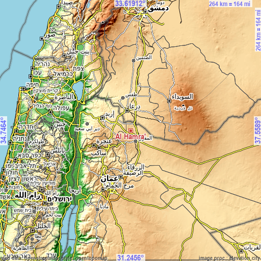
| \ | Map #1 | Map #2 | Topo.Map |
| Scale [m] | 592..760 m | 572..875 m | × |
| Scale [ft] | 1942..2493 ft | 1877..2871 ft | × |
| Average | 672.7 m = 2207 ft | 669.8 m = 2198 ft | × |
| Width | 8.25 km = 5.1 mi | 16.5 km = 10.3 mi | 263.9 km = 164 mi |
| Height | 8.25 km = 5.1 mi | 16.5 km = 10.3 mi | 263.9 km = 164 mi |
| ↑Max Latitude | 32.47725° | 32.514315° | 33.61912° |
| Latitude at center | 32.44017° | 32.44017° | 32.44017° |
| ↓Min Latitude | 32.403075° | 32.365964° | 31.2456° |
| ← Min Longitude | 36.108705° | 36.064759° | 34.7464° |
| Longitude center | 36.15265° | 36.15265° | 36.15265° |
| →Max Longitude | 36.196595° | 36.240541° | 37.5589° |
Nearby cities:
Cities around Al Ḩamrā’ sort by population:
• Ar Ramthā elevation 536 m
18.9 km,  314°
314°
• Mafraq 705 m
12 km,  154°
154°
• Rehab 896 m
14.2 km,  204°
204°
• Kitim 791 m
24 km,  269°
269°
• Balīlā 796 m
20.8 km,  254°
254°
• Qafqafā 998 m
22.5 km,  243°
243°
• Umm al Jimāl 674 m
23.7 km,  121°
121°
• Bal‘amā 673 m
23.4 km,  194°
194°
• Muthallath Jāmi‘at Āl al Bayt 679 m
12.9 km,  144°
144°
• Manshīyat Banī Ḩasan 820 m
10.3 km,  221°
221°
• Samā as Sirḩān 613 m
9.1 km,  69°
69°
• Ḩawshā 735 m
5.2 km,  283°
283°
Multilingual:
 En español:
Al Ḩamrā’ elevación 697 m.
 En France:
Al Ḩamrā’ élévation 697 m.
 Auf Deutsch:
Al Ḩamrā’ höhe über dem Meeresspiegel ist 697 m.

Sources and notes:
- [note 1] Map square and city borders are not equal. Map elevation data is calculated only from area inside that square.
- [src 1] Elevation data from geonames database provided with same terms of usage.
- [src 2] The elevation map of Al Ḩamrā’ is generated using elevation data from NASA's 3 arcsec (90m) resolution SRTM data.
- [src 3] Base (background) map © OpenStreetMap contributors tiles are generated by Geofabrik and OpenTopoMap.
Copyright & License:
This Al Ḩamrā’ Elevation Map is licensed under CC BY-SA. You may reuse any part from this page, if you give a proper credit by linking to this URL:
 More info on terms of use page.