Livera elevation
Livera (Piedmont, Provincia di Biella), Italy elevation is 676 meters and Livera elevation in feet is 2218 ft above sea level [src 1]. Livera is a seat of a third-order administrative division (feature code) with elevation that is 354 meters (1161 ft) bigger than average city elevation in Italy.
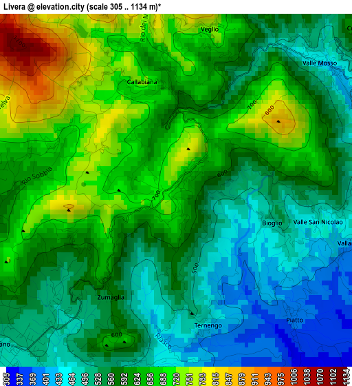
Below is the Elevation map of Livera, which displays elevation range with different colors. Scale of the first map is from 305 to 1134 m (1001 to 3720 ft) with average elevation of 596.1 meters (=1956 ft) [note 1]
These maps also provides idea of topography and contour of this city, they are displayed at different zoom levels. More info about maps, scale and edge coordinates you can find below images.
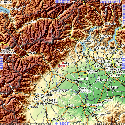
| \ | Map #1 | Topo.Map |
| Scale [m] | 305..1134 m | × |
| Scale [ft] | 1001..3720 ft | × |
| Average | 596.1 m = 1956 ft | × |
| Width | 6.84 km = 4.3 mi | 218.8 km = 136 mi |
| Height | 6.84 km = 4.3 mi | 218.7 km = 135.9 mi |
| ↑Max Latitude | 45.643122° | 46.58745° |
| Latitude at center | 45.61239° | 45.61239° |
| ↓Min Latitude | 45.581641° | 44.62008° |
| ← Min Longitude | 8.061765° | 6.69946° |
| Longitude center | 8.10571° | 8.10571° |
| →Max Longitude | 8.149655° | 9.51196° |
Nearby cities:
Cities around Livera sort by population:
• Pettinengo elevation 713 m
0.1 km,  302°
302°
• Zumaglia 587 m
2.4 km,  211°
211°
• Veglio 745 m
3.2 km,  11°
11°
• Bioglio-Portula-Andrè 594 m
2.4 km,  82°
82°
• Piatto 383 m
3.4 km,  137°
137°
• Ternengo 440 m
2.7 km,  166°
166°
• Vallanzengo 416 m
3.6 km,  106°
106°
• Maglione-Crosa 412 m
3.6 km, 107°
• Borgo 734 m
3 km, 13°
• Selve Marcone 759 m
1.6 km, 299°
• Valle San Nicolao 466 m
2.8 km,  102°
102°
• Callabiana - Chiesa 720 m
2.2 km,  342°
342°
Multilingual:
 En español:
Livera elevación 676 m.
 En France:
Livera élévation 676 m.


Sources and notes:
- [note 1] Map square and city borders are not equal. Map elevation data is calculated only from area inside that square.
- [src 1] Elevation data from geonames database provided with same terms of usage.
- [src 2] The elevation map of Livera is generated using elevation data from NASA's 3 arcsec (90m) resolution SRTM data.
- [src 3] Base (background) map © OpenStreetMap contributors tiles are generated by Geofabrik and OpenTopoMap.
Copyright & License:
This Livera Elevation Map is licensed under CC BY-SA. You may reuse any part from this page, if you give a proper credit by linking to this URL:
 More info on terms of use page.