Favari-Avatanei elevation
Favari-Avatanei (Piedmont, Torino), Italy elevation is 246 meters and Favari-Avatanei elevation in feet is 807 ft above sea level [src 1]. Favari-Avatanei is a populated place (feature code) with elevation that is 76 meters (249 ft) smaller than average city elevation in Italy.
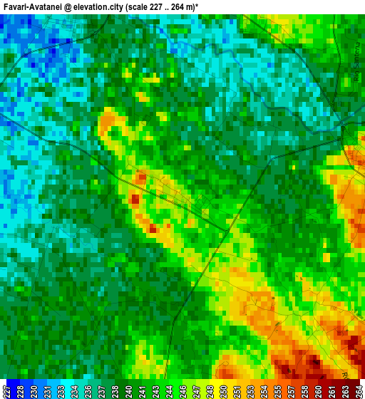
Below is the Elevation map of Favari-Avatanei, which displays elevation range with different colors. Scale of the first map is from 227 to 264 m (745 to 866 ft) with average elevation of 240.7 meters (=790 ft) [note 1]
These maps also provides idea of topography and contour of this city, they are displayed at different zoom levels. More info about maps, scale and edge coordinates you can find below images.
| \ | Map #1 | Topo.Map |
| Scale [m] | 227..264 m | × |
| Scale [ft] | 745..866 ft | × |
| Average | 240.7 m = 790 ft | × |
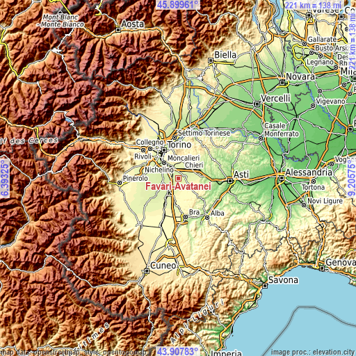
| Width | 6.92 km = 4.3 mi | 221.5 km = 137.6 mi |
| Height | 6.92 km = 4.3 mi | 221.5 km = 137.6 mi |
| ↑Max Latitude | 44.943463° | 45.89961° |
| Latitude at center | 44.91235° | 44.91235° |
| ↓Min Latitude | 44.88122° | 43.90783° |
| ← Min Longitude | 7.755555° | 6.39325° |
| Longitude center | 7.7995° | 7.7995° |
| →Max Longitude | 7.843445° | 9.20575° |
Nearby cities:
Cities around Favari-Avatanei sort by population:
• Carmagnola elevation 239 m
9.4 km,  221°
221°
• Trofarello 250 m
8.8 km,  331°
331°
• Santena 236 m
4.3 km, 331°
• Carignano 241 m
10 km,  265°
265°
• Poirino 257 m
3.7 km,  75°
75°
• Cambiano 254 m
6.8 km,  343°
343°
• Villastellone 237 m
4.5 km,  283°
283°
• Riva Presso Chieri 261 m
9.8 km,  36°
36°
• Pessione 253 m
6.7 km,  29°
29°
• Marocchi 245 m
3.6 km,  24°
24°
• Pralormo 308 m
10.1 km,  125°
125°
• Isolabella 263 m
8.7 km,  94°
94°
Multilingual:
 En español:
Favari-Avatanei elevación 246 m.
 En France:
Favari-Avatanei élévation 246 m.
 Auf Deutsch:
Favari-Avatanei höhe über dem Meeresspiegel ist 246 m.

Sources and notes:
- [note 1] Map square and city borders are not equal. Map elevation data is calculated only from area inside that square.
- [src 1] Elevation data from geonames database provided with same terms of usage.
- [src 2] The elevation map of Favari-Avatanei is generated using elevation data from NASA's 3 arcsec (90m) resolution SRTM data.
- [src 3] Base (background) map © OpenStreetMap contributors tiles are generated by Geofabrik and OpenTopoMap.
Copyright & License:
This Favari-Avatanei Elevation Map is licensed under CC BY-SA. You may reuse any part from this page, if you give a proper credit by linking to this URL:
 More info on terms of use page.