Cambiano elevation
Cambiano (Piedmont, Torino), Italy elevation is 254 meters and Cambiano elevation in feet is 833 ft above sea level [src 1]. Cambiano is a seat of a third-order administrative division (feature code) with elevation that is 68 meters (223 ft) smaller than average city elevation in Italy.
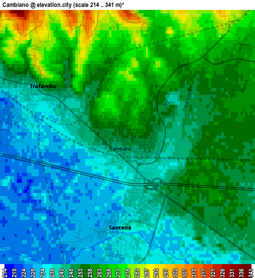
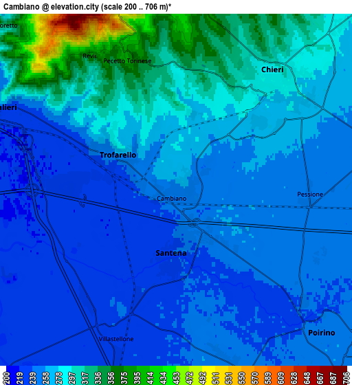
Below is the Elevation map of Cambiano, which displays elevation range with different colors. Scale of the first map is from 214 to 341 m (702 to 1119 ft) with average elevation of 251.3 meters (=824 ft) [note 1]
These maps also provides idea of topography and contour of this city, they are displayed at different zoom levels. More info about maps, scale and edge coordinates you can find below images.
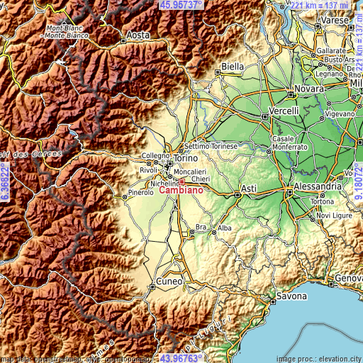
| \ | Map #1 | Map #2 | Topo.Map |
| Scale [m] | 214..341 m | 200..706 m | × |
| Scale [ft] | 702..1119 ft | 656..2316 ft | × |
| Average | 251.3 m = 824 ft | 269.9 m = 885 ft | × |
| Width | 6.91 km = 4.3 mi | 13.83 km = 8.6 mi | 221.2 km = 137.4 mi |
| Height | 6.91 km = 4.3 mi | 13.83 km = 8.6 mi | 221.2 km = 137.4 mi |
| ↑Max Latitude | 45.002211° | 45.033276° | 45.95737° |
| Latitude at center | 44.97113° | 44.97113° | 44.97113° |
| ↓Min Latitude | 44.940032° | 44.908917° | 43.96763° |
| ← Min Longitude | 7.730525° | 7.686579° | 6.36822° |
| Longitude center | 7.77447° | 7.77447° | 7.77447° |
| →Max Longitude | 7.818415° | 7.862361° | 9.18072° |
Nearby cities:
Cities around Cambiano sort by population:
• Chieri elevation 289 m
5.7 km,  40°
40°
• Trofarello 250 m
2.5 km,  299°
299°
• Santena 236 m
2.8 km,  182°
182°
• Pino Torinese 418 m
7.6 km,  1°
1°
• Poirino 257 m
7.9 km,  135°
135°
• Villastellone 237 m
6 km,  203°
203°
• Riva Presso Chieri 261 m
7.9 km,  80°
80°
• Pecetto 392 m
5.5 km,  340°
340°
• Revigliasco 332 m
5.9 km,  326°
326°
• Pessione 253 m
5.3 km,  97°
97°
• Marocchi 245 m
4.8 km,  132°
132°
• Favari-Avatanei 246 m
6.8 km,  163°
163°
Multilingual:
 En español:
Cambiano elevación 254 m.
 En France:
Cambiano élévation 254 m.
 Auf Deutsch:
Cambiano höhe über dem Meeresspiegel ist 254 m.

Sources and notes:
- [note 1] Map square and city borders are not equal. Map elevation data is calculated only from area inside that square.
- [src 1] Elevation data from geonames database provided with same terms of usage.
- [src 2] The elevation map of Cambiano is generated using elevation data from NASA's 3 arcsec (90m) resolution SRTM data.
- [src 3] Base (background) map © OpenStreetMap contributors tiles are generated by Geofabrik and OpenTopoMap.
Copyright & License:
This Cambiano Elevation Map is licensed under CC BY-SA. You may reuse any part from this page, if you give a proper credit by linking to this URL:
 More info on terms of use page.