Viadana elevation
Viadana (Lombardy, Provincia di Brescia), Italy elevation is 76 meters and Viadana elevation in feet is 249 ft above sea level [src 1]. Viadana is a populated place (feature code) with elevation that is 246 meters (807 ft) smaller than average city elevation in Italy.
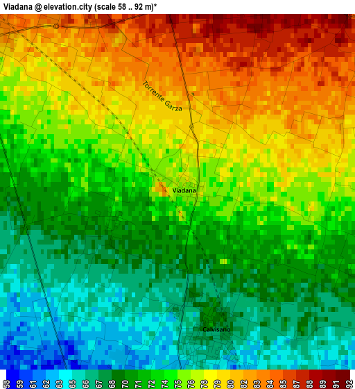
Below is the Elevation map of Viadana, which displays elevation range with different colors. Scale of the first map is from 58 to 92 m (190 to 302 ft) with average elevation of 74.1 meters (=243 ft) [note 1]
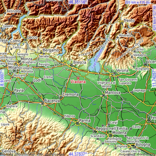
These maps also provides idea of topography and contour of this city, they are displayed at different zoom levels. More info about maps, scale and edge coordinates you can find below images.
| \ | Map #1 | Topo.Map |
| Scale [m] | 58..92 m | × |
| Scale [ft] | 190..302 ft | × |
| Average | 74.1 m = 243 ft | × |
| Width | 6.87 km = 4.3 mi | 219.7 km = 136.5 mi |
| Height | 6.87 km = 4.3 mi | 219.7 km = 136.5 mi |
| ↑Max Latitude | 45.402753° | 46.35116° |
| Latitude at center | 45.37189° | 45.37189° |
| ↓Min Latitude | 45.34101° | 44.37537° |
| ← Min Longitude | 10.292375° | 8.93007° |
| Longitude center | 10.33632° | 10.33632° |
| →Max Longitude | 10.380265° | 11.74257° |
Nearby cities:
Cities around Viadana sort by population:
• Ghedi elevation 85 m
5.7 km,  305°
305°
• Montichiari 104 m
6.7 km,  46°
46°
• Carpenedolo 77 m
7.5 km,  98°
98°
• Leno 65 m
9.3 km,  268°
268°
• Calvisano 67 m
3 km,  170°
170°
• Isorella 55 m
7.1 km,  188°
188°
• Vighizzolo 111 m
7.2 km,  11°
11°
• Visano 58 m
6.7 km,  156°
156°
• Castelletto 59 m
9.2 km,  240°
240°
• Acquafredda 54 m
9.4 km,  140°
140°
• Novagli 86 m
8.2 km,  78°
78°
• Sant'Antonio 93 m
3.9 km,  22°
22°
Multilingual:
 En español:
Viadana elevación 76 m.
 En France:
Viadana élévation 76 m.


Sources and notes:
- [note 1] Map square and city borders are not equal. Map elevation data is calculated only from area inside that square.
- [src 1] Elevation data from geonames database provided with same terms of usage.
- [src 2] The elevation map of Viadana is generated using elevation data from NASA's 3 arcsec (90m) resolution SRTM data.
- [src 3] Base (background) map © OpenStreetMap contributors tiles are generated by Geofabrik and OpenTopoMap.
Copyright & License:
This Viadana Elevation Map is licensed under CC BY-SA. You may reuse any part from this page, if you give a proper credit by linking to this URL:
 More info on terms of use page.