Bellavista elevation
Bellavista (Tuscany, Provincia di Siena), Italy elevation is 140 meters and Bellavista elevation in feet is 459 ft above sea level [src 1]. Bellavista is a populated place (feature code) with elevation that is 182 meters (597 ft) smaller than average city elevation in Italy.
Below is the Elevation map of Bellavista, which displays elevation range with different colors. Scale of the first map is from 85 to 277 m (279 to 909 ft) with average elevation of 169.6 meters (=556 ft) [note 1]
These maps also provides idea of topography and contour of this city, they are displayed at different zoom levels. More info about maps, scale and edge coordinates you can find below images.
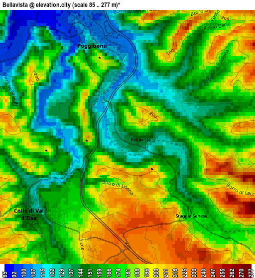
| \ | Map #1 | Topo.Map |
| Scale [m] | 85..277 m | × |
| Scale [ft] | 279..909 ft | × |
| Average | 169.6 m = 556 ft | × |
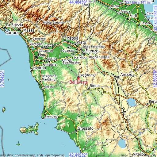
| Width | 7.1 km = 4.4 mi | 227.1 km = 141.1 mi |
| Height | 7.1 km = 4.4 mi | 227 km = 141.1 mi |
| ↑Max Latitude | 43.473869° | 44.45439° |
| Latitude at center | 43.44197° | 43.44197° |
| ↓Min Latitude | 43.410054° | 42.41232° |
| ← Min Longitude | 11.116565° | 9.75426° |
| Longitude center | 11.16051° | 11.16051° |
| →Max Longitude | 11.204455° | 12.56676° |
Nearby cities:
Cities around Bellavista sort by population:
• Poggibonsi elevation 100 m
3.3 km,  342°
342°
• Colle di Val d'Elsa 149 m
3.5 km,  229°
229°
• Certaldo 71 m
15.3 km,  320°
320°
• Tavarnelle Val di Pesa 366 m
13.4 km,  3°
3°
• San Gimignano 264 m
11.1 km,  288°
288°
• Staggia 175 m
2.9 km,  140°
140°
• Castellina Scalo 201 m
5.7 km, 136°
• Castellina in Chianti 561 m
10.7 km,  76°
76°
• Barberino Val d'Elsa 341 m
10.9 km, 4°
• Sambuca 177 m
15.2 km,  16°
16°
• Casole d'Elsa 374 m
14.4 km,  219°
219°
• Monteriggioni 272 m
7.7 km, 138°
Multilingual:
 En español:
Bellavista elevación 140 m.
 En France:
Bellavista élévation 140 m.
 Auf Deutsch:
Bellavista höhe über dem Meeresspiegel ist 140 m.

Sources and notes:
- [note 1] Map square and city borders are not equal. Map elevation data is calculated only from area inside that square.
- [src 1] Elevation data from geonames database provided with same terms of usage.
- [src 2] The elevation map of Bellavista is generated using elevation data from NASA's 3 arcsec (90m) resolution SRTM data.
- [src 3] Base (background) map © OpenStreetMap contributors tiles are generated by Geofabrik and OpenTopoMap.
Copyright & License:
This Bellavista Elevation Map is licensed under CC BY-SA. You may reuse any part from this page, if you give a proper credit by linking to this URL:
 More info on terms of use page.