Monteriggioni elevation
Monteriggioni (Tuscany, Provincia di Siena), Italy elevation is 272 meters and Monteriggioni elevation in feet is 892 ft above sea level [src 1]. Monteriggioni is a seat of a third-order administrative division (feature code) with elevation that is 50 meters (164 ft) smaller than average city elevation in Italy.
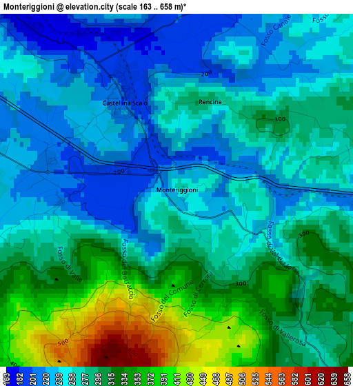
Below is the Elevation map of Monteriggioni, which displays elevation range with different colors. Scale of the first map is from 163 to 658 m (535 to 2159 ft) with average elevation of 282 meters (=925 ft) [note 1]
These maps also provides idea of topography and contour of this city, they are displayed at different zoom levels. More info about maps, scale and edge coordinates you can find below images.
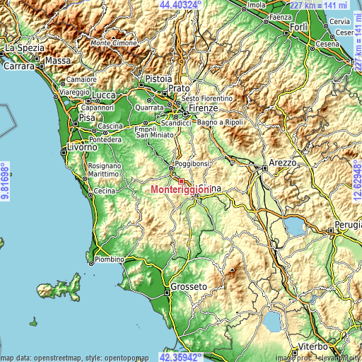
| \ | Map #1 | Topo.Map |
| Scale [m] | 163..658 m | × |
| Scale [ft] | 535..2159 ft | × |
| Average | 282 m = 925 ft | × |
| Width | 7.1 km = 4.4 mi | 227.3 km = 141.2 mi |
| Height | 7.1 km = 4.4 mi | 227.2 km = 141.2 mi |
| ↑Max Latitude | 43.421866° | 44.40324° |
| Latitude at center | 43.38994° | 43.38994° |
| ↓Min Latitude | 43.357997° | 42.35942° |
| ← Min Longitude | 11.179285° | 9.81698° |
| Longitude center | 11.22323° | 11.22323° |
| →Max Longitude | 11.267175° | 12.62948° |
Nearby cities:
Cities around Monteriggioni sort by population:
• Siena elevation 342 m
11.8 km,  132°
132°
• Poggibonsi 100 m
10.8 km,  325°
325°
• Colle di Val d'Elsa 149 m
8.5 km,  294°
294°
• Rosia 206 m
16 km,  180°
180°
• Staggia 175 m
4.8 km,  317°
317°
• Castellina Scalo 201 m
2 km, 325°
• Bellavista 140 m
7.7 km, 318°
• Castellina in Chianti 561 m
9.9 km,  32°
32°
• Belverde 333 m
8.3 km,  124°
124°
• Sovicille 262 m
12.2 km, 178°
• Casole d'Elsa 374 m
15.2 km,  249°
249°
• Radda in Chianti 498 m
16.2 km,  48°
48°
Multilingual:
 En español:
Monteriggioni elevación 272 m.
 En France:
Monteriggioni élévation 272 m.
 Auf Deutsch:
Monteriggioni höhe über dem Meeresspiegel ist 272 m.

Sources and notes:
- [note 1] Map square and city borders are not equal. Map elevation data is calculated only from area inside that square.
- [src 1] Elevation data from geonames database provided with same terms of usage.
- [src 2] The elevation map of Monteriggioni is generated using elevation data from NASA's 3 arcsec (90m) resolution SRTM data.
- [src 3] Base (background) map © OpenStreetMap contributors tiles are generated by Geofabrik and OpenTopoMap.
Copyright & License:
This Monteriggioni Elevation Map is licensed under CC BY-SA. You may reuse any part from this page, if you give a proper credit by linking to this URL:
 More info on terms of use page.