Budrio elevation
Budrio (Emilia-Romagna, Provincia di Forlì-Cesena), Italy elevation is 32 meters and Budrio elevation in feet is 105 ft above sea level [src 1]. Budrio is a populated place (feature code) with elevation that is 290 meters (951 ft) smaller than average city elevation in Italy.
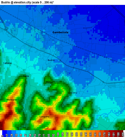
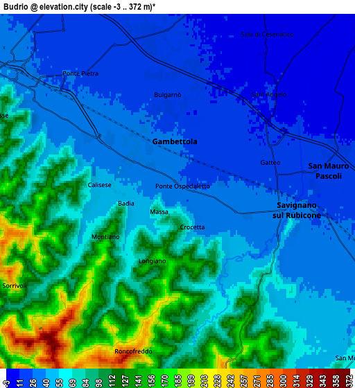
Below is the Elevation map of Budrio, which displays elevation range with different colors. Scale of the first map is from 9 to 206 m (30 to 676 ft) with average elevation of 49.4 meters (=162 ft) [note 1]
These maps also provides idea of topography and contour of this city, they are displayed at different zoom levels. More info about maps, scale and edge coordinates you can find below images.
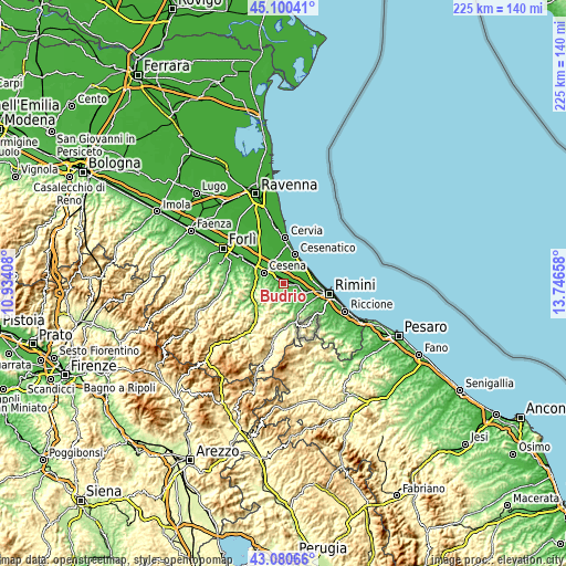
| \ | Map #1 | Map #2 | Topo.Map |
| Scale [m] | 9..206 m | -3..372 m | × |
| Scale [ft] | 30..676 ft | -10..1220 ft | × |
| Average | 49.4 m = 162 ft | 66.1 m = 217 ft | × |
| Width | 7.02 km = 4.4 mi | 14.04 km = 8.7 mi | 224.6 km = 139.6 mi |
| Height | 7.02 km = 4.4 mi | 14.04 km = 8.7 mi | 224.6 km = 139.6 mi |
| ↑Max Latitude | 44.13071° | 44.162244° | 45.10041° |
| Latitude at center | 44.09916° | 44.09916° | 44.09916° |
| ↓Min Latitude | 44.067593° | 44.036009° | 43.08066° |
| ← Min Longitude | 12.296385° | 12.252439° | 10.93408° |
| Longitude center | 12.34033° | 12.34033° | 12.34033° |
| →Max Longitude | 12.384275° | 12.428221° | 13.74658° |
Nearby cities:
Cities around Budrio sort by population:
• Cesena elevation 45 m
8.9 km,  299°
299°
• Savignano sul Rubicone 32 m
4.8 km,  102°
102°
• Gambettola 28 m
2.1 km,  352°
352°
• San Mauro Pascoli 18 m
6.4 km,  80°
80°
• Gatteo-Sant'Angelo 15 m
4.3 km,  70°
70°
• Roncofreddo 260 m
7.1 km,  206°
206°
• Sala 8 m
7.2 km,  28°
28°
• Bagnarola 13 m
7 km,  1°
1°
• Longiano 151 m
2.9 km,  197°
197°
• Roncofreddo-Santa Paola 300 m
6.6 km, 197°
• Montiano 153 m
3.4 km,  236°
236°
• Borghi 250 m
7.5 km,  170°
170°
Multilingual:
 En español:
Budrio elevación 32 m.
 En France:
Budrio élévation 32 m.


Sources and notes:
- [note 1] Map square and city borders are not equal. Map elevation data is calculated only from area inside that square.
- [src 1] Elevation data from geonames database provided with same terms of usage.
- [src 2] The elevation map of Budrio is generated using elevation data from NASA's 3 arcsec (90m) resolution SRTM data.
- [src 3] Base (background) map © OpenStreetMap contributors tiles are generated by Geofabrik and OpenTopoMap.
Copyright & License:
This Budrio Elevation Map is licensed under CC BY-SA. You may reuse any part from this page, if you give a proper credit by linking to this URL:
 More info on terms of use page.