Cesena elevation
Cesena (Emilia-Romagna, Provincia di Forlì-Cesena), Italy elevation is 45 meters and Cesena elevation in feet is 148 ft above sea level [src 1]. Cesena is a seat of a third-order administrative division (feature code) with elevation that is 277 meters (909 ft) smaller than average city elevation in Italy.
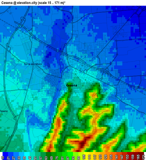
Below is the Elevation map of Cesena, which displays elevation range with different colors. Scale of the first map is from 15 to 171 m (49 to 561 ft) with average elevation of 43.6 meters (=143 ft) [note 1]
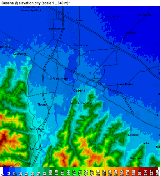
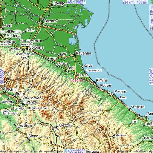
These maps also provides idea of topography and contour of this city, they are displayed at different zoom levels. More info about maps, scale and edge coordinates you can find below images.
| \ | Map #1 | Map #2 | Topo.Map |
| Scale [m] | 15..171 m | 1..340 m | × |
| Scale [ft] | 49..561 ft | 3..1115 ft | × |
| Average | 43.6 m = 143 ft | 58.9 m = 193 ft | × |
| Width | 7.01 km = 4.4 mi | 14.03 km = 8.7 mi | 224.4 km = 139.4 mi |
| Height | 7.01 km = 4.4 mi | 14.03 km = 8.7 mi | 224.4 km = 139.4 mi |
| ↑Max Latitude | 44.170629° | 44.202141° | 45.13967° |
| Latitude at center | 44.1391° | 44.1391° | 44.1391° |
| ↓Min Latitude | 44.107554° | 44.075991° | 43.12128° |
| ← Min Longitude | 12.199205° | 12.155259° | 10.8369° |
| Longitude center | 12.24315° | 12.24315° | 12.24315° |
| →Max Longitude | 12.287095° | 12.331041° | 13.6494° |
Nearby cities:
Cities around Cesena sort by population:
• Gambettola elevation 28 m
7.9 km,  107°
107°
• Forlimpopoli 28 m
10.8 km,  302°
302°
• Budrio 32 m
8.9 km,  119°
119°
• Santa Maria Nuova 21 m
7.8 km,  329°
329°
• Borello 96 m
10.3 km,  209°
209°
• Bagnarola 13 m
8.4 km,  72°
72°
• Bertinoro 181 m
8.6 km,  277°
277°
• Fratta Terme 70 m
11.3 km,  271°
271°
• Longiano 151 m
10 km,  136°
136°
• Pisignano 5 m
11.2 km,  10°
10°
• Panighina 28 m
7.3 km, 299°
• Montiano 153 m
8 km, 142°
Multilingual:
 En español:
Cesena elevación 45 m.
 En France:
Césène élévation 45 m.


Sources and notes:
- [note 1] Map square and city borders are not equal. Map elevation data is calculated only from area inside that square.
- [src 1] Elevation data from geonames database provided with same terms of usage.
- [src 2] The elevation map of Cesena is generated using elevation data from NASA's 3 arcsec (90m) resolution SRTM data.
- [src 3] Base (background) map © OpenStreetMap contributors tiles are generated by Geofabrik and OpenTopoMap.
Copyright & License:
This Cesena Elevation Map is licensed under CC BY-SA. You may reuse any part from this page, if you give a proper credit by linking to this URL:
 More info on terms of use page.