Borello elevation
Borello (Emilia-Romagna, Provincia di Forlì-Cesena), Italy elevation is 96 meters and Borello elevation in feet is 315 ft above sea level [src 1]. Borello is a populated place (feature code) with elevation that is 226 meters (741 ft) smaller than average city elevation in Italy.
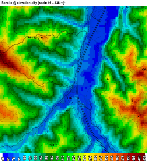
Below is the Elevation map of Borello, which displays elevation range with different colors. Scale of the first map is from 46 to 438 m (151 to 1437 ft) with average elevation of 183.1 meters (=601 ft) [note 1]
These maps also provides idea of topography and contour of this city, they are displayed at different zoom levels. More info about maps, scale and edge coordinates you can find below images.
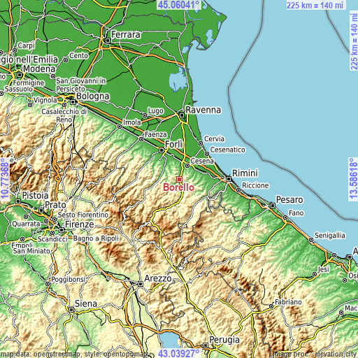
| \ | Map #1 | Topo.Map |
| Scale [m] | 46..438 m | × |
| Scale [ft] | 151..1437 ft | × |
| Average | 183.1 m = 601 ft | × |
| Width | 7.02 km = 4.4 mi | 224.7 km = 139.6 mi |
| Height | 7.02 km = 4.4 mi | 224.7 km = 139.6 mi |
| ↑Max Latitude | 44.090032° | 45.06041° |
| Latitude at center | 44.05846° | 44.05846° |
| ↓Min Latitude | 44.026871° | 43.03927° |
| ← Min Longitude | 12.135985° | 10.77368° |
| Longitude center | 12.17993° | 12.17993° |
| →Max Longitude | 12.223875° | 13.58618° |
Nearby cities:
Cities around Borello sort by population:
• Cesena elevation 45 m
10.3 km,  29°
29°
• Meldola 53 m
12.1 km,  309°
309°
• Roncofreddo 260 m
9.8 km,  100°
100°
• Mercato Saraceno 177 m
10.7 km,  172°
172°
• Bertinoro 181 m
10.6 km,  340°
340°
• Fratta Terme 70 m
11.1 km,  326°
326°
• Longiano 151 m
12.1 km,  81°
81°
• Roncofreddo-Santa Paola 300 m
11 km, 99°
• Panighina 28 m
12.7 km,  353°
353°
• Bora Bassa 96 m
1.3 km,  177°
177°
• Sogliano al Rubicone 379 m
11.4 km,  121°
121°
• Montiano 153 m
10.3 km, 75°
Multilingual:
 En español:
Borello elevación 96 m.
 En France:
Borello élévation 96 m.


Sources and notes:
- [note 1] Map square and city borders are not equal. Map elevation data is calculated only from area inside that square.
- [src 1] Elevation data from geonames database provided with same terms of usage.
- [src 2] The elevation map of Borello is generated using elevation data from NASA's 3 arcsec (90m) resolution SRTM data.
- [src 3] Base (background) map © OpenStreetMap contributors tiles are generated by Geofabrik and OpenTopoMap.
Copyright & License:
This Borello Elevation Map is licensed under CC BY-SA. You may reuse any part from this page, if you give a proper credit by linking to this URL:
 More info on terms of use page.