Meldola elevation
Meldola (Emilia-Romagna, Provincia di Forlì-Cesena), Italy elevation is 53 meters and Meldola elevation in feet is 174 ft above sea level [src 1]. Meldola is a seat of a third-order administrative division (feature code) with elevation that is 269 meters (883 ft) smaller than average city elevation in Italy.
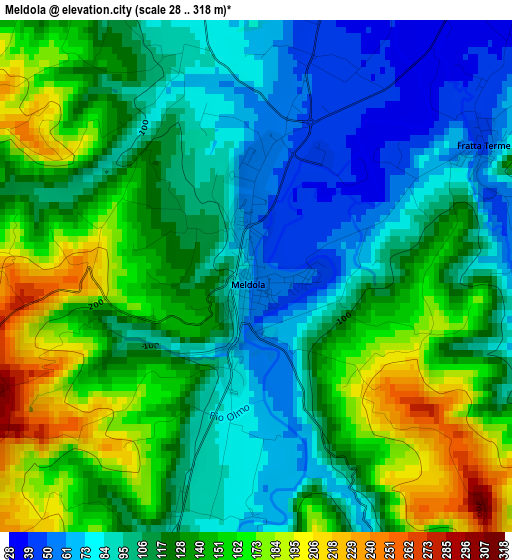
Below is the Elevation map of Meldola, which displays elevation range with different colors. Scale of the first map is from 28 to 318 m (92 to 1043 ft) with average elevation of 122.5 meters (=402 ft) [note 1]
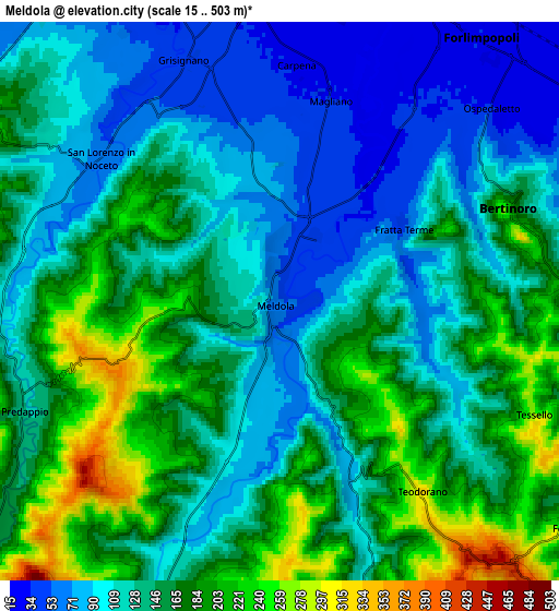
These maps also provides idea of topography and contour of this city, they are displayed at different zoom levels. More info about maps, scale and edge coordinates you can find below images.
| \ | Map #1 | Map #2 | Topo.Map |
| Scale [m] | 28..318 m | 15..503 m | × |
| Scale [ft] | 92..1043 ft | 49..1650 ft | × |
| Average | 122.5 m = 402 ft | 141.1 m = 463 ft | × |
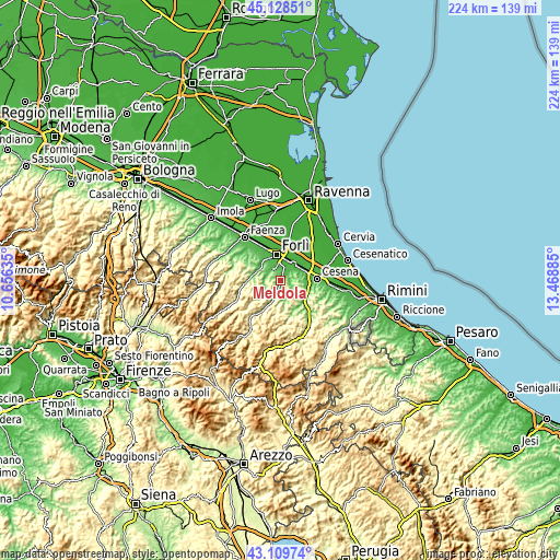
| Width | 7.01 km = 4.4 mi | 14.03 km = 8.7 mi | 224.5 km = 139.5 mi |
| Height | 7.01 km = 4.4 mi | 14.03 km = 8.7 mi | 224.5 km = 139.5 mi |
| ↑Max Latitude | 44.159285° | 44.190803° | 45.12851° |
| Latitude at center | 44.12775° | 44.12775° | 44.12775° |
| ↓Min Latitude | 44.096198° | 44.064629° | 43.10974° |
| ← Min Longitude | 12.018655° | 11.974709° | 10.65635° |
| Longitude center | 12.0626° | 12.0626° | 12.0626° |
| →Max Longitude | 12.106545° | 12.150491° | 13.46885° |
Nearby cities:
Cities around Meldola sort by population:
• Forlì elevation 36 m
10.6 km,  350°
350°
• Forlimpopoli 28 m
8.8 km,  36°
36°
• Castrocaro Terme e Terra del Sole 61 m
10.4 km,  308°
308°
• Predappio 125 m
6.8 km,  246°
246°
• Borello 96 m
12.1 km,  129°
129°
• Fiumana 75 m
6.3 km,  285°
285°
• Bertinoro 181 m
6.3 km,  68°
68°
• Fratta Terme 70 m
3.5 km,  64°
64°
• Panighina 28 m
9.4 km, 58°
• Bora Bassa 96 m
13.1 km, 133°
• Cusercoli 115 m
10.2 km,  205°
205°
• Castrocaro Terme 72 m
10.5 km,  300°
300°
Multilingual:
 En español:
Meldola elevación 53 m.
 En France:
Meldola élévation 53 m.


Sources and notes:
- [note 1] Map square and city borders are not equal. Map elevation data is calculated only from area inside that square.
- [src 1] Elevation data from geonames database provided with same terms of usage.
- [src 2] The elevation map of Meldola is generated using elevation data from NASA's 3 arcsec (90m) resolution SRTM data.
- [src 3] Base (background) map © OpenStreetMap contributors tiles are generated by Geofabrik and OpenTopoMap.
Copyright & License:
This Meldola Elevation Map is licensed under CC BY-SA. You may reuse any part from this page, if you give a proper credit by linking to this URL:
 More info on terms of use page.