Gatteo-Sant'Angelo elevation
Gatteo-Sant'Angelo (Emilia-Romagna, Provincia di Forlì-Cesena), Italy elevation is 15 meters and Gatteo-Sant'Angelo elevation in feet is 49 ft above sea level [src 1]. Gatteo-Sant'Angelo is a seat of a third-order administrative division (feature code) with elevation that is 307 meters (1007 ft) smaller than average city elevation in Italy.
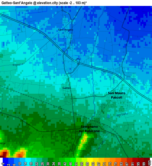
Below is the Elevation map of Gatteo-Sant'Angelo, which displays elevation range with different colors. Scale of the first map is from -2 to 103 m (-7 to 338 ft) with average elevation of 19.4 meters (=64 ft) [note 1]
These maps also provides idea of topography and contour of this city, they are displayed at different zoom levels. More info about maps, scale and edge coordinates you can find below images.
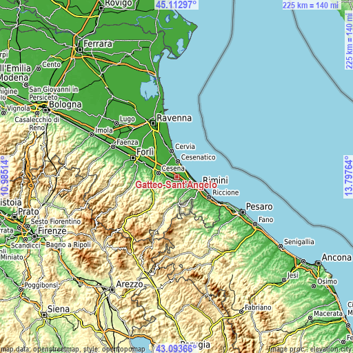
| \ | Map #1 | Map #2 | Topo.Map |
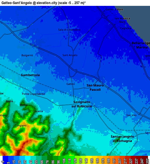
| Scale [m] | -2..103 m | -5..257 m | × |
| Scale [ft] | -7..338 ft | -16..843 ft | × |
| Average | 19.4 m = 64 ft | 31.5 m = 103 ft | × |
| Width | 7.02 km = 4.4 mi | 14.03 km = 8.7 mi | 224.5 km = 139.5 mi |
| Height | 7.02 km = 4.4 mi | 14.03 km = 8.7 mi | 224.5 km = 139.5 mi |
| ↑Max Latitude | 44.143483° | 44.17501° | 45.11297° |
| Latitude at center | 44.11194° | 44.11194° | 44.11194° |
| ↓Min Latitude | 44.08038° | 44.048802° | 43.09366° |
| ← Min Longitude | 12.347445° | 12.303499° | 10.98514° |
| Longitude center | 12.39139° | 12.39139° | 12.39139° |
| →Max Longitude | 12.435335° | 12.479281° | 13.79764° |
Nearby cities:
Cities around Gatteo-Sant'Angelo sort by population:
• Bellaria-Igea Marina elevation 5 m
7.2 km,  61°
61°
• Savignano sul Rubicone 32 m
2.5 km,  165°
165°
• Santarcangelo 42 m
7 km,  140°
140°
• Gambettola 28 m
4.4 km,  278°
278°
• San Mauro Pascoli 18 m
2.3 km,  98°
98°
• Budrio 32 m
4.3 km,  250°
250°
• Sala 8 m
5 km,  352°
352°
• Gatteo a Mare 2 m
7.4 km,  28°
28°
• Bagnarola 13 m
6.8 km,  325°
325°
• Longiano 151 m
6.5 km,  229°
229°
• San Mauro a Mare 3 m
7.2 km,  37°
37°
• Montiano 153 m
7.7 km,  244°
244°
Multilingual:
 En español:
Gatteo-Sant'Angelo elevación 15 m.
 En France:
Gatteo élévation 15 m.
 Auf Deutsch:
Gatteo-Sant'Angelo höhe über dem Meeresspiegel ist 15 m.

Sources and notes:
- [note 1] Map square and city borders are not equal. Map elevation data is calculated only from area inside that square.
- [src 1] Elevation data from geonames database provided with same terms of usage.
- [src 2] The elevation map of Gatteo-Sant'Angelo is generated using elevation data from NASA's 3 arcsec (90m) resolution SRTM data.
- [src 3] Base (background) map © OpenStreetMap contributors tiles are generated by Geofabrik and OpenTopoMap.
Copyright & License:
This Gatteo-Sant'Angelo Elevation Map is licensed under CC BY-SA. You may reuse any part from this page, if you give a proper credit by linking to this URL:
 More info on terms of use page.