Santarcangelo elevation
Santarcangelo (Emilia-Romagna, Provincia di Rimini), Italy elevation is 42 meters and Santarcangelo elevation in feet is 138 ft above sea level [src 1]. Santarcangelo is a seat of a third-order administrative division (feature code) with elevation that is 280 meters (919 ft) smaller than average city elevation in Italy.
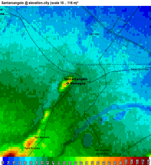
Below is the Elevation map of Santarcangelo, which displays elevation range with different colors. Scale of the first map is from 10 to 116 m (33 to 381 ft) with average elevation of 35.4 meters (=116 ft) [note 1]
These maps also provides idea of topography and contour of this city, they are displayed at different zoom levels. More info about maps, scale and edge coordinates you can find below images.
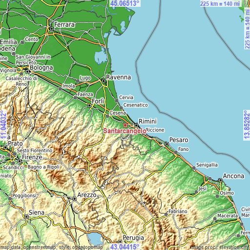
| \ | Map #1 | Map #2 | Topo.Map |
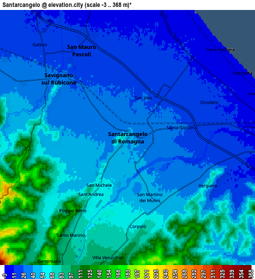
| Scale [m] | 10..116 m | -3..368 m | × |
| Scale [ft] | 33..381 ft | -10..1207 ft | × |
| Average | 35.4 m = 116 ft | 48.6 m = 159 ft | × |
| Width | 7.02 km = 4.4 mi | 14.04 km = 8.7 mi | 224.7 km = 139.6 mi |
| Height | 7.02 km = 4.4 mi | 14.04 km = 8.7 mi | 224.7 km = 139.6 mi |
| ↑Max Latitude | 44.094829° | 44.126382° | 45.06513° |
| Latitude at center | 44.06326° | 44.06326° | 44.06326° |
| ↓Min Latitude | 44.031674° | 44.000071° | 43.04415° |
| ← Min Longitude | 12.402625° | 12.358679° | 11.04032° |
| Longitude center | 12.44657° | 12.44657° | 12.44657° |
| →Max Longitude | 12.490515° | 12.534461° | 13.85282° |
Nearby cities:
Cities around Santarcangelo sort by population:
• Bellaria-Igea Marina elevation 5 m
9 km,  12°
12°
• Savignano sul Rubicone 32 m
4.8 km,  308°
308°
• San Mauro Pascoli 18 m
5.5 km,  336°
336°
• Villa Verucchio 85 m
6.5 km,  187°
187°
• Gatteo-Sant'Angelo 15 m
7 km,  320°
320°
• Santa Giustina 28 m
3.1 km,  80°
80°
• Corpolò 65 m
4.9 km,  174°
174°
• Sant'Andrea 66 m
4 km,  213°
213°
• San Martino dei Mulini 46 m
3.8 km,  158°
158°
• Verucchio 331 m
9.3 km, 191°
• Borghi 250 m
8 km,  244°
244°
• Poggio Berni 151 m
5.1 km,  215°
215°
Multilingual:
 En español:
Santarcangelo elevación 42 m.
 En France:
Santarcangelo di Romagna élévation 42 m.
 Auf Deutsch:
Santarcangelo höhe über dem Meeresspiegel ist 42 m.

Sources and notes:
- [note 1] Map square and city borders are not equal. Map elevation data is calculated only from area inside that square.
- [src 1] Elevation data from geonames database provided with same terms of usage.
- [src 2] The elevation map of Santarcangelo is generated using elevation data from NASA's 3 arcsec (90m) resolution SRTM data.
- [src 3] Base (background) map © OpenStreetMap contributors tiles are generated by Geofabrik and OpenTopoMap.
Copyright & License:
This Santarcangelo Elevation Map is licensed under CC BY-SA. You may reuse any part from this page, if you give a proper credit by linking to this URL:
 More info on terms of use page.