Onè elevation
Onè (Veneto, Provincia di Treviso), Italy elevation is 103 meters and Onè elevation in feet is 338 ft above sea level [src 1]. Onè is a seat of a third-order administrative division (feature code) with elevation that is 219 meters (719 ft) smaller than average city elevation in Italy.
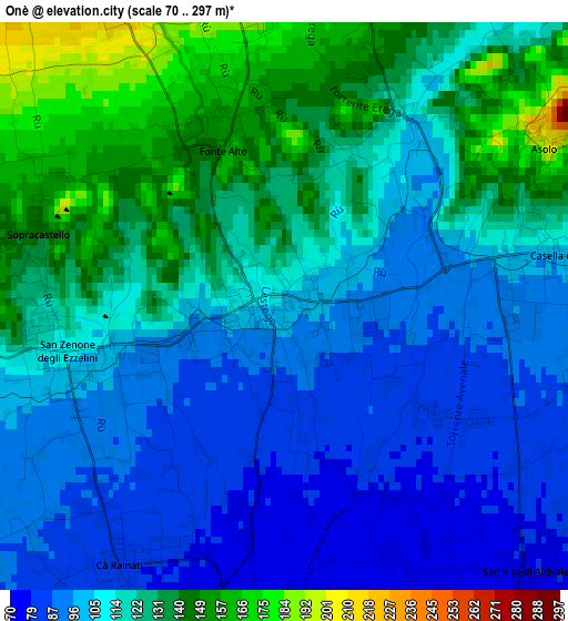
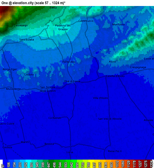
Below is the Elevation map of Onè, which displays elevation range with different colors. Scale of the first map is from 70 to 297 m (230 to 974 ft) with average elevation of 114.1 meters (=374 ft) [note 1]
These maps also provides idea of topography and contour of this city, they are displayed at different zoom levels. More info about maps, scale and edge coordinates you can find below images.
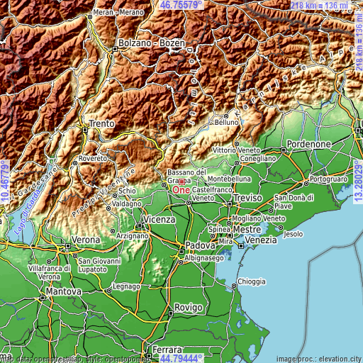
| \ | Map #1 | Map #2 | Topo.Map |
| Scale [m] | 70..297 m | 57..1324 m | × |
| Scale [ft] | 230..974 ft | 187..4344 ft | × |
| Average | 114.1 m = 374 ft | 152.5 m = 500 ft | × |
| Width | 6.82 km = 4.2 mi | 13.63 km = 8.5 mi | 218.1 km = 135.5 mi |
| Height | 6.82 km = 4.2 mi | 13.63 km = 8.5 mi | 218.1 km = 135.5 mi |
| ↑Max Latitude | 45.814378° | 45.844998° | 46.75579° |
| Latitude at center | 45.78374° | 45.78374° | 45.78374° |
| ↓Min Latitude | 45.753085° | 45.722414° | 44.79444° |
| ← Min Longitude | 11.830095° | 11.786149° | 10.46779° |
| Longitude center | 11.87404° | 11.87404° | 11.87404° |
| →Max Longitude | 11.917985° | 11.961931° | 13.28029° |
Nearby cities:
Cities around Onè sort by population:
• San Zenone degli Ezzelini elevation 116 m
2.9 km,  262°
262°
• Crespano del Grappa 303 m
5.8 km,  327°
327°
• Loria Bessica 69 m
6 km,  186°
186°
• Asolo 101 m
3.4 km,  80°
80°
• Mussolente 113 m
5.3 km, 264°
• Casoni 100 m
5.6 km,  241°
241°
• Paderno del Grappa 290 m
5.1 km,  345°
345°
• Ca' Rainati 84 m
3.4 km,  211°
211°
• Castelcucco 189 m
5.2 km,  7°
7°
• San Vito 77 m
4.5 km,  134°
134°
• Villa d'Asolo 83 m
2.4 km,  123°
123°
• Paderno 289 m
5.1 km,  344°
344°
Multilingual:
 En español:
Onè elevación 103 m.
 En France:
Onè élévation 103 m.


Sources and notes:
- [note 1] Map square and city borders are not equal. Map elevation data is calculated only from area inside that square.
- [src 1] Elevation data from geonames database provided with same terms of usage.
- [src 2] The elevation map of Onè is generated using elevation data from NASA's 3 arcsec (90m) resolution SRTM data.
- [src 3] Base (background) map © OpenStreetMap contributors tiles are generated by Geofabrik and OpenTopoMap.
Copyright & License:
This Onè Elevation Map is licensed under CC BY-SA. You may reuse any part from this page, if you give a proper credit by linking to this URL:
 More info on terms of use page.