Quaregna elevation
Quaregna (Piedmont, Provincia di Biella), Italy elevation is 258 meters and Quaregna elevation in feet is 846 ft above sea level [src 1]. Quaregna is a seat of a third-order administrative division (feature code) with elevation that is 64 meters (210 ft) smaller than average city elevation in Italy.
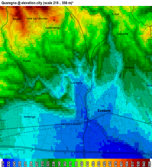
Below is the Elevation map of Quaregna, which displays elevation range with different colors. Scale of the first map is from 219 to 556 m (719 to 1824 ft) with average elevation of 322.3 meters (=1057 ft) [note 1]
These maps also provides idea of topography and contour of this city, they are displayed at different zoom levels. More info about maps, scale and edge coordinates you can find below images.
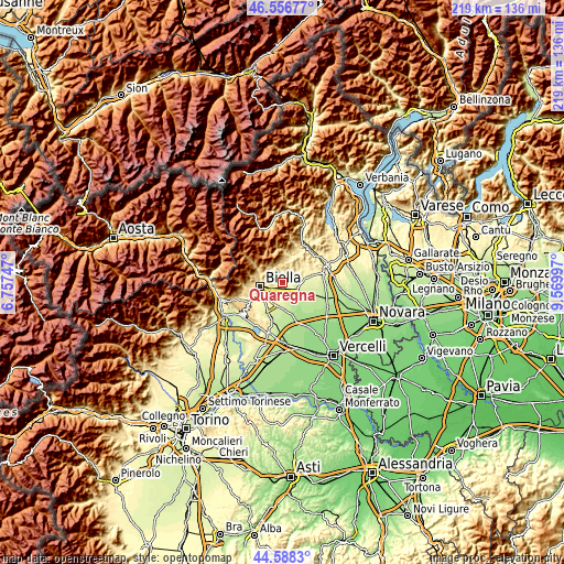
| \ | Map #1 | Topo.Map |
| Scale [m] | 219..556 m | × |
| Scale [ft] | 719..1824 ft | × |
| Average | 322.3 m = 1057 ft | × |
| Width | 6.84 km = 4.3 mi | 218.9 km = 136 mi |
| Height | 6.84 km = 4.3 mi | 218.9 km = 136 mi |
| ↑Max Latitude | 45.611909° | 46.55677° |
| Latitude at center | 45.58116° | 45.58116° |
| ↓Min Latitude | 45.550394° | 44.5883° |
| ← Min Longitude | 8.119775° | 6.75747° |
| Longitude center | 8.16372° | 8.16372° |
| →Max Longitude | 8.207665° | 9.56997° |
Nearby cities:
Cities around Quaregna sort by population:
• Cossato elevation 258 m
2 km,  126°
126°
• Valdengo 275 m
2.5 km,  231°
231°
• Lessona 330 m
2.5 km,  74°
74°
• Cerreto Castello 255 m
1.9 km,  186°
186°
• Bioglio-Portula-Andrè 594 m
4.4 km,  330°
330°
• Fontanella-Ozino 461 m
4.3 km,  5°
5°
• Casapinta 431 m
4.6 km,  33°
33°
• Piatto 383 m
2.4 km,  293°
293°
• Ternengo 440 m
4 km,  282°
282°
• Vallanzengo 416 m
2.7 km,  337°
337°
• Maglione-Crosa 412 m
2.7 km, 335°
• Valle San Nicolao 466 m
3.4 km, 328°
Multilingual:
 En español:
Quaregna elevación 258 m.
 En France:
Quaregna élévation 258 m.
 Auf Deutsch:
Quaregna höhe über dem Meeresspiegel ist 258 m.

Sources and notes:
- [note 1] Map square and city borders are not equal. Map elevation data is calculated only from area inside that square.
- [src 1] Elevation data from geonames database provided with same terms of usage.
- [src 2] The elevation map of Quaregna is generated using elevation data from NASA's 3 arcsec (90m) resolution SRTM data.
- [src 3] Base (background) map © OpenStreetMap contributors tiles are generated by Geofabrik and OpenTopoMap.
Copyright & License:
This Quaregna Elevation Map is licensed under CC BY-SA. You may reuse any part from this page, if you give a proper credit by linking to this URL:
 More info on terms of use page.