Cavernago elevation
Cavernago (Lombardy, Provincia di Bergamo), Italy elevation is 193 meters and Cavernago elevation in feet is 633 ft above sea level [src 1]. Cavernago is a seat of a third-order administrative division (feature code) with elevation that is 129 meters (423 ft) smaller than average city elevation in Italy.
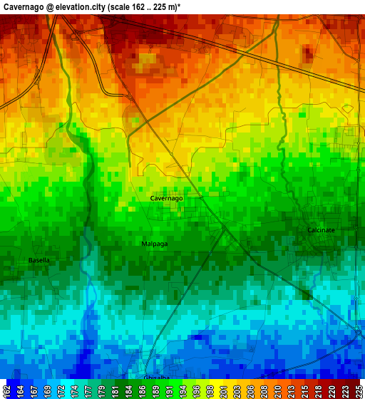
Below is the Elevation map of Cavernago, which displays elevation range with different colors. Scale of the first map is from 162 to 225 m (531 to 738 ft) with average elevation of 190.8 meters (=626 ft) [note 1]
These maps also provides idea of topography and contour of this city, they are displayed at different zoom levels. More info about maps, scale and edge coordinates you can find below images.
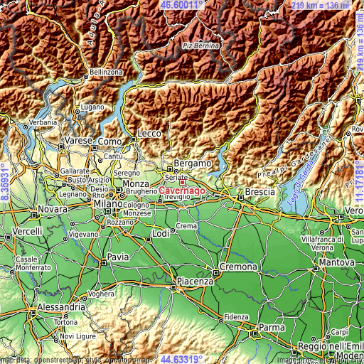
| \ | Map #1 | Topo.Map |
| Scale [m] | 162..225 m | × |
| Scale [ft] | 531..738 ft | × |
| Average | 190.8 m = 626 ft | × |
| Width | 6.83 km = 4.2 mi | 218.7 km = 135.9 mi |
| Height | 6.83 km = 4.2 mi | 218.7 km = 135.9 mi |
| ↑Max Latitude | 45.656005° | 46.60011° |
| Latitude at center | 45.62528° | 45.62528° |
| ↓Min Latitude | 45.594539° | 44.63319° |
| ← Min Longitude | 9.721615° | 8.35931° |
| Longitude center | 9.76556° | 9.76556° |
| →Max Longitude | 9.809505° | 11.17181° |
Nearby cities:
Cities around Cavernago sort by population:
• Martinengo elevation 152 m
5.9 km,  178°
178°
• Urgnano 173 m
6.2 km,  242°
242°
• Zanica 210 m
6.4 km,  285°
285°
• Grassobbio 222 m
4.7 km,  318°
318°
• Ghisalba 166 m
3.6 km,  189°
189°
• Bolgare 196 m
3.9 km,  78°
78°
• Brusaporto 234 m
5.1 km,  355°
355°
• Calcinate 189 m
2.6 km,  103°
103°
• Bagnatica 220 m
4.1 km,  16°
16°
• Montello 228 m
6.1 km,  30°
30°
• Costa di Mezzate 218 m
4.8 km, 29°
• Mornico al Serio 164 m
5.1 km,  137°
137°
Multilingual:
 En español:
Cavernago elevación 193 m.
 En France:
Cavernago élévation 193 m.
 Auf Deutsch:
Cavernago höhe über dem Meeresspiegel ist 193 m.

Sources and notes:
- [note 1] Map square and city borders are not equal. Map elevation data is calculated only from area inside that square.
- [src 1] Elevation data from geonames database provided with same terms of usage.
- [src 2] The elevation map of Cavernago is generated using elevation data from NASA's 3 arcsec (90m) resolution SRTM data.
- [src 3] Base (background) map © OpenStreetMap contributors tiles are generated by Geofabrik and OpenTopoMap.
Copyright & License:
This Cavernago Elevation Map is licensed under CC BY-SA. You may reuse any part from this page, if you give a proper credit by linking to this URL:
 More info on terms of use page.