Andora elevation
Andora (Liguria, Provincia di Savona), Italy elevation is 7 meters and Andora elevation in feet is 23 ft above sea level [src 1]. Andora is a seat of a third-order administrative division (feature code) with elevation that is 315 meters (1033 ft) smaller than average city elevation in Italy.
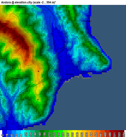
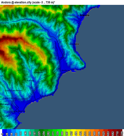
Below is the Elevation map of Andora, which displays elevation range with different colors. Scale of the first map is from -2 to 554 m (-7 to 1818 ft) with average elevation of 158.3 meters (=519 ft) [note 1]
These maps also provides idea of topography and contour of this city, they are displayed at different zoom levels. More info about maps, scale and edge coordinates you can find below images.
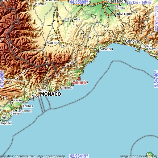
| \ | Map #1 | Map #2 | Topo.Map |
| Scale [m] | -2..554 m | -3..739 m | × |
| Scale [ft] | -7..1818 ft | -10..2425 ft | × |
| Average | 158.3 m = 519 ft | 211.7 m = 695 ft | × |
| Width | 7.04 km = 4.4 mi | 14.07 km = 8.7 mi | 225.1 km = 139.9 mi |
| Height | 7.04 km = 4.4 mi | 14.07 km = 8.7 mi | 225.1 km = 139.9 mi |
| ↑Max Latitude | 43.986767° | 44.018377° | 44.95885° |
| Latitude at center | 43.95514° | 43.95514° | 43.95514° |
| ↓Min Latitude | 43.923496° | 43.891835° | 42.93419° |
| ← Min Longitude | 8.097265° | 8.053319° | 6.73496° |
| Longitude center | 8.14121° | 8.14121° | 8.14121° |
| →Max Longitude | 8.185155° | 8.229101° | 9.54746° |
Nearby cities:
Cities around Andora sort by population:
• Alassio elevation 12 m
5.8 km,  20°
20°
• Diano Marina 6 m
6.9 km,  224°
224°
• Marina di Andora 45 m
1.1 km,  99°
99°
• San Bartolomeo al Mare 4 m
4.6 km, 219°
• Laigueglia 8 m
2.7 km,  30°
30°
• Diano Castello 125 m
6.9 km,  240°
240°
• Cervo 61 m
3.9 km,  212°
212°
• Stellanello 135 m
8.2 km,  307°
307°
• Diano San Pietro 65 m
6.2 km, 242°
• Rossi 137 m
8.3 km, 307°
• Diano Arentino 311 m
8 km,  265°
265°
• Villa Faraldi 332 m
4.4 km,  289°
289°
Multilingual:
 En español:
Andora elevación 7 m.
 En France:
Andora élévation 7 m.


Sources and notes:
- [note 1] Map square and city borders are not equal. Map elevation data is calculated only from area inside that square.
- [src 1] Elevation data from geonames database provided with same terms of usage.
- [src 2] The elevation map of Andora is generated using elevation data from NASA's 3 arcsec (90m) resolution SRTM data.
- [src 3] Base (background) map © OpenStreetMap contributors tiles are generated by Geofabrik and OpenTopoMap.
Copyright & License:
This Andora Elevation Map is licensed under CC BY-SA. You may reuse any part from this page, if you give a proper credit by linking to this URL:
 More info on terms of use page.