Cassola elevation
Cassola (Veneto, Provincia di Vicenza), Italy elevation is 91 meters and Cassola elevation in feet is 299 ft above sea level [src 1]. Cassola is a seat of a third-order administrative division (feature code) with elevation that is 231 meters (758 ft) smaller than average city elevation in Italy.
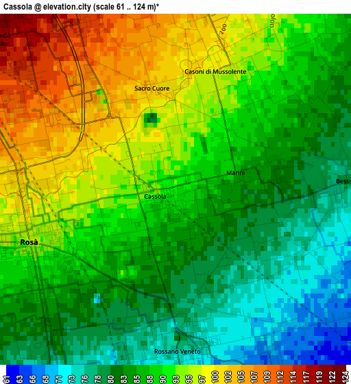
Below is the Elevation map of Cassola, which displays elevation range with different colors. Scale of the first map is from 61 to 124 m (200 to 407 ft) with average elevation of 88.7 meters (=291 ft) [note 1]
These maps also provides idea of topography and contour of this city, they are displayed at different zoom levels. More info about maps, scale and edge coordinates you can find below images.
| \ | Map #1 | Map #2 | Topo.Map |
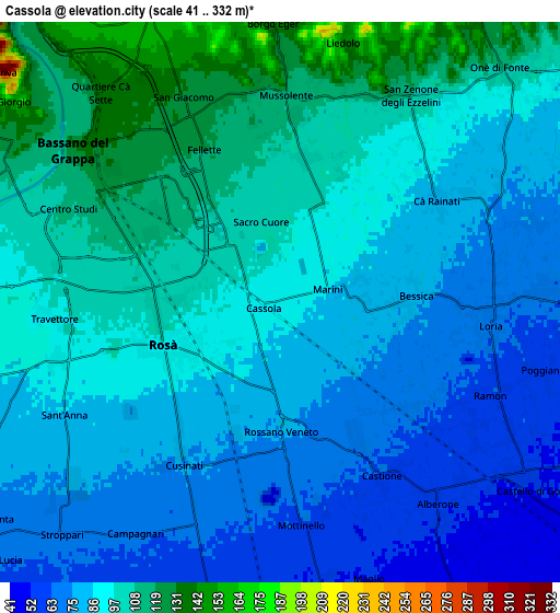
| Scale [m] | 61..124 m | 41..332 m | × |
| Scale [ft] | 200..407 ft | 135..1089 ft | × |
| Average | 88.7 m = 291 ft | 89.5 m = 294 ft | × |
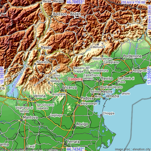
| Width | 6.82 km = 4.2 mi | 13.64 km = 8.5 mi | 218.3 km = 135.6 mi |
| Height | 6.82 km = 4.2 mi | 13.64 km = 8.5 mi | 218.3 km = 135.6 mi |
| ↑Max Latitude | 45.764265° | 45.794914° | 46.70653° |
| Latitude at center | 45.7336° | 45.7336° | 45.7336° |
| ↓Min Latitude | 45.702918° | 45.672219° | 44.74342° |
| ← Min Longitude | 11.755455° | 11.711509° | 10.39315° |
| Longitude center | 11.7994° | 11.7994° | 11.7994° |
| →Max Longitude | 11.843345° | 11.887291° | 13.20565° |
Nearby cities:
Cities around Cassola sort by population:
• Bassano del Grappa elevation 112 m
6.7 km,  303°
303°
• Romano d'Ezzelino 130 m
5.7 km,  333°
333°
• Rosà 76 m
4.6 km,  219°
219°
• San Zeno-San Giuseppe 117 m
3.9 km,  312°
312°
• Rossano Veneto 74 m
3.4 km,  174°
174°
• Belvedere 69 m
5.3 km,  203°
203°
• San Zenone degli Ezzelini 116 m
6 km,  29°
29°
• Loria Bessica 69 m
5.1 km,  94°
94°
• Mussolente 113 m
5.1 km,  5°
5°
• Casoni 100 m
3 km,  16°
16°
• Ca' Rainati 84 m
4.8 km,  56°
56°
• Ramon 63 m
5.8 km,  112°
112°
Multilingual:
 En español:
Cassola elevación 91 m.
 En France:
Cassola élévation 91 m.


Sources and notes:
- [note 1] Map square and city borders are not equal. Map elevation data is calculated only from area inside that square.
- [src 1] Elevation data from geonames database provided with same terms of usage.
- [src 2] The elevation map of Cassola is generated using elevation data from NASA's 3 arcsec (90m) resolution SRTM data.
- [src 3] Base (background) map © OpenStreetMap contributors tiles are generated by Geofabrik and OpenTopoMap.
Copyright & License:
This Cassola Elevation Map is licensed under CC BY-SA. You may reuse any part from this page, if you give a proper credit by linking to this URL:
 More info on terms of use page.