Gerenzano elevation
Gerenzano (Lombardy, Provincia di Varese), Italy elevation is 226 meters and Gerenzano elevation in feet is 741 ft above sea level [src 1]. Gerenzano is a seat of a third-order administrative division (feature code) with elevation that is 96 meters (315 ft) smaller than average city elevation in Italy.
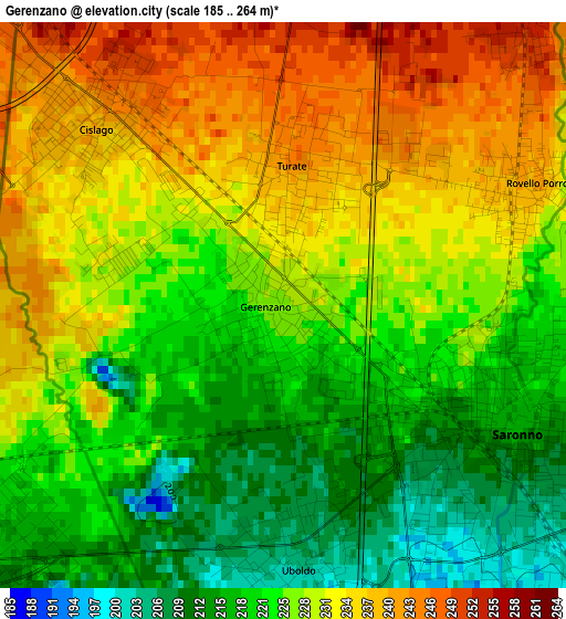
Below is the Elevation map of Gerenzano, which displays elevation range with different colors. Scale of the first map is from 185 to 264 m (607 to 866 ft) with average elevation of 226.7 meters (=744 ft) [note 1]
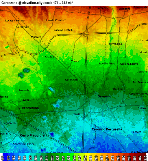
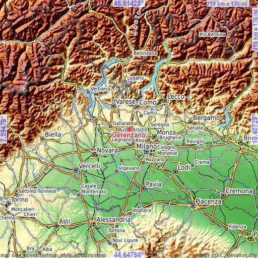
These maps also provides idea of topography and contour of this city, they are displayed at different zoom levels. More info about maps, scale and edge coordinates you can find below images.
| \ | Map #1 | Map #2 | Topo.Map |
| Scale [m] | 185..264 m | 171..312 m | × |
| Scale [ft] | 607..866 ft | 561..1024 ft | × |
| Average | 226.7 m = 744 ft | 231.7 m = 760 ft | × |
| Width | 6.83 km = 4.2 mi | 13.67 km = 8.5 mi | 218.6 km = 135.8 mi |
| Height | 6.83 km = 4.2 mi | 13.67 km = 8.5 mi | 218.6 km = 135.8 mi |
| ↑Max Latitude | 45.670387° | 45.701087° | 46.61425° |
| Latitude at center | 45.63967° | 45.63967° | 45.63967° |
| ↓Min Latitude | 45.608936° | 45.578186° | 44.64784° |
| ← Min Longitude | 8.957095° | 8.913149° | 7.59479° |
| Longitude center | 9.00104° | 9.00104° | 9.00104° |
| →Max Longitude | 9.044985° | 9.088931° | 10.40729° |
Nearby cities:
Cities around Gerenzano sort by population:
• Saronno elevation 215 m
3.1 km,  121°
121°
• Caronno Pertusella 196 m
5.8 km,  142°
142°
• Rescaldina 226 m
4.6 km,  241°
241°
• Uboldo 207 m
2.7 km,  175°
175°
• Cislago 239 m
3.1 km,  314°
314°
• Turate 245 m
2 km,  7°
7°
• Mozzate 259 m
5.2 km,  318°
318°
• Rovellasca 247 m
4.8 km,  51°
51°
• Origgio 193 m
4.9 km,  165°
165°
• Rovello Porro 239 m
3.3 km,  65°
65°
• Limido Comasco 277 m
5.7 km,  343°
343°
• Manera 258 m
4.9 km,  39°
39°
Multilingual:
 En español:
Gerenzano elevación 226 m.
 En France:
Gerenzano élévation 226 m.
 Auf Deutsch:
Gerenzano höhe über dem Meeresspiegel ist 226 m.

Sources and notes:
- [note 1] Map square and city borders are not equal. Map elevation data is calculated only from area inside that square.
- [src 1] Elevation data from geonames database provided with same terms of usage.
- [src 2] The elevation map of Gerenzano is generated using elevation data from NASA's 3 arcsec (90m) resolution SRTM data.
- [src 3] Base (background) map © OpenStreetMap contributors tiles are generated by Geofabrik and OpenTopoMap.
Copyright & License:
This Gerenzano Elevation Map is licensed under CC BY-SA. You may reuse any part from this page, if you give a proper credit by linking to this URL:
 More info on terms of use page.