Alatri elevation
Alatri (Latium, Provincia di Frosinone), Italy elevation is 407 meters and Alatri elevation in feet is 1335 ft above sea level [src 1]. Alatri is a seat of a third-order administrative division (feature code) with elevation that is 85 meters (279 ft) bigger than average city elevation in Italy.
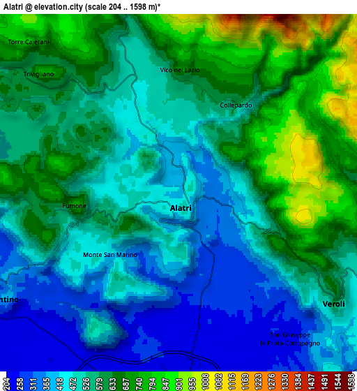
Below is the Elevation map of Alatri, which displays elevation range with different colors. Scale of the first map is from 266 to 919 m (873 to 3015 ft) with average elevation of 456.1 meters (=1496 ft) [note 1]
These maps also provides idea of topography and contour of this city, they are displayed at different zoom levels. More info about maps, scale and edge coordinates you can find below images.

| \ | Map #1 | Map #2 | Topo.Map |
| Scale [m] | 266..919 m | 204..1598 m | × |
| Scale [ft] | 873..3015 ft | 669..5243 ft | × |
| Average | 456.1 m = 1496 ft | 547.6 m = 1797 ft | × |
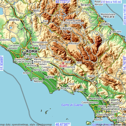
| Width | 7.29 km = 4.5 mi | 14.59 km = 9.1 mi | 233.4 km = 145 mi |
| Height | 7.29 km = 4.5 mi | 14.59 km = 9.1 mi | 233.4 km = 145 mi |
| ↑Max Latitude | 41.764657° | 41.797426° | 42.77273° |
| Latitude at center | 41.73187° | 41.73187° | 41.73187° |
| ↓Min Latitude | 41.699067° | 41.666247° | 40.67387° |
| ← Min Longitude | 13.297255° | 13.253309° | 11.93495° |
| Longitude center | 13.3412° | 13.3412° | 13.3412° |
| →Max Longitude | 13.385145° | 13.429091° | 14.74745° |
Nearby cities:
Cities around Alatri sort by population:
• Ferentino elevation 340 m
8.4 km,  237°
237°
• Tecchiena 254 m
4.9 km,  175°
175°
• Veroli 555 m
7.5 km,  123°
123°
• San Giuseppe le Prata-Cotropagno 239 m
7.6 km,  142°
142°
• Castelmassimo 234 m
8.2 km,  156°
156°
• Fumone 679 m
5.9 km,  272°
272°
• Monte San Marino 400 m
3.3 km,  227°
227°
• Guarcino 628 m
7.8 km,  343°
343°
• San Giovanni-Patoni 643 m
7.1 km,  309°
309°
• Vico nel Lazio 712 m
5.2 km,  1°
1°
• Collepardo 581 m
4.2 km,  32°
32°
• Trivigliano 758 m
7.5 km, 310°
Multilingual:
 En español:
Alatri elevación 407 m.
 En France:
Alatri élévation 407 m.


Sources and notes:
- [note 1] Map square and city borders are not equal. Map elevation data is calculated only from area inside that square.
- [src 1] Elevation data from geonames database provided with same terms of usage.
- [src 2] The elevation map of Alatri is generated using elevation data from NASA's 3 arcsec (90m) resolution SRTM data.
- [src 3] Base (background) map © OpenStreetMap contributors tiles are generated by Geofabrik and OpenTopoMap.
Copyright & License:
This Alatri Elevation Map is licensed under CC BY-SA. You may reuse any part from this page, if you give a proper credit by linking to this URL:
 More info on terms of use page.