Ferentino elevation
Ferentino (Latium, Provincia di Frosinone), Italy elevation is 340 meters and Ferentino elevation in feet is 1115 ft above sea level [src 1]. Ferentino is a seat of a third-order administrative division (feature code) with elevation that is 18 meters (59 ft) bigger than average city elevation in Italy.
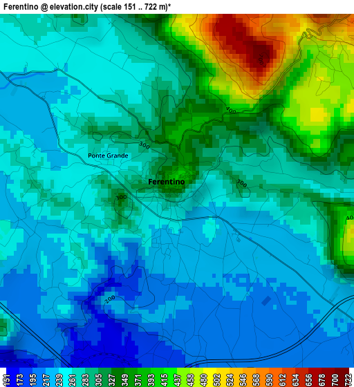
Below is the Elevation map of Ferentino, which displays elevation range with different colors. Scale of the first map is from 151 to 722 m (495 to 2369 ft) with average elevation of 286 meters (=938 ft) [note 1]
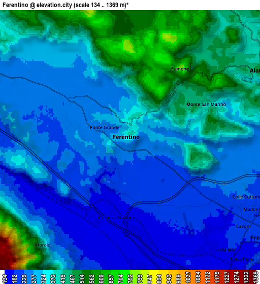
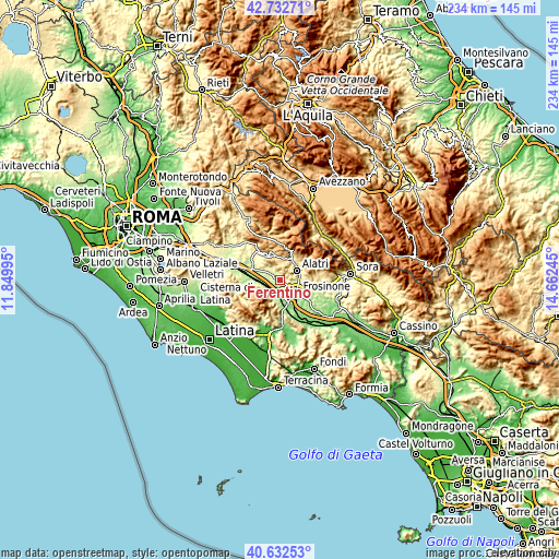
These maps also provides idea of topography and contour of this city, they are displayed at different zoom levels. More info about maps, scale and edge coordinates you can find below images.
| \ | Map #1 | Map #2 | Topo.Map |
| Scale [m] | 151..722 m | 134..1369 m | × |
| Scale [ft] | 495..2369 ft | 440..4491 ft | × |
| Average | 286 m = 938 ft | 330.7 m = 1085 ft | × |
| Width | 7.3 km = 4.5 mi | 14.6 km = 9.1 mi | 233.5 km = 145.1 mi |
| Height | 7.3 km = 4.5 mi | 14.6 km = 9.1 mi | 233.5 km = 145.1 mi |
| ↑Max Latitude | 41.723997° | 41.756788° | 42.73271° |
| Latitude at center | 41.69119° | 41.69119° | 41.69119° |
| ↓Min Latitude | 41.658366° | 41.625525° | 40.63253° |
| ← Min Longitude | 13.212255° | 13.168309° | 11.84995° |
| Longitude center | 13.2562° | 13.2562° | 13.2562° |
| →Max Longitude | 13.300145° | 13.344091° | 14.66245° |
Nearby cities:
Cities around Ferentino sort by population:
• Frosinone elevation 183 m
9.1 km,  129°
129°
• Alatri 407 m
8.4 km,  57°
57°
• Tecchiena 254 m
7.4 km,  92°
92°
• Supino 218 m
8 km,  193°
193°
• Sgurgola 338 m
9.2 km,  254°
254°
• Fumone 679 m
5 km,  13°
13°
• Monte San Marino 400 m
5.2 km, 63°
• Cartiera-Stazione 152 m
4.1 km,  198°
198°
• San Giovanni-Patoni 643 m
9.1 km, 9°
• Cerquotti-Madonna del Piano 188 m
6.5 km,  213°
213°
• Morolo 366 m
7.6 km,  219°
219°
• Trivigliano 758 m
9.5 km, 8°
Multilingual:
 En español:
Ferentino elevación 340 m.
 En France:
Ferentino élévation 340 m.
 Auf Deutsch:
Ferentino höhe über dem Meeresspiegel ist 340 m.

Sources and notes:
- [note 1] Map square and city borders are not equal. Map elevation data is calculated only from area inside that square.
- [src 1] Elevation data from geonames database provided with same terms of usage.
- [src 2] The elevation map of Ferentino is generated using elevation data from NASA's 3 arcsec (90m) resolution SRTM data.
- [src 3] Base (background) map © OpenStreetMap contributors tiles are generated by Geofabrik and OpenTopoMap.
Copyright & License:
This Ferentino Elevation Map is licensed under CC BY-SA. You may reuse any part from this page, if you give a proper credit by linking to this URL:
 More info on terms of use page.