Baronissi elevation
Baronissi (Campania, Provincia di Salerno), Italy elevation is 192 meters and Baronissi elevation in feet is 630 ft above sea level [src 1]. Baronissi is a seat of a third-order administrative division (feature code) with elevation that is 130 meters (427 ft) smaller than average city elevation in Italy.
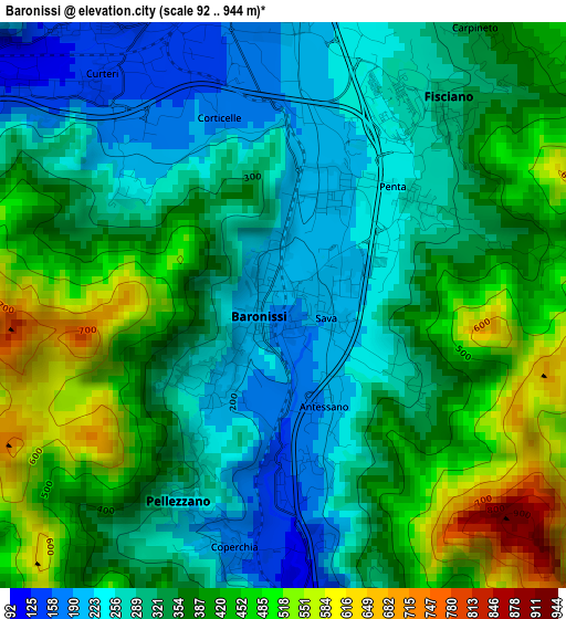
Below is the Elevation map of Baronissi, which displays elevation range with different colors. Scale of the first map is from 92 to 944 m (302 to 3097 ft) with average elevation of 353.6 meters (=1160 ft) [note 1]
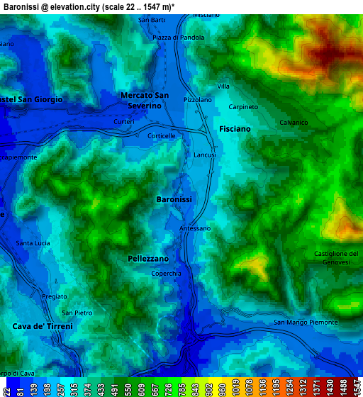
These maps also provides idea of topography and contour of this city, they are displayed at different zoom levels. More info about maps, scale and edge coordinates you can find below images.
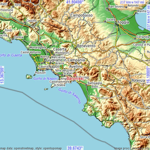
| \ | Map #1 | Map #2 | Topo.Map |
| Scale [m] | 92..944 m | 22..1547 m | × |
| Scale [ft] | 302..3097 ft | 72..5075 ft | × |
| Average | 353.6 m = 1160 ft | 385.1 m = 1263 ft | × |
| Width | 7.4 km = 4.6 mi | 14.81 km = 9.2 mi | 236.9 km = 147.2 mi |
| Height | 7.4 km = 4.6 mi | 14.81 km = 9.2 mi | 236.9 km = 147.2 mi |
| ↑Max Latitude | 40.781454° | 40.814721° | 41.80498° |
| Latitude at center | 40.74817° | 40.74817° | 40.74817° |
| ↓Min Latitude | 40.714869° | 40.681552° | 39.6743° |
| ← Min Longitude | 14.729855° | 14.685909° | 13.36755° |
| Longitude center | 14.7738° | 14.7738° | 14.7738° |
| →Max Longitude | 14.817745° | 14.861691° | 16.18005° |
Nearby cities:
Cities around Baronissi sort by population:
• Mercato San Severino elevation 145 m
4.4 km,  337°
337°
• Lancusi-Penta-Bolano 224 m
1.7 km,  33°
33°
• Piazza del Galdo-Sant'Angelo 107 m
5.6 km,  300°
300°
• Antessano 187 m
1.7 km,  169°
169°
• Capezzano-Cologna 116 m
3.7 km,  180°
180°
• Coperchia 168 m
3.2 km,  191°
191°
• Capezzano Inferiore 74 m
5.3 km, 180°
• Calvanico 499 m
5.5 km,  55°
55°
• Capriglia 249 m
2.1 km,  212°
212°
• Pellezzano 242 m
2.9 km, 208°
• Faraldo-Nocelleto 156 m
3.6 km,  346°
346°
• Fisciano 276 m
3.2 km, 33°
Multilingual:
 En español:
Baronissi elevación 192 m.
 En France:
Baronissi élévation 192 m.
 Auf Deutsch:
Baronissi höhe über dem Meeresspiegel ist 192 m.

Sources and notes:
- [note 1] Map square and city borders are not equal. Map elevation data is calculated only from area inside that square.
- [src 1] Elevation data from geonames database provided with same terms of usage.
- [src 2] The elevation map of Baronissi is generated using elevation data from NASA's 3 arcsec (90m) resolution SRTM data.
- [src 3] Base (background) map © OpenStreetMap contributors tiles are generated by Geofabrik and OpenTopoMap.
Copyright & License:
This Baronissi Elevation Map is licensed under CC BY-SA. You may reuse any part from this page, if you give a proper credit by linking to this URL:
 More info on terms of use page.