Piazza del Galdo-Sant'Angelo elevation
Piazza del Galdo-Sant'Angelo (Campania, Provincia di Salerno), Italy elevation is 107 meters and Piazza del Galdo-Sant'Angelo elevation in feet is 351 ft above sea level [src 1]. Piazza del Galdo-Sant'Angelo is a populated place (feature code) with elevation that is 215 meters (705 ft) smaller than average city elevation in Italy.
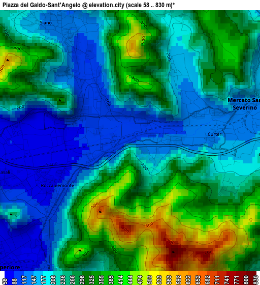
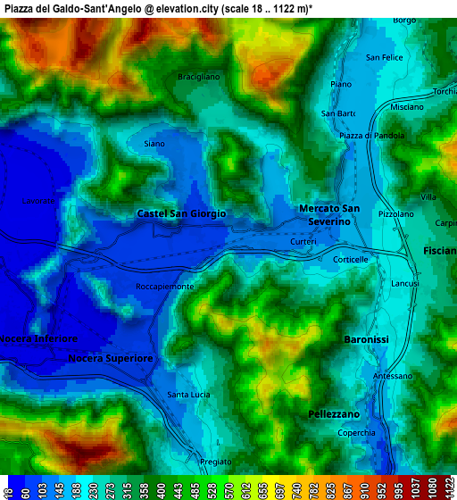
Below is the Elevation map of Piazza del Galdo-Sant'Angelo, which displays elevation range with different colors. Scale of the first map is from 58 to 830 m (190 to 2723 ft) with average elevation of 258.3 meters (=847 ft) [note 1]
These maps also provides idea of topography and contour of this city, they are displayed at different zoom levels. More info about maps, scale and edge coordinates you can find below images.
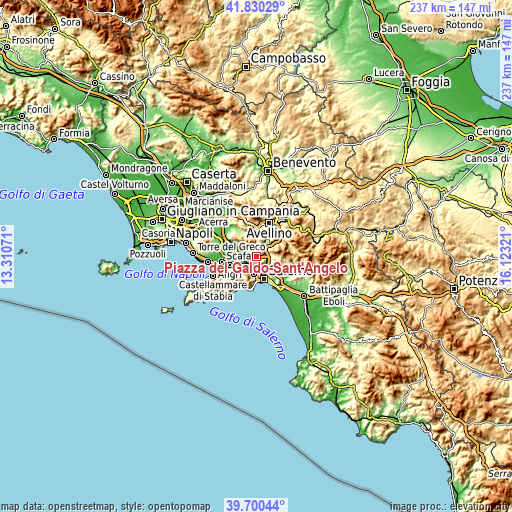
| \ | Map #1 | Map #2 | Topo.Map |
| Scale [m] | 58..830 m | 18..1122 m | × |
| Scale [ft] | 190..2723 ft | 59..3681 ft | × |
| Average | 258.3 m = 847 ft | 318.4 m = 1045 ft | × |
| Width | 7.4 km = 4.6 mi | 14.8 km = 9.2 mi | 236.8 km = 147.1 mi |
| Height | 7.4 km = 4.6 mi | 14.8 km = 9.2 mi | 236.8 km = 147.1 mi |
| ↑Max Latitude | 40.807171° | 40.840426° | 41.83029° |
| Latitude at center | 40.7739° | 40.7739° | 40.7739° |
| ↓Min Latitude | 40.740612° | 40.707308° | 39.70044° |
| ← Min Longitude | 14.673015° | 14.629069° | 13.31071° |
| Longitude center | 14.71696° | 14.71696° | 14.71696° |
| →Max Longitude | 14.760905° | 14.804851° | 16.12321° |
Nearby cities:
Cities around Piazza del Galdo-Sant'Angelo sort by population:
• Nocera Superiore elevation 71 m
5 km,  225°
225°
• Baronissi 192 m
5.6 km,  120°
120°
• Mercato San Severino 145 m
3.3 km,  68°
68°
• Siano 131 m
3.7 km,  327°
327°
• Castel San Giorgio 94 m
1.6 km,  303°
303°
• Roccapiemonte 89 m
2.7 km,  235°
235°
• Lanzara 74 m
3.4 km,  271°
271°
• Bracigliano 301 m
5.1 km,  351°
351°
• Casali-San Potito 76 m
3.7 km,  252°
252°
• Carifi-Torello-Priscoli 164 m
2.3 km,  33°
33°
• Piazza di Pandola 175 m
5.9 km,  51°
51°
• Faraldo-Nocelleto 156 m
4 km,  80°
80°
Multilingual:
 En español:
Piazza del Galdo-Sant'Angelo elevación 107 m.
 En France:
Piazza del Galdo-Sant'Angelo élévation 107 m.
 Auf Deutsch:
Piazza del Galdo-Sant'Angelo höhe über dem Meeresspiegel ist 107 m.
 На русском:
Piazza del Galdo-Sant'Angelo высота над уровнем моря 107 м
Sources and notes:
- [note 1] Map square and city borders are not equal. Map elevation data is calculated only from area inside that square.
- [src 1] Elevation data from geonames database provided with same terms of usage.
- [src 2] The elevation map of Piazza del Galdo-Sant'Angelo is generated using elevation data from NASA's 3 arcsec (90m) resolution SRTM data.
- [src 3] Base (background) map © OpenStreetMap contributors tiles are generated by Geofabrik and OpenTopoMap.
Copyright & License:
This Piazza del Galdo-Sant'Angelo Elevation Map is licensed under CC BY-SA. You may reuse any part from this page, if you give a proper credit by linking to this URL:
 More info on terms of use page.