Pellezzano elevation
Pellezzano (Campania, Provincia di Salerno), Italy elevation is 242 meters and Pellezzano elevation in feet is 794 ft above sea level [src 1]. Pellezzano is a seat of a third-order administrative division (feature code) with elevation that is 80 meters (262 ft) smaller than average city elevation in Italy.
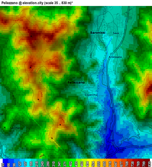
Below is the Elevation map of Pellezzano, which displays elevation range with different colors. Scale of the first map is from 35 to 830 m (115 to 2723 ft) with average elevation of 344.7 meters (=1131 ft) [note 1]
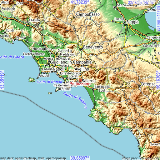
These maps also provides idea of topography and contour of this city, they are displayed at different zoom levels. More info about maps, scale and edge coordinates you can find below images.
| \ | Map #1 | Topo.Map |
| Scale [m] | 35..830 m | × |
| Scale [ft] | 115..2723 ft | × |
| Average | 344.7 m = 1131 ft | × |
| Width | 7.41 km = 4.6 mi | 237 km = 147.3 mi |
| Height | 7.41 km = 4.6 mi | 237 km = 147.3 mi |
| ↑Max Latitude | 40.758506° | 41.78239° |
| Latitude at center | 40.72521° | 40.72521° |
| ↓Min Latitude | 40.691898° | 39.65097° |
| ← Min Longitude | 14.713495° | 13.35119° |
| Longitude center | 14.75744° | 14.75744° |
| →Max Longitude | 14.801385° | 16.16369° |
Nearby cities:
Cities around Pellezzano sort by population:
• Salerno elevation 46 m
6.3 km,  151°
151°
• Cava Dè Tirreni 212 m
5.1 km,  235°
235°
• Baronissi 192 m
2.9 km,  28°
28°
• Lancusi-Penta-Bolano 224 m
4.6 km, 30°
• Antessano 187 m
1.9 km,  63°
63°
• Capezzano-Cologna 116 m
1.8 km,  129°
129°
• Coperchia 168 m
1 km, 126°
• Capezzano Inferiore 74 m
3 km, 154°
• Dragonea 296 m
6.4 km,  217°
217°
• Capriglia 249 m
0.8 km,  17°
17°
• Faraldo-Nocelleto 156 m
6.1 km,  4°
4°
• Fisciano 276 m
6 km, 31°
Multilingual:
 En español:
Pellezzano elevación 242 m.
 En France:
Pellezzano élévation 242 m.
 Auf Deutsch:
Pellezzano höhe über dem Meeresspiegel ist 242 m.

Sources and notes:
- [note 1] Map square and city borders are not equal. Map elevation data is calculated only from area inside that square.
- [src 1] Elevation data from geonames database provided with same terms of usage.
- [src 2] The elevation map of Pellezzano is generated using elevation data from NASA's 3 arcsec (90m) resolution SRTM data.
- [src 3] Base (background) map © OpenStreetMap contributors tiles are generated by Geofabrik and OpenTopoMap.
Copyright & License:
This Pellezzano Elevation Map is licensed under CC BY-SA. You may reuse any part from this page, if you give a proper credit by linking to this URL:
 More info on terms of use page.