Brisighella elevation
Brisighella (Emilia-Romagna, Provincia di Ravenna), Italy elevation is 116 meters and Brisighella elevation in feet is 381 ft above sea level [src 1]. Brisighella is a seat of a third-order administrative division (feature code) with elevation that is 206 meters (676 ft) smaller than average city elevation in Italy.
Below is the Elevation map of Brisighella, which displays elevation range with different colors. Scale of the first map is from 52 to 468 m (171 to 1535 ft) with average elevation of 175.9 meters (=577 ft) [note 1]
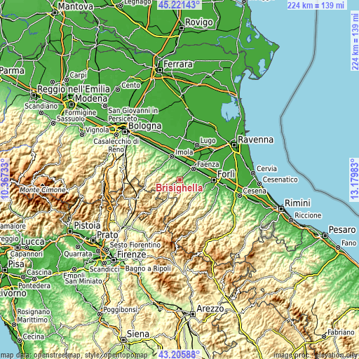
These maps also provides idea of topography and contour of this city, they are displayed at different zoom levels. More info about maps, scale and edge coordinates you can find below images.
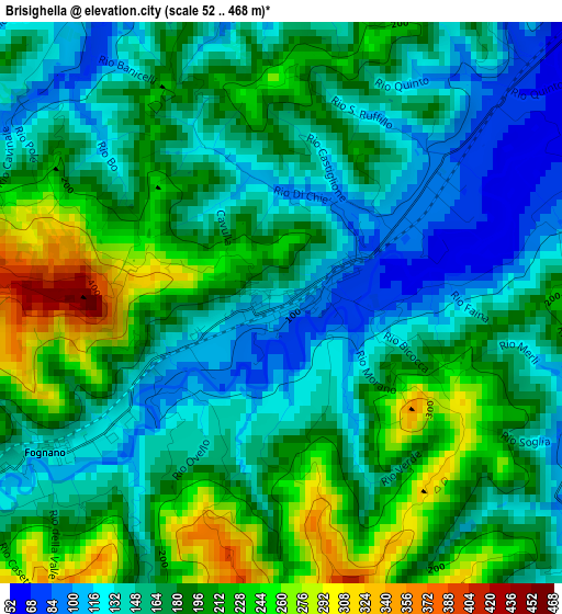
| \ | Map #1 | Topo.Map |
| Scale [m] | 52..468 m | × |
| Scale [ft] | 171..1535 ft | × |
| Average | 175.9 m = 577 ft | × |
| Width | 7 km = 4.3 mi | 224.1 km = 139.2 mi |
| Height | 7 km = 4.3 mi | 224.1 km = 139.2 mi |
| ↑Max Latitude | 44.253765° | 45.22143° |
| Latitude at center | 44.22228° | 44.22228° |
| ↓Min Latitude | 44.190779° | 43.20588° |
| ← Min Longitude | 11.729635° | 10.36733° |
| Longitude center | 11.77358° | 11.77358° |
| →Max Longitude | 11.817525° | 13.17983° |
Nearby cities:
Cities around Brisighella sort by population:
• Imola elevation 47 m
16 km,  342°
342°
• Faenza 41 m
11.3 km,  48°
48°
• Castel Bolognese 46 m
11 km,  10°
10°
• Castrocaro Terme e Terra del Sole 61 m
15.4 km,  104°
104°
• Riolo Terme 93 m
7 km,  328°
328°
• Modigliana 167 m
7.1 km,  167°
167°
• Borgo Tossignano 94 m
15.6 km,  295°
295°
• Casalfiumanese 88 m
14.5 km, 304°
• Casola Valsenio 200 m
11.9 km,  271°
271°
• Fognano 128 m
3.4 km,  236°
236°
• Dovadola 132 m
14.4 km,  140°
140°
• Castrocaro Terme 72 m
15 km,  110°
110°
Multilingual:
 En español:
Brisighella elevación 116 m.
 En France:
Brisighella élévation 116 m.
 Auf Deutsch:
Brisighella höhe über dem Meeresspiegel ist 116 m.

Sources and notes:
- [note 1] Map square and city borders are not equal. Map elevation data is calculated only from area inside that square.
- [src 1] Elevation data from geonames database provided with same terms of usage.
- [src 2] The elevation map of Brisighella is generated using elevation data from NASA's 3 arcsec (90m) resolution SRTM data.
- [src 3] Base (background) map © OpenStreetMap contributors tiles are generated by Geofabrik and OpenTopoMap.
Copyright & License:
This Brisighella Elevation Map is licensed under CC BY-SA. You may reuse any part from this page, if you give a proper credit by linking to this URL:
 More info on terms of use page.